Do you have a question about the Magellan MAP 330 and is the answer not in the manual?
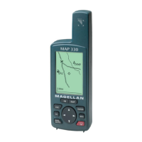
The Magellan MAP 330 is a portable GPS device designed for navigation and outdoor use, offering a range of features to assist users in various environments. Its primary function is to provide accurate positioning and navigation capabilities, allowing users to track their location, save waypoints, create routes, and view maps. The device is built with a weatherproof design, featuring wraparound rubber armor to ensure durability and protection against the elements, making it suitable for rugged outdoor adventures.
The MAP 330 operates on a 12 parallel-channel technology, enabling it to track up to 12 satellites simultaneously for precise positioning. It utilizes a quadrifilar antenna to enhance signal reception. The device offers quick acquisition times, with a warm start taking approximately 15 seconds and a cold start requiring about 1 minute. Its continuous update rate of 1 second ensures that location data is refreshed frequently, providing real-time tracking. The device can compute speeds up to 951 mph and elevations up to 17,500 meters, making it versatile for various activities, from hiking to aviation.
To turn on the MAP 330, users simply press the power button. The device will display startup screens before becoming fully operational.
The display backlight can be adjusted by holding a specific button for 2 seconds, allowing users to optimize visibility in different lighting conditions and conserve battery life.
The contrast of the display can be adjusted via the MENU button, which brings up a "Choose Contrast" option. This feature helps improve readability of the screen.
Users can navigate through different screens by pressing the NAV or ESC buttons, allowing them to access various navigational views such as the Map Screen, Compass Screen, Large Data Screen, Position Screens, and Sat Status Screen.
The Map Screen provides a visual representation of the user's location and surrounding area. Users can access map setup features and MAP 330 functions through the MENU button. The IN and OUT buttons allow for zooming in and out of the map, while the pan controls enable users to move around and view different map objects.
The Compass Screen displays bearing and heading information. Users can customize features and MAP 330 functions via the MENU button.
This screen presents detailed navigational data, including bearing, heading, speed, and distance. The MENU button allows for customization of features and MAP 330 functions.
The Position Screens show current coordinates, elevation, time, and date. Users can access customization options and MAP 330 functions through the MENU button. There is also an option to access a second Position screen for additional data.
This screen displays information about the satellites currently being tracked, including their signal strength. Users can access MAP 330 functions from this screen.
To save a waypoint, users press and hold the MARK button for 2 seconds. After saving, the device allows users to change waypoint data as needed, providing flexibility in labeling and categorizing saved locations.
Users can create a GOTO route by pressing the GOTO button, which prompts them to select a database category. After highlighting the desired category, they can select a "Destination Waypoint." The device offers options to choose "Alpha" or "Nearest" to alter how the destination waypoint is selected, catering to different routing preferences.
The device's settings can be accessed by pressing the MENU button and then highlighting "Setup."
The device is powered by 2 AA batteries or a 9-35 VDC external power source. It is crucial not to remove batteries from the MAP 330 while it is turned on to prevent data loss or device malfunction. The battery life with the display backlight turned off is approximately 10 hours, emphasizing the importance of managing backlight usage to extend operational time.
The weatherproof design with wraparound rubber armor helps protect the internal components from moisture and impacts, reducing the need for frequent repairs due to environmental exposure. Regular cleaning of the exterior, especially after exposure to dirt or water, will help maintain its integrity.
The "Clear Memory" function, found in the setup options, serves as a maintenance tool. It allows users to reset various data points or the entire device to its default settings. This can be useful for troubleshooting performance issues, clearing old data, or preparing the device for a new user or trip.
In summary, the Magellan MAP 330 is a robust and user-friendly GPS device designed for reliable navigation in diverse outdoor settings. Its comprehensive set of features, from detailed mapping and routing to customizable display options and durable construction, makes it a valuable tool for adventurers and professionals alike. Proper battery management and occasional use of the clear memory function will help ensure its longevity and optimal performance.
| Type | Handheld |
|---|---|
| Channels | 12 |
| Antenna | Internal |
| Display Type | LCD |
| Waypoints | 500 |
| Routes | 20 |
| Waterproof | Yes |
| Track Log | 2000 points |
| Accuracy | <15 meters |
| Differential GPS Ready | Yes |
| Basemap | Yes |
| Position Accuracy | <15 meters |