Do you have a question about the Magellan MAP 410 and is the answer not in the manual?
Ensures all items included in the MAP 410 box are present before initial use.
Explains formatting and symbols used throughout the manual for clarity.
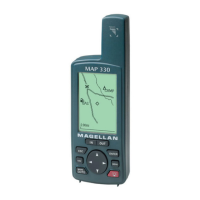
Overview of the portable, cartographic GPS receiver's features and capabilities.
Details on the GPS positioning accuracy and factors affecting it.
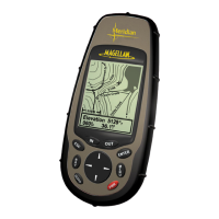
Explanation of the built-in sensor for providing altitude readings.
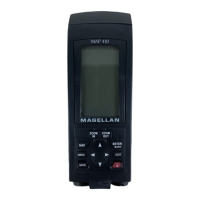
Explanation of each button and its function on the MAP 410 keypad.
Step-by-step guide for installing AA alkaline batteries into the receiver.
Guidance on basic operation, including signal reception and power management.
Procedure for initial setup, including location, time, and date settings.
Choosing between MARINE and LAND operating modes for the receiver.
Steps to turn on the receiver and initiate the start-up process.
Introduction to the nine navigation screens available on the MAP 410.
Displays satellite status, signal strength, battery life, and temperature.
Options for changing temperature units and calibrating temperature readings.
Shows computed position, coordinates, and basic navigation data.
Explanation of how the receiver averages fixes for improved accuracy.
Displays destination and selectable navigation measurements with a compass.
Allows changing the four navigational fields displayed on the NAV 1 screen.
Features a pointer compass and Course Deviation Indicator for navigation.
Enables modification of the four navigational fields on the compass screen.
Displays four customizable fields, designed for visibility at a distance.
Allows changing the four navigational fields on the NAV 2 screen.
Depicts computed position plotted against a cartographic background.
Controls the visual representation of land and water on the MAP screen.
Settings for map orientation, course projection, and cartographic preferences.
Options for screen orientation: North up, Course up, or Track up.
Sets projection options to predict future positions based on speed and heading.
Option to display or hide latitude and longitude grid lines on the MAP screen.
Controls the display of map text and the scale for cities on the MAP screen.
Adjusts the display scale for different categories of highways on the MAP screen.
Controls the display scale for railroads on the MAP screen.
Allows enabling or disabling uploaded data, with a warning about route erasure.
Configures how waypoints are displayed (OFF, ICONS ONLY, ICONS/NAMES) and at what scale.
Function to hide or show the data window on the MAP screen.
Manages track history recording and provides a function to clear track data.
Information on creating, saving, and managing routes defined by waypoints.
Displays map scale and allows finding specific waypoints on the MAP screen.
Allows users to navigate and view different areas of the MAP screen.
Retrieving information about waypoints by placing the cursor over their icons.
Displays navigation data and position relative to the desired route.
Allows changing the four navigational fields displayed on the ROAD screen.
Adjusts the zoom scale for the ROAD screen using zoom keys.
Shows graphical speedometer, odometer, trip odometer, and speed data.
Procedures for resetting the main odometer and the trip odometer.
Allows resetting the speed average calculation to different time intervals.
Displays current time, estimated time enroute (ETE), and time of arrival.
Options for choosing time format: LOCAL 24HR, LOCAL AM/PM, or UTC.
Chart showing default ON/OFF states for the nine navigation screens.
Guide to creating, saving, editing, deleting, projecting, and sorting waypoints.
Lists available waypoint categories and functions for User and Non-User types.
Details on waypoints uploaded from external sources, which are not editable.
Methods for saving current position as a waypoint with receiver or user-created names.
Instructions for editing waypoint name, icon, coordinates, and elevation.
Process for creating, editing, and deleting messages associated with waypoints.
Steps to save changes to a waypoint and to remove unnecessary waypoints.
Function to create a new waypoint at a specific distance and direction.
Options to sort waypoints by ALPHABETIC, NEAREST, or ICON/NAME.
Guide to creating, managing, and navigating routes using saved waypoints.
Accessing the route menu and creating GOTO routes from current position or map.
Using FIND to locate waypoints and clearing active GOTO routes.
Creating an immediate route to the current position in case of emergency.
Generates a route by retracing saved track history points.
Building routes by connecting multiple saved waypoints in sequence.
Accessing saved routes to view their details or make modifications.
Adding intermediate waypoints or segments to an existing route.
Changing or adding waypoints to an existing route structure.
Removing specific waypoints from a route without deleting the waypoint itself.
Procedures for saving route changes and managing route activation status.
Options to reverse the direction of a route or delete it entirely.
Viewing the entire route on a small screen overview.
Navigating stored track history by activating the TrackRoute function.
Displays solar/lunar data and fishing/hunting times based on location.
Generates artificial position fixes to familiarize users with receiver functions.
Allows users to adjust the display contrast for better visibility.
Introduction to the five types of alarms: Anchor, Arrival, XTE, Proximity, and GPS.
Configures an alarm to notify when the anchored boat drifts from its set position.
Sets an alarm to trigger when nearing the destination's arrival circle.
Alerts the user when they deviate from the set course.
Triggers an alarm when within a set distance of chosen waypoints.
Manages GPS signal quality alarms, viewing messages, and resetting defaults.
Accessing the main setup menu to configure receiver parameters.
Steps to establish the initial position for satellite acquisition.
Allows users to turn specific navigation screens ON or OFF.
Selects primary and secondary coordinate systems for position display.
Chooses the datum to match maps or charts for accurate position computation.
Configures elevation display between 2D (fixed) and 3D (variable) modes.
Options to set the time display format (LOCAL 24HR, AM/PM, or UTC).
Sets units of measure for navigation data (Miles/MPH, NM/Knots, KM/KPH).
Selects temperature units between Fahrenheit and Celsius.
Sets the reference for navigation computations (Magnetic or True North).
Sets automatic turn-off time for the display backlight to save power.
Configures when the receiver's beeper will sound (OFF, KEYS ONLY, ALARM ONLY, KEYS/ALARM).
Option to input user's name into the receiver for personalization.
Deletes track history, waypoints, routes, and resets factory defaults.
Configures GPS data output format for interfacing with external devices.
Matches receiver's baud rate to external devices for data communication.
Addresses problems with the receiver not turning on or taking long to get a fix.
Troubleshoots fluctuating elevation readings and short battery life.
Resolves discrepancies between receiver coordinates and map coordinates.
Answers frequently asked questions about daylight saving, year 2000, coordinates, and battery life.
Provides contact information for technical service and warranty repair.
Details the latitude and longitude system for describing locations on Earth.
Explains the Universal Transverse Mercator system used on land-based maps.
Describes how UTM projects the globe into zones for flat surface representation.
Explains Time Delay Grids (LOPs) used with Loran-C navigation.
Details the components of a Loran chain and selecting secondary stations.
Describes the OSGB system specific to Great Britain and its associated datum.
Details receiver technology, acquisition times, and update rate.
Includes size, weight, display, and housing construction details.
Specifies power options (AA batteries, DC) and estimated continuous operation time.
Brackets for mounting and a carrying case for portability.
Cables for connecting to external power and for PC data transfer.
Includes PC interface cables and MapSend CD-ROM for chart software.
External antenna kits and a guide for UTM map positioning.
Connects to receiver for differential corrections, enhancing accuracy.
Definitions for terms starting with A through D.
Definitions for terms starting with E through M.
Definitions for terms starting with O through W.
Details the one-year warranty against defects in material and workmanship.
Outlines the exclusive remedy and purchaser's responsibilities for service.
Specifies limitations on implied warranties and exclusions from coverage.
States Magellan's non-liability for incidental or consequential damages.
| Type | Handheld |
|---|---|
| Channels | 12 |
| WAAS | Yes |
| Display Type | LCD |
| Backlit | Yes |
| Waterproof | Yes |
| Waypoints | 500 |
| Routes | 20 |
| Track Log | 2000 points |
| Battery | 2 AA batteries |
| Map Coverage | Americas |
| Preloaded Maps | No |
| Screen Type | Monochrome |