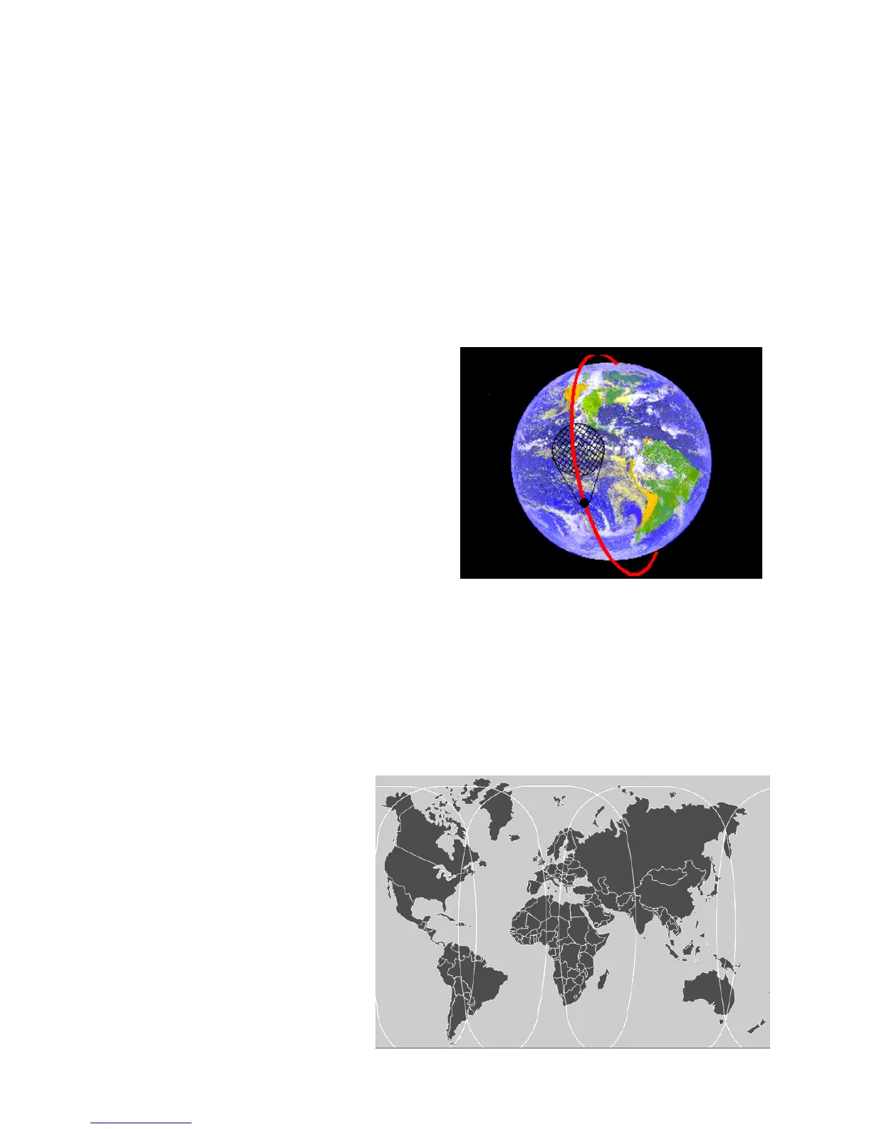
LEOSAR satellite path and scan footprint
13 APPENDIX – SATELLITE SYSTEMS
COSPAS-SARSAT satellite system
The COSPAS-SARSAT system provides distress alert and location information to
search and rescue authorities anywhere in the world for maritime, aviation and
terrestrial users in distress.
There are two satellite arrays carrying the COSPAS-SARSAT system. The principal
array is LEOSAR (Low Earth Orbit Search and Rescue) which has seven satellites in
polar and near-polar orbits. The orbits of these satellites are arranged to scan the
entire surface of the Earth; on average, a satellite comes into view every 45 minutes.
Distress transmissions from EPIRBs are picked up by the satellites and retransmitted
to ground receiving stations, which then pass the message to the appropriate rescue
organisation. On average, the total delay from activation of an EPIRB to the message
being received by the rescue services is 90 minutes.
COSPAS-SARSAT is in an advanced stage of commissioning the second satellite
array, GEOSAR (Geostationary Search and Rescue). This array uses geostationary
satellites which are always in view (over their area of coverage), so that reception of
the EPIRB signal is virtually instantaneous
GEOSAR coverage