Map coverage varies by country and region.
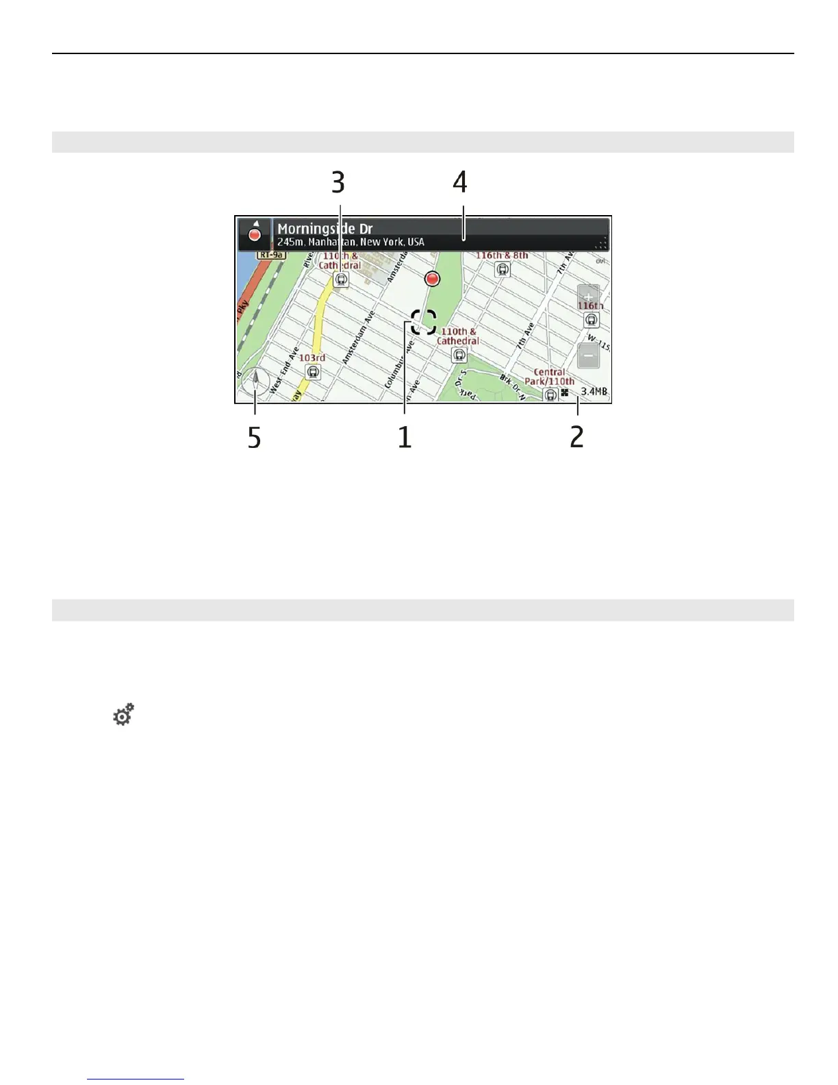
Map view
1 Selected location
2 Indicator area
3 Point of interest (for example, a railway station or a museum)
4 Information area
5 Compass
Change the look of the map
View the map in different modes, to easily identify where you are.
Select Menu > Maps and Map.
Select
and from the following:
Map view — In the standard map view, details such as location names or motorway
numbers are easy to read.
Satellite view — For a detailed view, use satellite images.
Terrain view — View at a glance the ground type, for example, when you are travelling
off-road.
3D view — For a more realistic view, change the perspective of the map.
Landmarks — Display prominent buildings and attractions on the map.
Night mode — Dim the colours of the map. When travelling at night, the map is easier
to read in this mode.
Transit lines — View selected public transport services, such as metro and tram routes.
The available options and features may vary by region. The unavailable options are
dimmed.
Maps 77