Do you have a question about the Panasonic CN-DV2300N and is the answer not in the manual?
Lists essential items included with the navigation system for setup.
Alerts users to the product's Class I Laser classification and necessary safety precautions.
Key instructions for safe operation while driving, emphasizing attention to traffic.
Guidelines for safe installation, avoiding vision obstruction, and using correct power supply.
Covers fuse replacement, wiring management, airbag interference, batteries, and remote control use.
Prohibits commercial use, exposure to elements, and specifies automobile use only.
Covers wiring care, parts usage, vent blockage, moving parts, vibration, and battery drain.
Cautions for handling batteries for the remote control unit, including disposal.
Outlines terms for personal, non-commercial use of Navtech software, including disclaimers.
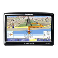
Highlights key features like detailed maps, destination registration, and place settings.
Advises on avoiding excessive moisture and operating in extreme temperatures.
Explains the use of GPS, speed, and gyrosensors for accurate vehicle positioning.
Specifies support for NAVTECH DVD-SDAL discs and handling instructions.
How to report map data errors and contact Navigation Technologies for support.
Procedure to view map and software version information for system updates.
Explains functions of remote buttons and controls for optional monitor operation.
Details specific key functions and remote battery information like type and replacement.
Guide to inserting the map disc and turning on the system for initial use.
Steps for selecting the user interface language and initial configuration.
Instructions for safely removing the map disc from the unit with caution.
Explains the functions and options available in the Pop Up menu for route management.
Details checks for wiring, distance correction, and GPS reception before use.
Warns against operating the system while driving and provides critical safety advice.
Provides detailed information on wiring checks and GPS reception status.
Explains the process and conditions for automatic distance correction for accuracy.
Describes current position map, route display, and relevant flags for navigation.
Explains guide mode map, intersection zoom, and scroll map features for navigation.
How to switch between North Up and Head Up map orientations for better viewing.
How to zoom in and out to change the map scale for detailed or overview views.
Steps to find destinations using address, street, city, or intersection details.
How to search for destinations based on POI categories like restaurants or gas stations.
Options to search previously visited locations or saved marked points.
Guides on entering city, street, house number, and postcode for destination.
Explains Shortest Route, Avoid Motorway, and Map designation for route planning.
Method for entering street, city, or name using character slots for search.
How to enter postcodes using the on-screen character chart for accurate location finding.
Displays and explains various POI icons shown on maps for easy identification.
Notice for entering postcodes, including country-specific digit variations and formatting.
How to position the cursor on the map to select a destination directly.
Procedure for selecting and navigating to the nearest Point of Interest based on category.
How to cancel route search or display the entire planned route.
Options to turn route guidance off or resume it for navigation.
Function to search for alternative routes to the same destination with different criteria.
Options to avoid specific streets or add via points for customized route planning.
How to select specific streets that the system should avoid during route calculation.
Procedures for adding or deleting intermediate points in a route for complex navigation.
Steps to mark the vehicle's current location for future reference or navigation.
How to mark any arbitrary point on the map for saving as a destination.
How to change the icon associated with a marked point to personalize it.
How to rename a marked point or User POI for easier identification.
Procedure for removing marked points from the system when no longer needed.
Accesses settings related to map display, appearance, and orientation.
Accesses settings related to route calculation, detours, and guidance.
Accesses general system configuration options like language and units.
Features for route simulation and adjusting vehicle position display.
Settings for day/night display modes and color schemes for the map.
Options for map orientation and current vehicle position indicator display.
Settings for displaying POI icons and tracing the route on the map.
Specifies detour distance and enables/disables automatic re-routing functionality.
Sets system mode (Map/Guide) and enables intersection zoom for better visibility.
Configures route guidance and announcement of estimated travel time.
Adjusts volume for voice guidance and beep sounds for user alerts.
Selects display language and measurement units (metric/imperial).
Settings for clock display and screen position adjustment for optimal viewing.
System automatically announces upcoming turns and distances for navigation.
Vocal announcement of upcoming highway junctions or branching points.
Explains GPS function and accuracy for vehicle positioning using satellite signals.
Identifies specific locations like tunnels or high-rise buildings where GPS signal reception may be poor.
Details how map matching improves positioning accuracy in various conditions like elevated roads.
Situations like elevated roads, sharp turns, or gridiron layouts affecting position display accuracy.
Discusses potential discrepancies in route guidance announcements or map displays due to intersection shapes.
Potential for guide map showing impassable, closed, or out-of-use roads.
Explains scenarios where route search might show one-way traffic or unchanged routes.
Solutions for no display or unresponsive remote control buttons.
Checks and actions for when the vehicle position is not displayed correctly on the map.
Solutions for missing GPS symbols or vehicle position display issues.
Checks for issues related to voice guidance and beep sounds from the system.
Solutions for route calculation failures and disc read issues.
Addresses 'Accessing Data Please wait' and 'Please Select another point' messages.
Solutions for no picture or no sound from external equipment connections.
Instructions for cleaning the product and proper handling of map discs.
Technical details including power supply, dimensions, weight, and reception sensitivity.
| Voice Guidance | Yes |
|---|---|
| GPS Receiver | Built-in |
| Audio Output | 4 x 45W |
| Media Source | DVD, CD |
| Power Supply | 12V |