261
06 INFORMATION
SYSTEM VERSION, SATELLITE
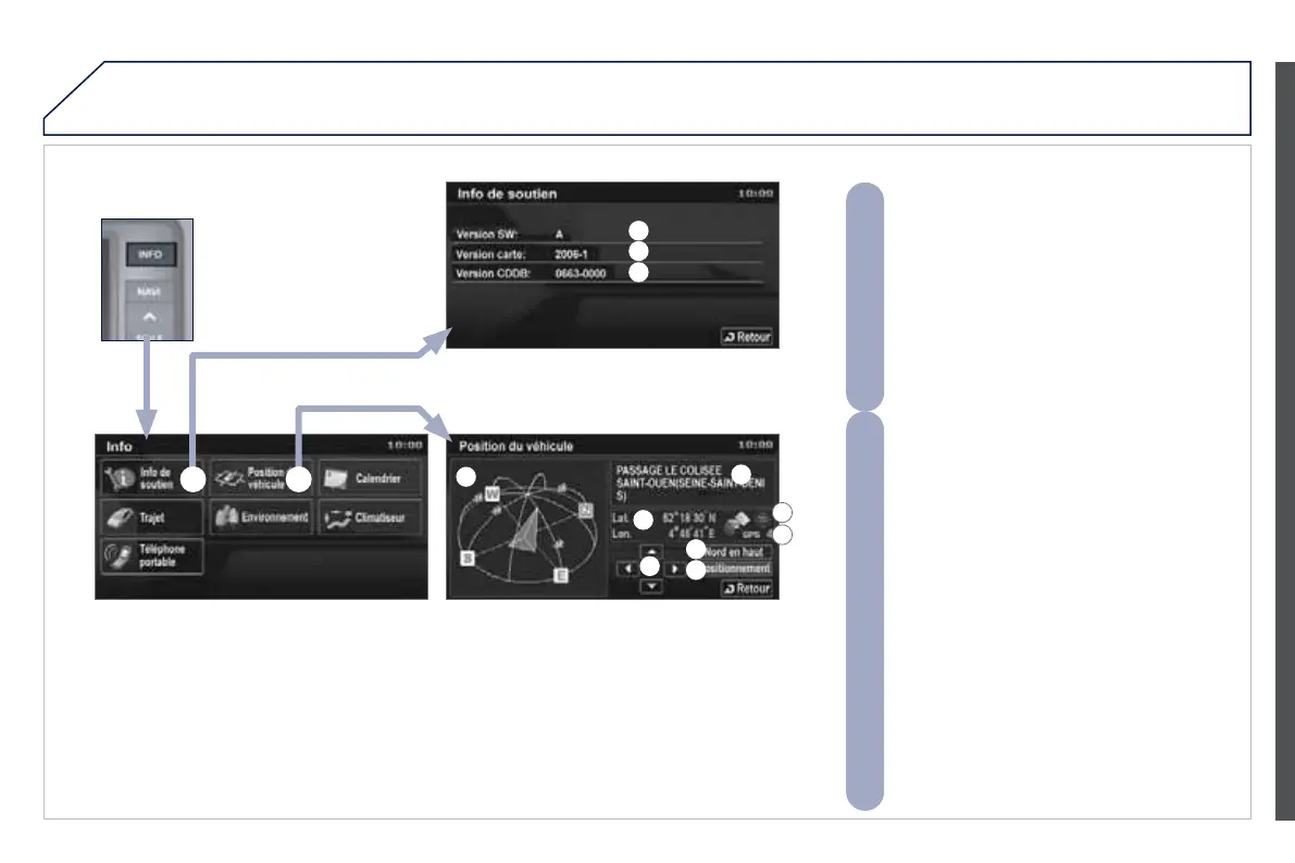
A - View the system information:
A1 - the software version,
A2 - the map data version,
A3 - the system information database version.
To update the versions, insert the DVD
containing the new data and follow the
instructions on the screen.
B - View the GPS information:
B1 - the satellite positions diagram with the
direction of movement of the vehicle. Plus
the position of the satellite signal receivers,
B2 - the name of the current location,
B3 - the longitude and latitude of the current
location,
B4 - the position measurement status (2D=3
satellites or fewer, 3D=4 satellites or more),
B5 - the number of receiving satellites,
B6 - to have north at the top of the map,
B7 - to have the direction of the vehicle at the
top of the map,
B8 - to pivot the map from overhead or change
the angle of the map.
A2
A1
A3
B1
B2
B3
B4
B5
B6
B7
B8
A B
 Loading...