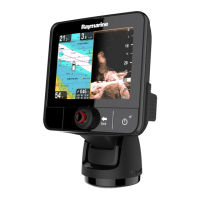
Do you have a question about the Raymarine E70011 - c95 MFD and is the answer not in the manual?
| Display Size | 9 inches |
|---|---|
| Display Type | LCD |
| Display Resolution | 800 x 480 pixels |
| GPS Receiver | Internal |
| Waterproof Rating | IPX6 |
| Weight | 2.2 kg (4.85 lbs) |
| Chartplotter | Yes |
| Touchscreen | Yes |
| Radar Compatibility | Yes |
| Sonar Compatibility | Yes |
| Wi-Fi | Yes |
| NMEA 2000 Compatible | Yes |
| Network Compatibility | NMEA 2000 |
| Networking | Ethernet |
| Sonar | Compatible |
Covers essential product safety, installation, and operational guidelines, including warnings and cautions.
Details about the handbook, available handbooks, product information, illustrations, conventions, and touch operations.
Guidance on planning the installation, including system integration, checklists, limits, data sources, networking, typical systems, and protocols.
Information on cabling guidance, connections overview, power connections, network connections, GPS, AIS, SeaTalkng, NMEA, video, media player, Bluetooth, and Wi-Fi.
Guidelines for selecting a suitable location and mounting procedures for New a Series, New c Series, and New e Series displays.
Introduction to operating the display, covering power, controls, homescreen overview, system checks, autopilot and AIS functions, pages, applications, and splitscreen controls.
Instructions on managing display data, including memory cards, saving/retrieving user data and settings, and taking screenshots.
Overview of the document viewer application for viewing and searching PDF documents, including opening files and browsing content.
Information on controlling the autopilot, including engaging, disengaging, status symbols, and alarms.
Details on using Man Overboard (MOB) functions and managing alarms, including alarm menu options.
Instructions for integrating a DSC VHF radio with the display, including using the radio and enabling integration.
Overview of the fuel manager application, including enabling, disabling, setting up, fuel logging, low fuel alarms, and fuel range rings.
Information on the AIS feature, including overview, prerequisites, context menu, enabling AIS, displaying vectors, status symbols, silent mode, target symbols, and collision avoidance.
Details on managing waypoints, routes, and tracks, including placing, navigating, editing, erasing, and storage capacity.
Comprehensive guide to the chart application, covering overview, ranging, panning, vessel position, chart views, context menu, My Data options, navigation options, measuring, vectors, current, tide, chart objects, presentation, and set-up menus.
Guide to the radar application, covering overview, scan speed, status symbols, range, image quality, display overview, dual range, mode, orientation, tuning, adjustments, presentation menus, measuring, tracking, and scanner set-up.
Details on the fishfinder application, including how it works, sonar modules, sonar technologies, introduction, transducer bandwidth, sonar image, presets, dual/single frequency, frequency controls, display modes, range, sensitivity, presentation options, depth, scrolling, waypoints, alarms, and sonar reset.
Overview and customization of the data application, allowing display of system and instrument data, pre-configured datapages, and custom datapages.
Guide to using the thermal camera application with pan and tilt cameras, covering overview, image, controls, camera control, image adjustments, pan/tilt interface, high power/torque modes.
Information on using the thermal camera application with fixed mount cameras, covering overview, image, controls, camera control, image adjustments, and menu options.
Overview of the camera application for viewing and managing camera or video feeds, including changing feeds, cycling, setting intervals, and adjusting video image.
Guide to the Fusion link application for controlling a Fusion entertainment system, covering overview, media sources, browsing music, shuffle/repeat, volume, zone control, tone controls, system selection, and menu options.
Guide to the weather application for North America, covering overview, setup, display, map navigation, context menu, weather information, reports, animated graphics, menu options, and glossary.
Overview of the Sirius audio application for controlling a Raymarine Sirius marine weather/satellite radio receiver, including channel selection and volume controls.
Information on Raymarine mobile apps for viewing and controlling the multifunction display via Wi-Fi, including enabling Wi-Fi, mobile apps, security setup, and channel selection.
Guidance on customizing the display, including language selection, boat details, units setup, time/date, display preferences, data cell/databar customization, list of data items, and system setup menus.
Information on maintaining the display, including service, maintenance, and cleaning procedures.
Guide to troubleshooting common problems with the display and connected equipment, covering power, radar, GPS, sonar, thermal camera, system data, video, Wi-Fi, Bluetooth, touchscreen, and miscellaneous issues.
Information on obtaining technical support from Raymarine and third-party suppliers.
Detailed technical specifications for various Raymarine display models, including physical, power, environmental, and video specifications.
List of available spares and accessories, including transducer accessories, network cables, video cables, and spares for specific display models.
List of supported NMEA 0183 sentences applicable to NMEA 0183 and SeaTalk protocols, detailing transmit and receive capabilities.
List of supported NMEA 2000 sentences applicable to NMEA 2000, SeaTalkng, and SeaTalk 2 protocols.
Diagrams and pinout details for various connectors including power, data, video, network, SeaTalkng, and video in/out.
Information on the Switch Panel application for vessel control and monitoring, including system connection, configuration, and switch operation.
Table detailing software versions, compatible displays, and enhancements introduced in each release.


