The Ruskin Mobile application is a streamlined version of the full Ruskin software, designed to provide essential functions for managing deployments of RBR instruments. It leverages the capabilities of smartphones and tablets, including GPS tracking, live data display, and cloud uploading. The app connects to Wi-Fi enabled RBR instruments and is compatible with iPhone®, iPad®, Android™ phones, and Android™ tablets. Users can install the Ruskin app from the Apple App Store or Google Play.
Function Description:
Ruskin Mobile facilitates the setup and management of RBR instrument deployments. It allows users to connect to their instruments, configure deployment parameters, track instrument locations, access datasets, view charts, and adjust application settings.
Important Technical Specifications:
- Data Storage Format: By default, new deployments initiated from a mobile device use the "Mobile" data storage format. This format stores calibrated data, enabling faster Wi-Fi downloads and GPS location tracking. Deployments started from a desktop computer default to "Desktop" format, which limits mobile viewing capabilities.
- RSK Files: The app generates RSK files, which are single-file databases based on SQLite. These files provide high-speed access to dataset parts and can be exported to Excel, OceanDataView®, or text files. RSK files obtained via Ruskin Mobile support charting and GPS tracking but do not allow changes to calibration coefficients. The file extension is
.rsk and should not be altered.
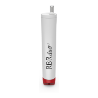
- Wi-Fi Connectivity: RBR instruments with a built-in Wi-Fi module feature a "WI-FI READY" icon on the end-cap. Twisting the end-cap to the RUN or PAUSE position activates the Wi-Fi for 60 seconds, allowing connection to a mobile device. The Wi-Fi module must be enabled at the time of purchase.
- GPS Tracking: The app utilizes the mobile device's GPS capabilities to log instrument locations automatically upon connection and manually via a "TAG" button. GPS tracking occurs when the Ruskin App is open or when a track is being recorded, helping conserve battery life. An accuracy of approximately 5 meters can be expected when GPS is working well.
- Deployment Status: The app displays the instrument's status, including the number of samples taken, logging state (ON or OFF), and sampling rate.
- Charting: Charts are separated into "casts," with one cast per page. Each descent and ascent of the instrument is considered a new cast. The instrument determines cast start and end times based on depth (pressure) readings.
Usage Features:
- Connecting to Instrument:
- Android: Twist the instrument end-cap to activate Wi-Fi, open Ruskin, and tap "Search for instruments." The app will automatically connect if only one instrument is detected.
- iOS: Twist the instrument end-cap to activate Wi-Fi, open Ruskin, tap the convenience button on the landing page, navigate to Wi-Fi in Settings, and select the instrument's SSID (e.g., RBR 060286).
- User Interface: The app features a toolbar at the bottom with four main views: "Instrument," "Datasets," "Locations," and "Settings."
- Instrument View: Used for setting up and managing deployments, displaying instrument name, serial number, sample count, logging state, sampling rate, sparkline chart, last tagged coordinates, current location tagging, and measured/derived channels.
- Datasets View: Provides access to local and archived datasets, allows uploading to Dropbox or other sharing destinations, and enables deletion of archived datasets.
- Locations View: Displays GPS coordinates and plots data points on a map during deployment, relying on the mobile device's location capabilities.
- Settings View: Manages deployment preferences, allows sharing feedback, and provides contact information for support.
- Deployment Control:
- The "START" button initiates a new deployment, erasing existing data on the instrument.
- The "STOP" button ends the current deployment. A stopped deployment cannot be resumed.
- The sampling rate can only be changed when a deployment is stopped.
- Twisting the end-cap to "PAUSE" will pause the instrument without stopping the deployment, allowing it to be resumed later.
- Realtime Data: A sparkline chart shows the last 50 readings (150 for tablets) from measured channels, providing real-time feedback. Tapping the "VIEW" button displays full deployment charts.
- Geotagging: The app automatically logs the instrument's location upon connection. Manual location tagging is possible via the purple "TAG" button. Both automatic and manual waypoints are plotted on the "Locations" map.
- Data Access and Sharing:
- Local datasets can be viewed as charts on the device.
- Datasets can be uploaded to Dropbox or other cloud services.
- On iOS, swiping left on a dataset reveals "Info," "Share," and "Delete" options. On Android, long-pressing achieves the same.
- The "Cloud" button in the "Datasets" tab allows bulk uploading of local datasets.
- Charting Features:
- In portrait orientation, channel data is plotted by depth (downcast data only).
- In landscape orientation, channel data is plotted by time (depth inverted).
- Users can select which channels to display on the chart using toggle buttons in the legend.
- Pinch-to-zoom allows detailed inspection of data, with chart axes adjusting dynamically.
- The "Details" option reveals information about the displayed cast and deployment parameters.
- Tracking Features:
- The "Locations" view displays the instrument's current location, velocity, and accuracy.
- The "START TRACKING" button initiates GPS tracking, with a red banner appearing on the "Locations" icon.
- "STOP TRACKING" ends the tracking.
- Previously recorded tracks are displayed as "GPS Track" files.
- Track data is drawn on the map using red for downcast segments, green for upcast segments, and light grey for out-of-water periods.
- Tag pins (red for profiles, purple for manual, blue for download) mark locations on the map.
- Settings:
- Dropbox Account: Allows signing in to Dropbox for archiving and sharing datasets. By default, local datasets are removed after archiving.
- Clock Sync: Automatically sets the instrument time from the phone/tablet upon deployment start. Users can choose UTC, Local, or Off.
- Charting Units: Allows selection of temperature units (°C or °F) and depth units (m, ft, or ftm).
- Location Units: Allows selection of velocity units (m/s, km/h, kts) and distance units (km, nm).
Maintenance Features:
- Battery Conservation: To conserve phone battery, GPS tracking only occurs when the Ruskin App is open or actively recording a track.
- Clock Reset: If instrument batteries are removed for more than a few seconds, the clock will reset. Starting a new deployment with "Clock sync" enabled provides a convenient way to correct the clock.
- Data Management: The option to automatically remove local datasets after uploading to Dropbox helps manage device storage.