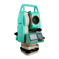
Do you have a question about the Ruide rts-820 series and is the answer not in the manual?
Essential safety and handling guidelines to ensure instrument longevity and user safety.
Step-by-step guide for mounting, leveling, and centering the instrument.
Procedures for performing horizontal and vertical angle measurements.
Procedures for setting up the instrument using known coordinates or backsight points.
Detailed steps for establishing the instrument's position using known XYZ coordinates.
Determining instrument position by measuring to multiple known points.
A faster method for setting up the station without prior coordinate knowledge.
Procedure to determine the instrument's height (HI) using measurements to known points.
Guiding the user to stake out points based on angle and distance measurements.
Stakeout procedure using known XYZ coordinates for target points.
Measuring distances to points offset from a primary line or target.
Measuring angles to points offset from a primary line or target.
Measuring distances between points without direct line of sight.
Measuring the elevation difference between points indirectly.
Functions for designing and staking out road alignments.
Defining the horizontal geometry of a road alignment (line, curve, spiral).
Defining the vertical geometry of a road alignment.
Guiding the user to stake out points along a defined road alignment.
Stakeout procedure accounting for slope gradients.
Procedures for setting up the instrument using known coordinates or backsight points.
Detailed steps for establishing the instrument's position using known XYZ coordinates.
Performing various geometric calculations using coordinate data.
Calculating distance and angles between two defined points.
Calculating coordinates based on azimuth, horizontal, and vertical distances.
Configuring various instrument and measurement settings.
Transferring data from the instrument to a PC.
Transferring coordinate data files from a PC to the instrument.
Adjusting the reticle alignment for optical accuracy.
Checking and adjusting the perpendicularity of optical axes.
Calibrating the vertical index for accurate angle readings.
Adjusting vertical index difference and setting the zero datum.
Verifying and adjusting the instrument constant for distance measurements.
Checking the alignment of optical and laser axes.
Safety precautions related to the instrument's laser distance meter.
| Angle measurement method | Absolute encoder |
|---|---|
| Telescope magnification | 30x |
| Laser Wavelength | 635nm |
| Operating Temperature | -20°C to +50°C |
| Angle minimum reading | 1" |
| Display | LCD |
| Communication | USB |
| Measurement Range | Varies depending on prism and reflectorless mode. See Distance measurement (Prism) and Distance measurement (Reflectorless) |
| Accuracy | See Angle accuracy and Distance accuracy (Prism) and Distance accuracy (Reflectorless) |
| Power Supply | Rechargeable battery |
| Angle accuracy | 2″ |