Do you have a question about the South N3 Series and is the answer not in the manual?
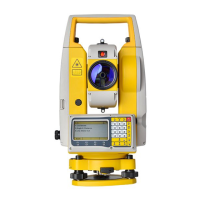
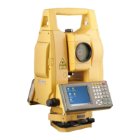
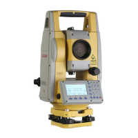
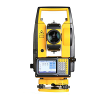
Shows external components of the total station with labels.
Explains the function of each key on the instrument's keypad.
Explains the different sections of the instrument's display screen.
Details the meaning of various icons shown on the screen.
Lists common abbreviations used in the manual and their meanings.
Lists the functions assigned to different keys in various menus.
Explains how to access quick settings using the star key.
Steps for unpacking and storing the instrument before use.
Guides on setting up the tripod and the instrument, including using the plummet.
Detailed steps for leveling the instrument using circular and plate vials.
Instructions for inserting, replacing, and charging the instrument's battery.
Procedures for dismounting and mounting the tribrach.
Adjusts eyepiece for clear view and explains input mode switching.
How to set the horizontal angle to zero for measurements.
Function to lock the current horizontal angle value.
Manually inputting a horizontal angle value.
Switching the vertical angle display between degrees and percent.
Switching horizontal angle readings between right and left faces.
Switching vertical angle reference between horizontal and vertical zero.
Measures slope distance (SD), horizontal distance (HD), and vertical distance (VD).
Selects measurement modes like fine, repeat, or tracking.
Calculates distance elements for stakeout points.
Measures N, E, Z coordinates based on the occupied point.
Selects measurement modes like fine, repeat, or tracking.
Sets the occupied point as the station with its coordinates.
Inputs the height of the reflector for measurements.
Sets the instrument height manually or via auto height.
Sets the backsight point using coordinates (N/E).
Checks the current time and date settings.
Displays information about the total station model and version.
Records points using angle, distance, or coordinate measurements.
Calculates point coordinates based on lateral and longitudinal offsets.
Calculates a point's coordinate by defining a plane from three points.
Calculates the coordinate of a hidden point on a column using offsets.
Computes HD/VD/SD and azimuth difference between two target points.
Measures the height of unreachable targets using a reflector.
Stakes out points based on input or selected coordinates.
Stakes out points using relative angle and distance from the station.
Calculates coordinates of unknown points using a reference line.
Calculates unknown coordinates based on known points and measurements.
Calculates relationships (azimuth, distance) between two known points.
Calculates the area and perimeter of a polygon defined by points.
Calculates coordinates and distances related to a point and a line.
Calculates coordinates of points projected onto a line.
Defines the horizontal path of a road with lines, curves, and transitions.
Defines the vertical profile of a road using chainages and elevations.
Stakeout points along a road alignment based on design data.
Calculates coordinates for single or multiple points along a road.
Sets the station using a known point and instrument height.
Determines station position by measuring angles/distances to known points.
Calculates occupied point coordinates from two known points.
Adjusts station height based on known point coordinates.
Verifies the backsight angle against a preset value.
Manages project files, including creation, deletion, and editing.
Views and manages measured data points.
Manages coordinate data, including viewing, adding, and deleting.
Manages feature codes used for points.
Transfers coordinate or raw data to USB or Bluetooth.
Imports data from USB to the instrument's internal memory.
Displays the status of internal memory usage.
Clears internal storage or codes.
Configures settings for angle, distance, and coordinate measurements.
Changes display units for angle, distance, temperature, and pressure.
Configures Bluetooth settings for connectivity.
Adjusts backlight, battery management, and reticle illumination.
Sets the instrument's current time and date.
Configures settings for how data is collected and saved.
Enables or disables the job selection pop-up.
Turns the touch screen sensor on or off.
Inspection and adjustment procedures for the plate vial.
Inspection and adjustment procedures for the circular vial.
Inspection and adjustment of the electronic compensator.
Inspection and adjustment of the reticle's inclination.
Adjusts the perpendicularity between sight and horizontal axes.
Adjusts vertical index (I Angle) and vertical zero (V0).
Inspection and adjustment of the optical plummet.
Inspection and adjustment of the laser plummet.
Inspects and potentially adjusts the instrument's EDM constant.
Checks and ensures alignment between sight and emitting axes.
Tightens leveling screws on the tribrach if loose.
Details optical and physical characteristics of the telescope.
Lists accuracy, methods, and units for angle measurements.
Outlines range, accuracy, and measurement intervals.
Details the system, range, and accuracy of the compensator.
Lists accuracy, brightness, and laser class for the plummet.
Describes keyboard type, display size, resolution, and position.
Details data interface types like USB and Bluetooth.
Specifies battery type and operating time.
Lists specifications for plate and circular vials.
Covers storage capacity, IP rating, size, and weight.
Safety warnings and precautions for the laser EDM.
Warnings about reflections, improper use, and general laser safety.
Safety classification and precautions for the laser plummet.
| Type | Total Station |
|---|---|
| Angle Accuracy | 2" |
| Laser Plummet | Yes |
| Display | LCD |
| Operating Temperature | -20°C to +50°C |
| Power Supply | Rechargeable Li-ion battery |
| Distance Measurement (Prism) | 3, 000m |
| Communication | USB |
| Resolution | 1mm / 0.1mm |
| Accuracy | ±(2mm + 2ppm) |