84 GPS location services
CFA radios do not transmit their altitude, and
No data will appear instead.
5 Press Back to exit the GPS log display.
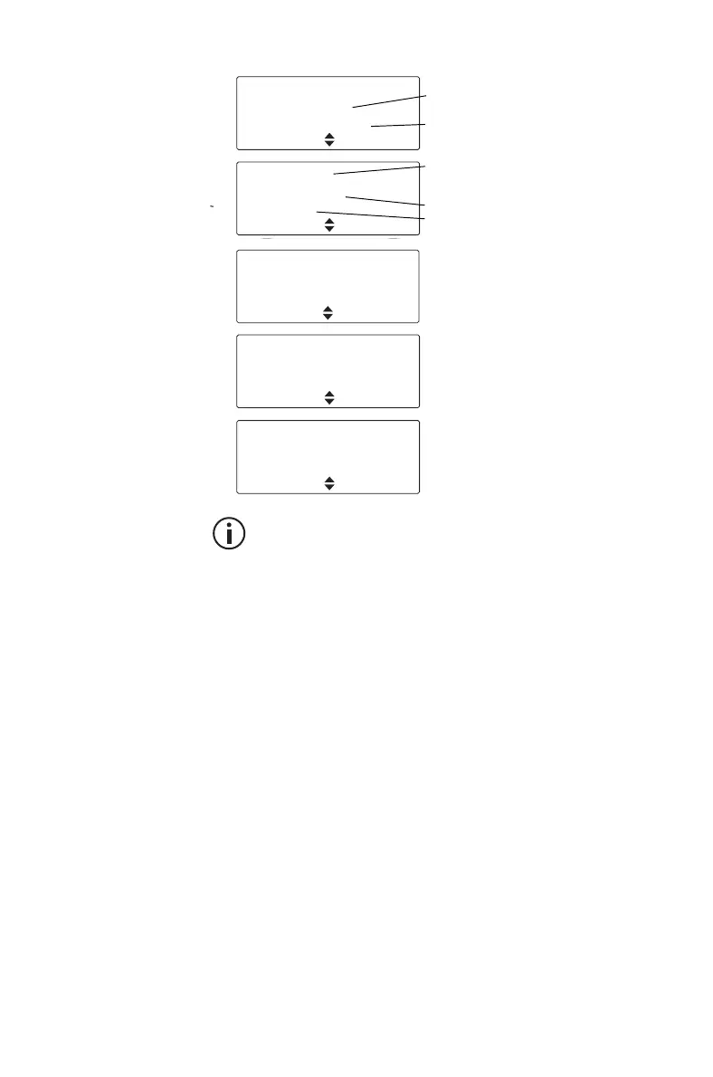
GPS Log valid
ID: 3310001
Age: 0h 01m 10 s
Back
■ Alternating between radio ID,
address book label and role
■ Time since the last GPS
information was receiced
Relative Pos. valid
Range: 90.0 km
Bearing: 20°
Back
■ Alternating between title, radio ID,
address book label and role
(all screens, if available)
■ Distance from the selected radio
■ Bearing from north to the selected
radio
GPS Log valid
27°15.0'
153°06.5'
Back
■ GPS coordinates in decimal
degrees
GPS Log valid
Altitude:
34m
Exit
■ The radio’s altitude in metres
above or below mean sea level
MGA: valid
Zone:
56J
PM264837
Exit
■ MGA: Map Grid of Australia
coordinate system
■ Zone: UTM zone number
■ PM: The grid square
264837: Easting and Northing to
the nearest 100 m
 Loading...