46 Navigation System
If desired, rotate the
Interface Dial
knob
to change the map scale. When you
have the crosshairs in the desired icon,
map feature, or road, push in on the
Interface Dial
. The address of the
location will appear at the top of the
screen.
NOTE:
The selected icon or road segment is
displayed on the 1/2 mile (800 meter) or
less map scale.
If this is the desired address, push in on
the Interface Dial again. If not, use the
Interface Dial to reposition the
crosshairs, then push in on the
Interface Dial again to display the new
address.
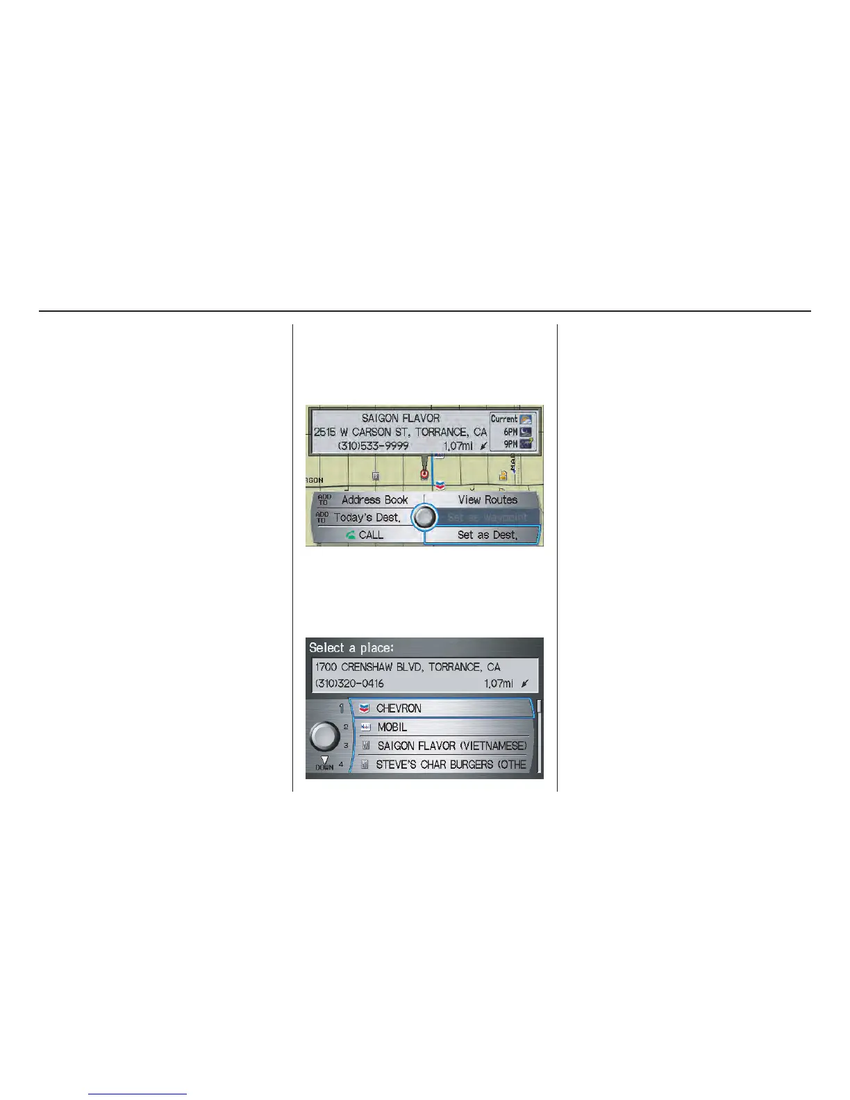
If you select a single icon or road
segment within the target mark, the
following screen appears. Select Set as
Dest. to calculate a route to the selected
destination.
If you select multiple icons within the
cursor radius, the following screen
appears. Select an item from the list.
Then select OK to calculate a route to
the selected destination.
Showing the Map of City
With the City selection, the display
changes to the Enter city name screen.
When you have entered the desired city,
the display changes to a map. The
starting location will be the central
position in the selected city.
See Showing the Map of Current
Position on page 45 for instructions on
finding and entering your desired
destination.
Entering a Destination

 Loading...


