EasyManua.ls Logo

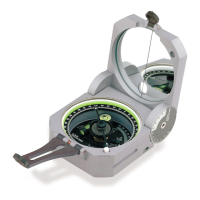
Brunton Transit User Manual

Brunton Transit
15 pages
To Next Page IconTo Next Page
Page #1 background imageLoading...
Page #1 background image
P O C K E T
T R A N S I T
INSTRUCTION MANUAL
1 – IMPORTANT INFORMATION ................................................ Page(s): 1
2 – ORIENTATION ...................................................................................... 2
3 – MAGNETIC DECLINATION ................................................................... 4
4 – AZIMUTH MEASUREMENT ................................................................ 6
5 – VERTICAL & PERCENT GRADE MEASUREMENT ............................. 9
6 – COMPASS USE WITH A TOPOGRAPHIC MAP .................................. 12
7 – ADDITIONAL MEASUREMENT ......................................................... 13
8 – PROSPECTING ................................................................................... 14
9 – REFERENCE MATERIAL .................................................................... 20
10 – SPECIFICATIONS ............................................................................. 21
11 – SERVICE ............................................................................................ 22
i
Copyright 2000, The Brunton Company
A subsidiary of Silva Production, AB
Printed in U.S.A.
form 51-600 rev 0011
Owner’s Purchase Record
Model _______________________________________________________
Date of Purchase ______________________________________________
Dealer Purchased From: _________________________________________
_____________________________________________________________
Serial #:
Question and Answer IconNeed help?

Do you have a question about the Brunton Transit and is the answer not in the manual?

Brunton Transit Specifications

General IconGeneral
BrandBrunton
ModelTransit
CategoryCompass
LanguageEnglish

Summary

Important Information

Orientation

Magnetic Declination

Azimuth Measurement

Azimuth Using a Tripod or Unipod

Method for mounting transit on a tripod for greatest accuracy.

Azimuth Measurement Waist-Level

Method for measuring azimuth when object is above or below observer.

Vertical & Percent Grade Measurement

Inclination and Percent Grade Using Tripod

Measures vertical angles and percent grade using a tripod.

Inclination to the nearest 30 minutes

Using the vernier scale for 30-minute readable accuracy.

percent grade

Using the percent scale to measure grade directly.

Inclination Using Prismatic Compass

Measures angles of inclination without using a tripod.

Height Measurement Using Vertical Angles

Calculates height of objects using vertical angles.

Height Measurements Using % Grade

Calculates height of objects using percent grade.

Compass Use with a Topographic Map

Map Azimuth

Sighting azimuths on a topographic map to determine direction.

Triangulation

Method to find approximate position using a compass and map.

Specifications

Related product manuals