12
EN
Wait for the reconstruction
to be completed. Tap Plan
Field to perform operations.
Drag the map and tap
Add to add a point at the
crosshair position. Tap
to save.
Tap and move the
slider to take off. The
aircraft will perform the
mapping operation along
the route automatically.
Tap in the middle of
the right screen to select
Crosshair.
Drag the map and tap Add
to add a point on the map.
Set route parameters,
drag
to adjust the flight
direction of the route, and
tap
to save.
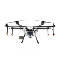
Using the T25
Getting Ready for Takeoff
A. Place the aircraft on open, flat ground with the rear of the aircraft facing toward you.
B. Make sure that the propellers are securely mounted, there are no foreign objects in or on the
motors and propellers, the propeller blades and arms are unfolded, and the arm locks are firmly
fastened.
C. Make sure that the spray tank and flight battery are firmly in place.
D. Power on the remote controller, make sure that the DJI
TM
AGRAS
TM
app is open, and then power on
the aircraft. Go to the home screen in the app and tap Start to enter Operation View. Make sure
that there is a strong signal (the GNSS icon or RTK icon on upper right corner of screen is white).
Otherwise, the aircraft cannot take off.
●
RTK positioning is recommended. In the app, go to Operation View, tap and then RTK to select a method for
receiving RTK signals.
●
DJI Cellular Dongle is recommended for internet connection. In the app, go to Operation View, tap and select
Network Diagnostics. The cellular dongle and SIM card are functioning properly if the status of all the devices in
the network chain are displayed in green.
Starting Operations
Users can perform mapping operations in the operating area using the DJI Agras app and receive an
HD map via offline reconstruction using the remote controller, then plan a field on the HD map for
Route operations. DJI Agras provides multiple methods to add points. The following description uses
Route Mapping and Crosshair as an example.
Power on the remote
controller and then the
aircraft. Enter Operation
View in the DJI Agras app.
App
Tap the mode button on the
upper left and select Route
Mapping on the Mapping
panel in the task mode
selection screen.
Tap on the right screen,
select Area Route or
Boundary Route, then tap
and select Crosshair.
 Loading...