Aircraft
©
2017 DJI All Rights Reserved.
17
Phantom 4 Advanced / Advanced+ User Manual
Precision Landing
The Phantom 4 Advanced / Advanced+ automatically scans and attempts to match the terrain features
underneath during Return to Home. When current terrain matches home point terrain, the Phantom 4
Advanced / Advanced+ will start landing immediately to achieve precision landing. The DJI GO 4 app
will show a terrain feature mismatch prompt if matching fails.
Precision Landing performance is subject to the following conditions:
a) Home point is recorded upon take off, and cannot not be refreshed during ight.
b) Aircraft must take off vertically. Take off altitude must be greater than 7 meters.
c) Home point terrain features remain largely unchanged.
d) Home point terrain with no distinctive features will affect the performance.
e) Lighting conditions cannot be too light nor too dark.
The following actions are available during landing:
a) Pull throttle down to accelerate landing.
b) Moving the control sticks in any other direction will stop Precision Landing. The Phantom 4
Advanced / Advanced+ will descend vertically and Landing Protection will remain active.
Estimated
remaining
ight time
Estimated
remaining ight
based on current
battery level.
N/A N/A N/A
When the Critical low battery level warning is triggered and the aircraft begins to land
automatically, push the left stick upward to make the aircraft hover at its current altitude, giving
you an opportunity to navigate to a more appropriate landing location.
The colored zones and markers on the battery level indicator bar reflect the estimated
remaining ight time. They are automatically adjusted according to the aircraft’s current location
and status.
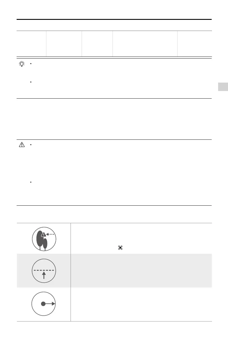
The aircraft cannot avoid obstruction during the Failsafe RTH when the
Forward Vision System is disabled. Therefore, it is important to set a
suitable Failsafe altitude before each ight. Launch the DJI GO 4 app,
enter “Camera” and tap to set the Failsafe Altitude.
20 m
If the aircraft is ying under 65 feet (20 meters) and Failsafe (including
Smart RTH, Lower Battery RTH ) is triggered, the aircraft will first
automatically ascend to 65 feet (20 meters) from the current altitude. You
can only cancel the ascending by exiting the Failsafe.
20 m
H
Aircraft automatically descends and lands if RTH is triggered when the
aircraft ies within a 65 feet (20 meters) radius of the Home Point. Aircraft
will stop ascending and immediately return to the Home Point if you move
the left stick if the aircraft reaches 65 feet (20 meters) altitudes or beyond
during Failsafe.
Failsafe Safety Notices