Do you have a question about the Eagle FishElite 480 and is the answer not in the manual?
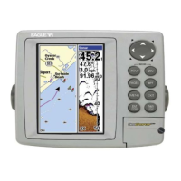
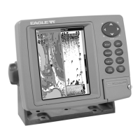
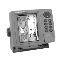
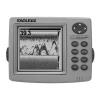
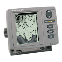
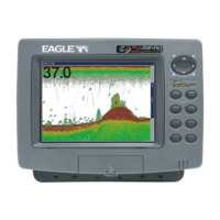
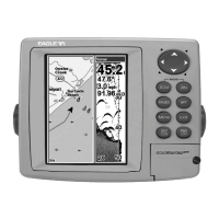
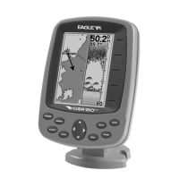
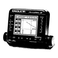
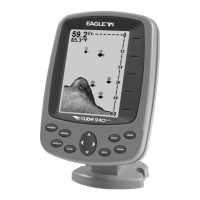
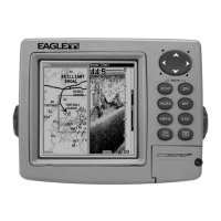
Details the display, resolution, power, and general features of the FishElite 480 and SeaCharter 480DF units.
Explains the fundamental principles of sonar technology and how it detects underwater objects like fish and the bottom.
Describes the basic operation of the unit's GPS receiver, satellite signals, and position calculation.
Provides an overview of the Global Positioning System (GPS) and the Wide Area Augmentation System (WAAS).
Explains text formatting, key conventions, and menu command sequences used throughout the manual.
Guides users through installing the Skimmer transducer on a transom, trolling motor, or inside a hull.
Lists necessary tools and supplies for transducer installation, differentiating by mounting type.
Provides criteria for choosing an optimal transducer mounting location for best sonar performance.
Compares shoot-thru-hull and transom mounting methods for transducers, detailing advantages and disadvantages.
Explains the function and compatibility of speed and temperature sensors with the unit.
Provides instructions for installing an optional speed sensor to track speed and distance.
Details how to install and use MultiMedia Cards (MMC) or Secure Digital (SD) cards for data storage.
Explains how to properly connect the unit to a 12-volt battery system, emphasizing safety and interference prevention.
Describes the GPS module, its antenna, and mounting recommendations for clear sky view.
Covers various methods for mounting the unit, including gimbal bracket, in-dash, and portable options.
Identifies and explains the function of each key on the unit's control panel.
Details how to turn the unit on, adjust backlight, and turn the unit off.
Introduces the Main Menu structure and the function of its primary commands.
Explains the four main Page displays (Satellite, Navigation, Map, Sonar) and how to switch between them.
Provides information on satellite lock-on and position acquisition quality, including WAAS reception.
Describes the Navigation Page, including compass rose, track, and waypoint information.
Explains the Map Page, showing course, track, and position on a moving map.
Details the Sonar Page, which displays the sonar chart and underwater echoes.
Offers a simplified, 10-step guide for basic operation and fish finding with the unit's default settings.
Explains the ASP feature for noise rejection and its four settings: Off, Low, Medium, and High.
Covers the unit's three alarm types: Fish Alarm, Zone Alarm, and Depth Alarms (Shallow and Deep).
Guides users on calibrating the speed sensor to compensate for inaccuracies by comparing it to GPS ground speed.
Explains chart speed settings, recommending maximum for most conditions and suggesting adjustments for specific situations.
Describes how to use the depth cursor to pinpoint the exact depth of targets on the sonar display.
Explains the Auto Ranging feature, which automatically places the bottom signal in the lower half of the screen.
Details how to manually control the depth range, offering 16 settings from 5 to 4,000 feet.
Explains the FasTrack feature, which converts echoes to short horizontal bars for rapid updates, useful for stationary fishing.
Describes the Fish I.D. feature, which identifies targets as fish and displays symbols instead of arches.
Explains the FishTrack feature, which shows the depth of fish symbols when Fish I.D. is active.
Details the FishReveal feature, which uses gray tones to highlight fish targets hidden by clutter or cover.
Explains the 200 kHz and 50 kHz transducer frequencies and their respective cone angles and penetration capabilities.
Describes the Grayline feature for distinguishing between strong and weak echoes and identifying bottom hardness or weeds.
Guides users on how to record sonar data to an MMC card for later playback or analysis.
Explains how to select and display digital data like speed, temperature, and bearing on the Sonar or Map pages.
Details how Ping Speed controls the transmitter rate and how increasing it activates HyperScroll mode.
Explains how to reset all unit features, options, and settings to their original factory defaults.
Guides users on calibrating depth readings to account for the transducer's position relative to the boat's keel.
Explains how sensitivity controls echo detection and how to adjust it manually or use the automatic mode.
Describes options for changing the sonar chart's color scheme, including grayscale, reverse, bottom black, and FishReveal.
Introduces the four sonar chart display options: Full Sonar Chart, Split Zoom, Split Frequency, and Digital Data.
Describes the split screen option that displays both the map and sonar data simultaneously.
Explains how to use the built-in simulator to practice unit functions and features without being on the water.
Details how to temporarily stop the sonar chart from scrolling, useful when using multiple units.
Explains how to adjust Surface Clarity to reduce or eliminate surface clutter from wave action or boat wakes.
Covers the Zoom In (ZIN) and Zoom Out (ZOUT) features for enlarging details on the sonar display.
Provides steps to diagnose and resolve issues when the unit fails to power on.
Offers solutions for unit malfunctions, including electrical noise and cable issues.
Addresses problems with weak bottom signals or inaccurate readings, often related to transducer issues.
Troubleshoots the absence of fish arches, suggesting checks for transducer orientation, sensitivity, and zoom settings.
Explains common causes of sonar noise and methods to identify and minimize electrical interference.
Identifies and explains the function of each key on the unit's control panel for GPS operations.
Introduces the Main Menu structure for GPS operations and its primary commands.
Explains the four main Page displays (Satellite, Navigation, Map, Sonar) and how to switch between them for GPS.
Provides information on satellite lock-on and position acquisition quality, including WAAS reception.
Describes the Navigation Page, including compass rose, track, and waypoint information.
Explains the Map Page, showing course, track, and position on a moving map.
Explains how the unit automatically finds and displays the current position upon startup.
Details how to use zoom keys and arrow keys to navigate and explore the map display.
Guides users on how to select map items like POIs or features using the cursor for detailed information.
Introduces the unit's powerful search functions for finding addresses, highways, POIs, and other map features.
Explains how to create and save waypoints, which are electronic addresses for locations.
Guides users on quickly saving the current position as a waypoint using the Quick Save method.
Describes how to manually place a waypoint on the map at a desired location.
Details how to create a waypoint by manually entering its latitude and longitude coordinates.
Explains how to select and navigate to a saved waypoint using map cursor or find functions.
Describes the MOB feature, allowing immediate saving of the current position for man overboard situations.
Guides users on navigating back to the Man Overboard position using the Navigation or Map Page.
Explains how to navigate to any location selected on the map using the cursor.
Details how to navigate to Points of Interest (POIs) found on the map or through search.
Explains how to create and save trails, which are records of the path taken, useful for retracing journeys.
Guides users on how to selectively turn trail display on or off on the map.
Covers three methods for following trails: visual trailing, navigating forward, and backtracking.
Describes the simplest method of following a trail by visually tracking the position arrow on the Map Page.
Explains how to navigate a trail in its recorded direction from start to end, providing navigation data.
Details how to navigate a trail in reverse order, from the end to start, providing navigation data.
Explains how to transfer custom maps and GPS data files between the unit, MMC cards, and computers.
Guides users on measuring the distance and bearing from their current position to any point on the map.
Explains how to measure the distance and bearing between any two points selected on the map.
Describes how to use graphic symbols (icons) to mark locations and events on the map.
Guides users on creating an icon at a specific location on the map.
Explains how to create an icon at the unit's current position while traveling.
Details methods for deleting icons from the map, individually or in bulk.
Explains how to navigate to a selected icon on the map.
Defines routes as sequences of waypoints for marking travel courses and provides navigation options.
Guides users on creating and saving routes by selecting waypoints or from the map.
Recommends MapCreate software for preparing routes on a PC and loading them into the unit.
Explains how to create routes directly on the unit using existing waypoints or map locations.
Details how to delete a specific route or all routes from the unit's memory.
Guides users on how to change the name of a saved route.
Explains how to add or remove waypoints from an existing route.
Details how to navigate a route from start to destination, providing navigation information.
Explains how to navigate a route in reverse order, from the last waypoint to the first.
Covers the unit's various GPS alarms, including arrival, off-course, and anchor alarms, and how to configure them.
Explains how the unit automatically searches for satellites to determine its position.
Guides users on how to view the contents and available space on the installed MMC card.
Details how to configure the NMEA 0183 communication port for data exchange with other marine devices.
Explains how to configure the unit to recognize and utilize DGPS receivers for enhanced accuracy.
Allows users to select the preferred coordinate system for displaying and entering position data.
Describes the Map Fix feature for determining position on a printed chart using a reference point.
Explains how to customize the information displayed on the Position, Navigation, and Map pages.
Provides information on DGPS status and signal quality for troubleshooting.
Explains how to use the GPS simulator to practice navigation and practice with unit features.
Details how to simulate trail or route navigation within the GPS simulator.
Explains how to hide GPS menus and features when the GPS antenna is not attached.
Allows setting a specific starting location for practice or simulation purposes.
Describes the auto zoom feature that adjusts map scale during navigation to keep the destination in view.
Covers options for controlling map display, including detail level, pop-up info, boundaries, and overlays.
Allows selection of the map datum, which affects how latitude/longitude are displayed and interpreted.
Enables customization of map display by selectively showing or hiding features like cities, highways, and POIs.
Explains map orientation options: North Up, Track Up, and Course Up.
Details how to display Navionics electronic charts on MMCs, similar to MapCreate maps.
Explains how to view Port Services information, represented by icons on Navionics charts.
Describes how to view tidal current data, including velocity and direction, from icons on Navionics charts.
Explains how to view tidal information, including daily tidal data and tidal range patterns, from icons on Navionics charts.
Explains how to enable or disable pop-up help messages that describe menu item functions.
Describes the feature that locks the current position on the GPS plotter when stationary or moving slowly.
Explains how to reset all unit features, options, and settings to their factory defaults.
Allows forcing the unit to require DGPS for valid position reporting.
Guides users on adjusting the display's contrast and brightness for optimal viewing.
Explains how to change the unit's menu language from a selection of 10 languages.
Details how to set the unit's local time and date for accurate navigation and waypoint logging.
Explains how to turn the WAAS acquired/lost alarm on or off without affecting WAAS functionality.
Shows how to find the unit's current software version, useful for updates.
Covers adjusting key press sounds, alarm sounds, volume, and alarm styles.
Explains Track Smoothing, a factory setting that prevents trail wandering and improves accuracy at slow speeds.
Details various options for managing trails, including updating, displaying, and creating new trails.
Allows selection of units for speed, distance, depth, temperature, and heading.
Guides users on searching for specific street addresses, including options for city and street name entry.
Explains how to find information about any item selected on the map using the cursor.
Details how to search for highway exits and view associated services.
Covers searching for Points of Interest (POIs) by category, subcategory, name, or nearest location.
Explains how to search for specific streets and their intersections.
Guides users on searching for a specific street name by spelling it out or selecting from a list.
Details how to search for intersections by specifying two street names.
Explains how to search for waypoints by name or by nearest location.
Lists various geodetic datums supported by the unit for accurate positioning.
Enables customization of map display by selectively showing or hiding features like cities, highways, and POIs.
Explains map orientation options: North Up, Track Up, and Course Up.
| Display Type | Color LCD |
|---|---|
| Transducer Type | Dual Beam |
| GPS | No |
| Waterproof Rating | IPX7 |
| Transducer | Included |
| Sonar Frequency | 200 kHz |