Do you have a question about the Eagle FishStrike 2000 and is the answer not in the manual?
Explains how to use the manual for quick access to information.
Steps to take before beginning the installation of the sonar/GPS unit and its components.
Detailed instructions for installing the sonar transducer on a transom, trolling motor, or inside a hull.
Lists the necessary tools and supplies required for various transducer installation methods.
Guidelines for choosing the optimal location for transducer mounting to ensure proper water flow and performance.
Explains how to adjust transducer height for optimal performance and protection from impacts.
Compares the advantages and disadvantages of shoot-thru-hull and transom transducer mounting methods.
Step-by-step guide for assembling and mounting transducers using one-piece or two-piece brackets.
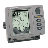
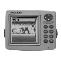
Details the function of each key on the sonar/GPS unit's control panel for operation.
Instructions on how to turn the unit on, off, and adjust screen backlight levels.
Explains the Main Menu structure and the function of its various commands for unit setup and operation.
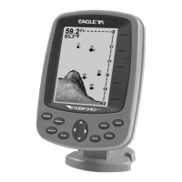
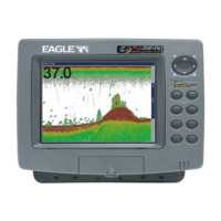
Describes the four main page displays (Satellite Status, Navigation, Map, Sonar) and how to switch between them.
A simplified, step-by-step guide for quick operation of sonar features in automatic modes.
Explains the ASP feature for noise rejection and how to adjust its levels for optimal display clarity.
Covers the setup and function of various sonar alarms including Fish, Zone, and Depth alarms.
How to use the depth cursor to pinpoint the exact depth of targets on the sonar display.
Explains the Auto Ranging feature for automatically adjusting depth display and manual settings.
Details the Fish I.D. feature for identifying fish with symbols and its limitations compared to reading arches.
Discusses the use of 200 kHz and 50 kHz frequencies for different water depths and conditions.
Explains how to adjust sonar sensitivity for better echo detection in auto or manual modes.
Describes how to change the sonar chart's color scheme and display appearance.
Troubleshooting steps for issues where the unit fails to power on.
Solutions for problems like unit freezing, locking up, or erratic operation due to electrical noise or connections.
Guidance for addressing issues with weak bottom echoes, erratic readings, or lack of fish signals.
Explains sources of electrical noise and methods to eliminate or minimize its impact on the sonar display.
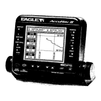
Identifies the keys and their functions for operating the GPS features of the unit.
Instructions for turning the unit on, off, and managing backlight settings for GPS operations.
Explains the Main Menu and its commands relevant to GPS functions and system setup.
Describes the four main page displays (Satellite Status, Navigation, Map, Sonar) for GPS operations.
Provides detailed information on GPS satellite lock-on status, position acquisition, and signal quality.
Explains how to use the Navigation Page, including compass rose, course lines, and navigation data display.
Covers how to use the Map Page, including viewing tracks, navigating, and map zoom functionality.
How to use zoom and arrow keys to navigate and explore the map display for location details.
How to navigate back to the MOB position using the Navigation or Map Page displays.
Step-by-step process for saving a recorded trail, making it inactive, and starting a new one.
How custom maps work, including loading from MMC cards and compatibility with MapCreate software.
Information on GPS Data Files, including waypoints, routes, trails, and how to transfer them.
How to measure the distance from the unit's current position to a selected map location.
Information on using icons to mark locations, points of interest, or events on the map screen.
Explains what routes are, how they are composed of waypoints, and their automatic navigation capabilities.
Information on managing trails, including deleting, editing names, colors, and patterns.
Covers waypoint management, including deleting, editing names, symbols, and positions.
Configuration of GPS alarms, including arrival, off-course, and anchor alarms with adjustable settings.
How to select different coordinate systems (degrees, UTM, MGRS, etc.) for displaying position data.
How to customize digital data boxes displayed on various pages to show preferred information.
How to use the GPS simulator for practicing navigation without being outdoors.
Options for controlling map display, including detail levels, boundaries, water fill, and overlays.
How to change the map datum to adjust position display based on different survey standards.
How to change map orientation from North Up to Track Up or Course Up modes.
How to display Navionics electronic charts on MMC cards, similar to MapCreate maps.
Steps for searching for specific addresses by entering street and city information.
How to search for Points of Interest (POIs) by category or nearest location.
How to search for specific streets or intersections by entering street names.
Methods for finding waypoints by name or by nearest location.
A comprehensive list of geodetic datums supported by the unit for position referencing.
| Brand | Eagle |
|---|---|
| Model | FishStrike 2000 |
| Category | Fish Finder |
| Language | English |