Do you have a question about the Emlid REACH RS2 and is the answer not in the manual?
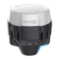
Details on how to power the Reach RS2/RS2+ unit, including battery and external power options.
Step-by-step guide for the initial setup of the Reach RS2/RS2+ device and Emlid Flow app.
Instructions on how to establish a connection between your device and the Reach receiver.
Guidance on optimal placement of the Reach receiver for accurate GNSS and RTK positioning.
Explanation of the different LED indicators on the Reach RS2/RS2+ and their meanings.
An explanation of the Real-Time Kinematic (RTK) technique and its principles for accurate positioning.
Step-by-step guide to configure two Reach RS2/RS2+ units as base and rover for RTK operation.
Instructions for connecting the Reach receiver to the internet using a Wi-Fi network.
Guide on connecting the Reach receiver to the internet using a mobile hotspot.
Steps to connect the Reach receiver to the internet using its built-in cellular modem.
Configuration details for receiving RTK corrections via an NTRIP service.
Best practices and methods for placing the base station for optimal RTK performance.
An overview of the Post-Processed Kinematic (PPK) technique for accurate positioning.
Instructions on recording GNSS raw data logs for PPK processing.
Guide on logging data for Stop & Go workflows using the Emlid Flow app.
Steps for recording GNSS raw data logs for Precise Point Positioning (PPP) services.
Instructions for logging data for NOAA's Online Positioning User Service (OPUS).
An explanation of the Precise Point Positioning (PPP) technique for determining accurate coordinates.
Guide on using the NRCan CSRS-PPP service for precise coordinate determination.
Instructions for using the IBGE-PPP service for post-processing GNSS data.
Guide on using the Australian online GPS processing service AUSPOS.
Instructions for using NOAA's Online Positioning User Service (OPUS) for static point determination.
How to obtain precise coordinates from Reach on an Android device using Bluetooth.
Step-by-step guide for integrating Reach RS2/RS2+ with ArcGIS Survey123 via TCP.
Guide on using QGIS as a survey tool with Reach for GIS data collection and analysis.
Tutorial for setting up data collector running FieldGenius with Reach via Bluetooth.
Guide to set up Reach RS2/RS2+ as a base for DJI RTK drones for geotagging images.
Guide to set up Reach RS2/RS2+ as a base for Autel EVO II Enterprise drones.
Tutorial on surveying in RTK with senseFly drones and Reach RS2/RS2+.
Guide on performing PPK with senseFly drones and Reach RS2/RS2+ in eMotion software.
Overview of Reach RS2/RS2+ performance specifications and datasheet links.
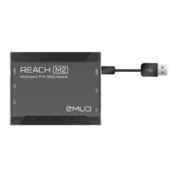
Description of the Reach RS2/RS2+ ports, including SIM card, RS-232, USB-C, and LoRa.
Details on the mechanical specifications of the Reach RS2/RS2+ unit.
Information regarding the electrical specifications and antenna reference point of the receiver.
Specifications for available extension cables for Reach RS2/RS2+.
Guide on updating the Reach RS2/RS2+ firmware using the Emlid Flow app's Updater tool.
Instructions for reflashing the Reach RS2/RS2+ firmware using the Reach Firmware Flash Tool.
Steps to download a Simple System Report (SSR) for Reach troubleshooting.
Steps to download a Full System Report (FSR) for advanced Reach troubleshooting.
Guide on how to locate the serial number of your Reach RS2/RS2+ device.
Instructions for enabling the raw data debug option for troubleshooting purposes.
| RTK | Yes |
|---|---|
| Static | Yes |
| Channels | 184 |
| Update Rate | Up to 10 Hz |
| Operating Temperature | -20°C to +65°C |
| Ingress Protection | IP67 |
| Internal Memory | 16 GB |
| GNSS | GPS/QZSS L1C/A, L2C; GLONASS L1OF, L2OF; BeiDou B1I, B2I; Galileo E1-B/C, E5b |
| Positioning Accuracy RTK | Horizontal: 7 mm + 1 ppm, Vertical: 14 mm + 1 ppm |
| Positioning Accuracy Static | Horizontal: 4 mm + 0.5 ppm, Vertical: 8 mm + 1 ppm |
| Connectivity | Wi-Fi, Bluetooth |
| Weight | 950 g |