Do you have a question about the Furuno FAR-3330S-SSD and is the answer not in the manual?
General advice for users, including copyright and manual handling.
Instructions for proper disposal of the product according to local regulations.
Guidelines for disposing of used batteries, including terminal taping and collection sites.
Information on potential hazards of RF energy emitted by the radar antenna and safety distances.
Details about warning labels attached to the equipment and instructions for replacement.
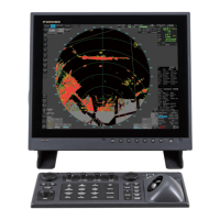
Step-by-step instructions for powering the radar system on and off.
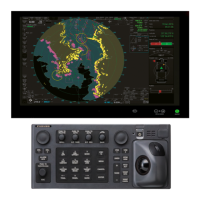
Description of available operating modes: RADAR and CHART for RADAR.
Description of the Status bar, its buttons, and their functions in radar and chart modes.
Overview of the InstantAccess bar buttons for quick access to functions and modes.
Explanation of the Sensor Information and Datum Box, including data indications and sensor names.
Procedure for selecting and configuring navigation sensors for radar and chart modes.
Instructions for entering ship speed manually or automatically for TT and stabilized modes.
Using the Man Overboard (MOB) feature to mark a position on the display.
Procedures for transmitting radar pulses and tuning the receiver for optimal performance.
Selecting pulse length and adjusting receiver sensitivity using the GAIN control.
Methods for reducing sea and rain clutter using A/C SEA and A/C RAIN controls.
Using ACE to automatically reduce sea and rain clutter for a cleaner display.
Description of available presentation modes: Relative Motion and True Motion.
Using VRM and EBL to accurately measure target range and bearing.
Using offset EBL to assess collision risk and read CPA.
Overview of TT function, showing/hiding TT display, and displaying target data.
Setting up automatic acquisition zones and manually acquiring and stopping target tracking.
Selecting vector modes and configuring past position display for target movement analysis.
Setting CPA/TCPA alarms and simulating maneuvers to assess collision risks.
Showing/hiding AIS display and understanding AIS symbols for target identification.
Filtering sleeping targets and setting conditions for automatic activation.
Selecting association methods to present a single symbol for same physical target.
Creating, transmitting, and displaying AIS safety and routine messages.
Definition and purpose of radar maps for indicating safety-related areas and objects.
Erasing, copying, exporting, and importing radar map marks and lines.
Setting up ship's track recording and displaying routes on the radar.
Layout of the chart screen, operating modes, and presentation modes.
Description of Status bar buttons and InstantAccess bar functions for chart modes.
Details on electronic chart area, supported types, and sensor setting selection.
Managing routes and user charts in navigation and planning modes.
Procedures for installing public keys, ENC licenses, and ENC chart data.
Manually updating ENC and C-MAP charts with new objects or modifications.
Viewing chart cell status, managing licenses, and exporting lists.
Synchronizing chart data between multiple units via network.
Viewing charts using different positions, scales, and navigation tools.
Managing the display of chart features like contours, symbols, and boundaries.
Configuring display settings for chart symbols, depths, boundaries, and light sectors.
Accessing menus to control display of standard, other, and AIO chart features.
Configuring visibility of own ship, target, route, and Mariner symbols.
Overview of S57 charts, their encryption, and manual update procedures.
Understanding S57 chart symbology and finding information about chart objects.
Using the AIO to display temporary and preliminary notices for navigation.
Detecting dangerous areas based on depth contours and setting safety contours.
Setting check areas and generating chart alerts for planned routes.
Overview of route planning, creating new routes, and route optimization strategies.
Managing routes by importing, exporting, and deleting route data.
Using the SAR feature for search and rescue operations, including defining search patterns.
Overview of user charts and their constituent objects: tidal, lines, areas, circles, labels.
Steps for creating new user charts and editing objects within them.
Procedures for deleting individual objects or entire user charts.
Controlling the visibility and transparency of user chart objects on the display.
Starting route monitoring from the InstantAccess bar or Route Information box.
Methods for manually or automatically stopping route monitoring.
Using Instant Track modes (Safe Off Track, Back to Track) for deviations and returns.
Viewing waypoint details and displaying route elements on the radar.
Using PI lines for maintaining constant distance from coastline or partner ship.
Setting check areas for safe navigation and monitoring ship's drift at anchor.
Checking ship's draught setting (UKC) and actual depth for alerts.
Estimating future positions with Predictor and measuring distances with Divider.
Understanding CCRS and selecting navigation sensors for system use.
Choosing primary/secondary position sources and selecting sources for SOG, COG, Heading, and Wind.
Checking sensor integrity, filtering data, and fine-tuning ship's position.
Sending, receiving, displaying, and deleting AIS safety messages.
Receiving and reading Navtex navigational and meteorological warnings.
Displaying TT targets, symbols, color, size, and detailed data.
Displaying AIS targets, voyage data, filtering options, and managing target activation.
Selecting association methods to present a single symbol for same physical target.
Recording user comments and saving ship positions manually or automatically.
Viewing and searching recorded voyage information and details.
Storing information about dangerous radar (TT) and AIS targets with conditions.
Definition, priority classification (Alarm, Warning, Caution), and category (A, B, C) of system alerts.
Using the Alert Box and List to view, acknowledge, silence, and find details of alerts.
Storing, displaying, filtering, and exporting alert history.
Setting basic ship parameters (speed, height, draught) and route parameters (ROT, approach).
Configuring instant track parameters like delay, turn radius, and channel limit.
Defining cost parameters (cost/hour, cost/ton, fuel consumption) for route optimization.
Exporting and importing system settings, routes, charts, and radar configurations.
Performing self-tests on equipment and checking all controls and keys.
Restoring default settings and selecting the Consistent Common Reference Point.
Key topics for maintaining the Common Reference System, including installation and accuracy factors.
Recommended maintenance tasks for system components like monitor, processor, and antenna.
Procedures for replacing fuses and cleaning the trackball module.
Diagnosing and resolving common radar issues, from disappearing echoes to sensor errors.
Detailed menu structure for radar functions and settings.
Detailed menu structure for AIS functions and settings.
Alphabetical list of abbreviations and their meanings used in the manual.
Graphic representations of symbols used on operating buttons and display elements.
Explanation of indication colors for sensor data and their status.
Details on antenna radiator type, beam width, TX frequency, output power, and transmitter type.
Specifications for processor unit (range, accuracy) and monitor units (screen size, brightness).
Details on interface ports, power supply requirements, and operating environmental conditions.
Specifications for the performance monitor functions across different radar bands.
| Transmitter | Solid-state |
|---|---|
| Antenna Type | Slotted waveguide array |
| Power Supply | 24 VDC |
| Radar Frequency | 9410 MHz ±30 MHz |
| Range | Up to 96 nautical miles |
| Range Scales | 0.125, 0.25, 0.5, 0.75, 1.5, 3, 6, 12, 24, 48 NM |
| Antenna Length | 1.2 m |