Do you have a question about the Garmin 276Cx and is the answer not in the manual?
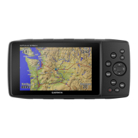
Provides an overview of the device's physical components and ports.
Details the function of each physical button on the device.
Explains how to navigate between the primary screens and modes.
Covers warnings and precautions related to the device's batteries.
Offers tips and settings to extend battery operational time.
Describes how to enable battery save mode for extended use.
Provides instructions for storing the device for extended periods.
Explains how to install AA batteries as an alternative power source.
Details on how to charge the device's battery pack using various power sources.
Simple instruction on how to power on the GPS device.
Guides on adjusting screen brightness and audio output volume.
Information on accessing Garmin support and device software updates.
Steps to connect the device to a computer for Garmin Express setup.
Overview of features available via smartphone or wireless network connection.
Explains the process and factors affecting the acquisition of GPS signals.
How to customize the display of satellite information on the GPS page.
Instructions on how to disable GPS tracking to conserve battery or for other uses.
Enables setting a manual location for use when GPS is off.
Details on activating GLONASS and WAAS for improved positioning.
Instructions on how to save your current location as a waypoint.
Methods to search and locate saved waypoints by various criteria.
How to create a new location by projecting distance and bearing from a marked point.
Steps to start navigation towards a selected waypoint.
Procedure to refine waypoint accuracy by averaging multiple readings.
How to modify the details of an existing waypoint.
Instructions for managing waypoint categories, including adding and editing.
Steps to remove a waypoint from the device.
Guide to building a route by selecting sequential points.
How to start navigating a previously created or saved route.
Procedure to duplicate an existing route for modification or backup.
How to change the name of a saved route for better identification.
Steps to add, remove, or reorder points within an existing route.
Instructions on how to remove a route from the device.
How to start navigation to a route that has been previously saved.
How to view details and the map of the currently active route.
Procedure to end the current navigation session.
How to invert a route to navigate from the destination back to the start.
Guide on how to temporarily reroute around obstacles or construction.
How to input trip data to calculate trip details and estimates.
How to start, pause, and stop the device's track logging feature.
How to view the current track log on the map or as an elevation plot.
Procedure to save the currently recorded track log.
How to erase the current track log data.
Steps to remove saved track logs from the device.
How to start navigation along a previously saved track.
Explanation of archiving tracks to free up memory and store them.
How to set up automatic archiving of tracks based on schedule or storage.
Procedure to manually archive saved track logs.
How to use the find menu to search for various locations and items.
Step-by-step guide to start navigation to a chosen destination.
Procedure to end the current navigation session.
How to search for specific locations using their names.
Method to find locations relative to a specified point on the map.
How to use the compass page for directional guidance.
Instructions for calibrating the electronic compass for accuracy.
Explanation of the course pointer feature for straight-line navigation.
How to follow a route or track using the on-screen map display.
How to retrace your path back to the start of a track log.
How to set preferences to avoid specific road types during routing.
Procedure for marking a MOB location and navigating back to it.
Description of the elevation plot feature and its customization.
How to switch the elevation plot display between time or distance.
Procedure to manually calibrate the altimeter using known elevation or pressure.
Overview of the trip computer's display and statistics.
Instructions on how to reset trip data, speed, and odometer values.
Explanation of the highway page for steering guidance and route visualization.
Information on downloading and using BirdsEye satellite imagery.
How to view the device calendar and access almanac data.
How to look up tide height and tide times for specific stations.
How to view sunrise, sunset, moon data, and hunting/fishing times.
How to access current weather information and forecasts.
How to change the data fields displayed on various pages.
How to select and set up different page layouts.
How to enable or disable maps loaded on the device.
Settings for general map appearance, detail, and orientation.
Options to adjust map detail and orientation.
Settings for map display options like shaded relief and guidance text.
Settings specific to marine map display and features.
Settings for marine chart symbols and light sectors.
Options to customize the trip computer layout and reset data.
Settings for highway page appearance and data fields.
How to configure various types of alarms on the device.
How to turn off GPS functionality.
How to turn on GPS functionality.
Setting for satellite view orientation.
Option to set satellite page display to single color.
How to mark current location on the map.
Using Garmin AutoLocate to set the GPS position.
How to set the satellite system (GPS, GLONASS).
How to set the device mode to Marine or Automotive.
How to change the device's text language.
How to enable WAAS/EGNOS for improved GPS accuracy.
Setting for power mode when disconnected from external power.
Setting for power mode when connected to external power.
Settings for serial interface communication.
How to change the AA battery type setting.
How to adjust display color, backlight, and timeouts.
Settings for route calculation, avoidance, and behavior.
Settings for track recording, archiving, and output format.
How to set the barometer mode (Variable Elevation or Fixed Elevation).
How to view elevation or pressure changes over time or distance.
How to enable automatic altimeter calibration.
How to manually calibrate the altimeter using known data.
How to set the beeper for alarms and selections.
How to set the tone that sounds before voice prompts.
How to set voice prompt behavior for guidance.
How to select the language for voice prompts.
How to adjust the external speaker or headphone volume.
How to configure user and marine timer settings.
How to set the time format and time zone.
How to customize units for distance, speed, elevation, etc.
How to set the position format for location readings.
How to set the map datum coordinate system.
Shows the coordinate system the device is using.
How to set direction references for heading information.
Precautions for caring for the device, avoiding damage.
Instructions on how to properly clean the device.
Information on using optional fitness accessories with the device.
Steps to pair ANT+ wireless sensors, like heart rate monitors.
Information on managing files stored on the device.
Instructions for installing a microSD memory card for storage or maps.
Instructions for connecting the device to a computer via USB.
How to copy files from a computer to the device or memory card.
Instructions and warnings regarding the deletion of files from the device.
How to safely disconnect the device from a computer.
Technical specifications of the device, including battery and water rating.
| Display Resolution | 800 x 480 pixels |
|---|---|
| Water Rating | IPX7 |
| Waypoints | 10, 000 |
| Routes | 250 |
| Track Log | 20, 000 points, 250 saved tracks |
| Barometric Altimeter | Yes |
| Electronic Compass | Yes (tilt-compensated 3-axis) |
| Rugged Design | Yes |
| Display Size | 5" |
| Weight | 450 g with batteries |
| Battery Type | Rechargeable lithium-ion |
| Battery Life | Up to 16 hours |
| Memory | 8 GB |
| Interface | USB and NMEA 0183 |
| Receiver | High-sensitivity with GPS and GLONASS support |
| Connectivity | Bluetooth, ANT+ |
| Preloaded Maps | Yes (varies by region) |