Do you have a question about the Garmin DAKOTA 10 and is the answer not in the manual?
Details on battery types, installation, and replacement.
Instructions for powering the device on and off.
Steps to establish a connection with GPS satellites.
Guide on marking and saving specific geographical locations.
Instructions for finding and following routes to a chosen location.
How to interact with and interpret the map display.
Guide on utilizing the device's compass feature.
Steps for calibrating the electronic compass for accuracy.
Explanation of different compass pointer types and their meaning.
Editing, repositioning, and deleting saved waypoints.
Process for creating, saving, and navigating custom routes.
Modifying or removing saved routes.
Recording, saving, and viewing tracked paths.
Procedures for saving and accessing recorded tracks.
Viewing elevation changes over distance or time.
Transferring data between compatible Garmin devices.
Refining waypoint location accuracy.
Checking GPS signal status and accuracy.
Displaying current speed, distance, and trip data.
Information on geocaching and how to navigate to geocaches.
Configuring map display orientation and zoom.
Configuring route calculation and avoidance preferences.
Connecting wireless sensors like heart rate monitors.
Detailed technical specifications of the device.
Guide on connecting the device via USB.
Tips and suggestions for maximizing battery performance.
How to reset the device to its original factory configuration.
| Outdoor (hiking, trekking) | Yes |
|---|---|
| Marine (chartplotters, sounders) | No |
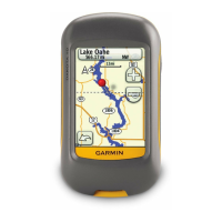
| Form factor | Handheld |
| Product color | Gray |
| GPS receiver | HotFix |
| Display diagonal | 2.6 \ |
| Display resolution | 160 x 240 pixels |
| Display size (HxV) (imperial) | 1.43 x 2.15 \ |
| Battery type | AA |
| Battery life (max) | 20 h |
| Number of batteries supported | 2 |
| Sustainability certificates | RoHS |
| Routes quantity | 50 |
| Tracks quantity | 200 |
| Number of waypoints | 1000 |
| Map storage | Internal storage |
| Compatible memory cards | Not supported |
| USB 2.0 ports quantity | 1 |
| Depth | 33 mm |
|---|---|
| Width | 55 mm |
| Height | 100 mm |
| Weight | 148.8 g |