Do you have a question about the Garmin DRIVE 53 and is the answer not in the manual?
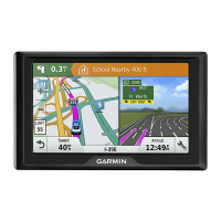
Overview of the Garmin Drive 53 device, detailing its buttons and ports.
Guidelines for safely and securely mounting the device in a vehicle.
Instructions for physically mounting the device and connecting it to power.
How to power the device on, put it in power saving mode, or turn it off completely.
Process and tips for the device to acquire satellite signals for location tracking.
Explanation of icons displayed in the status bar for device information.
How to navigate menus and options using the device's on-screen buttons.
Steps to adjust the main volume and mute the device.
Setting volume levels for different audio types like navigation prompts and calls.
Controlling specific audio outputs like navigation prompts and button press sounds.
How to adjust the display's brightness level using a slider.
Instructions to enable or disable various driver alert types on the device.
How to search for locations by entering categories, names, addresses, or cities.
Step-by-step guide to finding a specific street address.
Understanding and using the options available in search results, like viewing details or starting navigation.
How to specify a different area for location searches.
Explanation of what points of interest are and how they are organized.
How to find locations by browsing through categories and subcategories.
How to find and navigate to national parks and their amenities.
How to search for and view Foursquare points of interest on the device.
How to find locations with Tripadvisor ratings and search for nearby POIs.
Detailed steps to find specific Tripadvisor points of interest.
How to navigate to specific points of interest inside larger venues like malls or airports.
Overview of search tools for finding specific types of locations.
How to search for and navigate to street intersections.
How to find a location by entering latitude and longitude coordinates.
Instructions for finding parking spots near your current or a specified location.
Accessing a history of the last 50 locations found on the device.
How to delete the history of recently found locations.
Accessing information about your current location, useful for emergencies.
How to find nearby hospitals, police stations, and fuel stations.
How to share your current location's directions with others.
Creating shortcuts for quick access to locations, categories, or search tools.
How to delete existing shortcuts from the Where To? menu.
Steps to save a found location for future use.
How to save your device's current location.
Modifying details like name, categories, or map symbol for saved locations.
Organizing saved locations by assigning custom categories.
How to permanently remove saved locations from the device.
Steps to begin navigating to a destination using the device's routing capabilities.
How to initiate a route by selecting a location directly on the map.
Instructions for setting up and navigating to your home location.
How to change or update the pre-set home location.
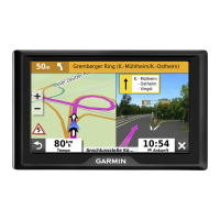
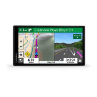
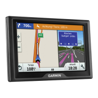
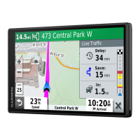
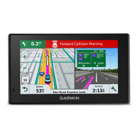
Understanding the information displayed on the map while navigating a route.
How to view upcoming turns, lane changes, and complete route directions.
Displaying the full route path on the map for an overview.
Information and actions when approaching and reaching the final destination.
How the device helps find parking spots near your destination.
Modifying the current route, such as adding stops or shaping the path.
How to insert new destinations into an active route.
Manually adjusting the route's path by selecting specific points on the map.
How to temporarily reroute around specific distances or roads.
Selecting how the device calculates routes (e.g., fastest time, shortest distance).
How to end the current navigation session.
Settings to avoid traffic delays, toll roads, and custom areas or roads.
How the device automatically or manually avoids traffic delays.
Configuring the device to avoid routes with tolls, bridges, or congestion areas.
Selecting specific road features to avoid during route calculation.
Setting specific roads or areas to avoid when calculating routes.
How to define a specific road segment to be avoided by the router.
How to define a geographical area to be avoided by the router.
Temporarily disabling a custom avoidance rule without deleting it.
How to remove custom avoided roads or areas from the device settings.
Quick access to device functions and information while viewing the map.
Viewing upcoming locations, points of interest, and services along the route.
How to see the next locations or categories of interest along the road.
Personalizing which types of locations appear in the Up Ahead tool.
Information about upcoming cities, exits, and services along highways.
Accessing details about cities and services near highway exits.
Accessing and customizing data related to your trips, like speed and mileage.
Displaying trip statistics directly from the map screen.
Selecting which data fields are shown for trip statistics.
Viewing speed and other statistics about your current trip.
Accessing a record of the paths and places you have traveled.
How to reset trip data, including trip meters and maximum speed.
How to see upcoming traffic incidents and delays along your route.
Understanding color-coded traffic flow and delay information on the map.
How to find and view details of specific traffic incidents.
Personalizing map appearance and data layers.
Selecting which data layers (e.g., topography) are displayed on the map.
Selecting the type of data displayed in specific fields on the map screen.
Switching between 2D (Track Up, North Up) and 3D map views.
How the device receives traffic data, including requirements for a traffic receiver.
Activating the traffic feature on the device.
Displaying traffic conditions using color-coded maps.
Accessing the full owner's manual directly on the device.
Creating, saving, and editing routes for future navigation.
Steps to create a new route with multiple destinations and preferences.
Modifying the order or content of locations within a planned route.
Customizing route calculation parameters and shaping points.
How to start navigating a route that has been previously saved.
Modifying and saving the route currently being navigated.
Accessing a history of previously navigated routes and destinations.
Configuring map display options, vehicle icon, and map layers.
How to enable installed map products on the device.
Configuring route calculation methods, avoidances, and GPS simulator.
Choosing how the device calculates routes based on time or distance.
Using the GPS simulator to plan routes from a simulated position.
Configuring alerts for speed limits, driver awareness, and proximity points.
Customizing alerts for speed cameras, red light cameras, and other proximity points.
Adjusting screen color mode, brightness, and display timeout.
Enabling and configuring the traffic feature.
Setting units of measure, time format, and position format.
Manually or automatically setting the device's current time.
Configuring voice prompts, on-screen text, and keyboard languages.
Managing device information, regulatory data, software licenses, and travel history.
Options for clearing travel history, resetting to defaults, or deleting all user data.
Accessing regulatory markings, compliance information, and end-user license agreements.
Technical details including operating temperature, frequency, power input, and battery type.
Methods for charging the device's battery using vehicle or external power.
Keeping maps and software up-to-date for optimal navigation performance.
Using Garmin Express software to download and install device updates.
Step-by-step guide to installing the Garmin Express application on a computer.
Precautions for handling, cleaning, and avoiding damage to the device.
How to clean the exterior casing of the device using mild detergent.
Proper methods for cleaning the device's touchscreen gently.
Tips to prevent device theft, such as removing it from sight when not in use.
How to restart the device if it stops functioning correctly.
Instructions for detaching the device, mount, and suction cup.
Solutions for problems with adjusting the device's screen brightness.
Steps to fix the suction cup if it does not stay attached to the windshield.
Solutions for when the device is unable to acquire GPS satellite signals.
Tips to improve battery life and resolve charging problems.
How to install a memory card to increase storage for maps and data.
Information about the device's memory card slot and compatibility.
Steps for connecting the device to a computer via USB for data transfer.
How to copy files from your computer to the device.
Proper procedures for safely disconnecting the device from a computer.
How to check the device's current GPS signal strength.
Information on where to buy extra map products for the device.
Information on where to find optional accessories for the device.
| Form factor | Fixed |
|---|---|
| Product color | Black, Grey |
| Widescreen | - |
| Display diagonal | - \ |
| Touch technology | Multi-touch |
| Backlight display | Yes |
| Display resolution | 800 x 480 pixels |
| Power source type | Battery |
| Battery life (max) | 1 h |
| Map coverage | All Europe |
| Compatible memory cards | MicroSD (TransFlash) |
| Internal storage capacity | 16 GB |
| Depth | 17 mm |
|---|---|
| Width | 126.35 mm |
| Height | 84.51 mm |
| Weight | 69 g |