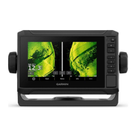
Do you have a question about the Garmin ECHOMAP UHD2 9 SV and is the answer not in the manual?
Illustrates and describes the various ports on the chartplotter.
Provides steps to connect a mobile device to the ECHOMAP UHD2 via the app.
Guides on using the ActiveCaptain app to download and install software updates.
Explains how to download and transfer chart updates using the ActiveCaptain app.
Step-by-step guide to buying chart subscriptions through the ActiveCaptain app.
Guides on configuring the device's Wi-Fi network for wireless connectivity.
Details how to wirelessly connect two devices for data and sonar sharing.
Covers connecting and adjusting wireless wind sensors.
Guides on navigating to a specific point on the chart using Go To, Route To, or Auto Guidance.
Introduces premium chart features like Mariner's Eye 3D, Fish Eye 3D, and Relief Shading.
Introduces the AIS system for identifying and tracking other vessels.
Details how to set a safe-zone collision alarm for AIS vessels.
Explains how to turn on/off chart layers and customize chart features.
Details chart settings like map orientation, vessel orientation, and detail level.
Step-by-step guide to recording sonar data for Quickdraw Contours maps.
Introduces the community for downloading and sharing Quickdraw Contours maps.
Steps to connect to the community using the ActiveCaptain app.
Guides on downloading contour maps created by other users via ActiveCaptain.
Explains how to share created contour maps with the community.
Details sharing contour maps via Garmin Connect website.
Guides on downloading community maps via the Garmin Connect website.
Step-by-step guide to setting and following a direct course using Go To.
Guides on creating and navigating a route immediately from the current location.
Details how to create and save routes with up to 250 turns.
Explains Auto Guidance for plotting optimal paths using chart data.
Guides on setting and following an Auto Guidance path to a destination.
Details how to create and save custom Auto Guidance paths.
Introduces sail racing features for crossing the start line precisely.
Details laylines settings, requiring a wind sensor, for racing.
Explains using polar table data for laylines and starting line guidance.
Introduces sailboat autopilot operation for heading or wind hold.
Explains setting autopilot for specific bearing relative to wind angle.
Explains Garmin ClearVü sonar for a detailed picture of structures.
Explains SideVü sonar for viewing what lies to the sides of the boat.
Introduces Panoptix sonar views for real-time underwater imaging.
Explains the LiveScope sonar view for live imaging ahead or below the boat.
Guides on selecting the correct transducer type for sonar function.
Outlines sonar setup options for transducers and appearance.
Details settings for LiveScope and Perspective sonar views.
Explains settings for reducing noise and interference on the sonar screen.
Details sonar alarm settings like shallow water, deep water, and fish alarms.
Explains how adjusting frequencies adapts sonar for goals and water depth.
Outlines setup options for Panoptix sonar views.
Guides on setting a depth alarm for the FrontVü sonar.
Guides on installing Panoptix transducers, including depth and beam width.
Guides on configuring the autopilot system to work with the boat.
Introduces steering patterns for fishing and specialty maneuvers.
Explains wirelessly connecting a Reactor autopilot remote control.
Introduces Yamaha autopilot system control via the chartplotter.
Outlines Yamaha autopilot settings like pattern set, direction, and spacing.
Guides on wirelessly connecting the trolling motor to the chartplotter.
Outlines trolling motor settings like calibrate compass, anchor gain, and navigation gain.
Explains features enabled when connecting VHF radio to chartplotter.
Guides on navigating to a vessel in distress using DSC information.
Introduces Yamaha engine gauges and their display variations.
Explains the Warning Manager for displaying color-coded alarm messages by severity.
Introduces the Media Player for controlling audio using the chartplotter.
Outlines system settings like sounds, display, and satellite positioning.
Details settings for beeper, audio, backlight, color mode, and startup image.
Details GPS settings like Skyview, GLONASS, WAAS/EGNOS, and Galileo.
Outlines preferences settings like units, language, and navigation.
Details navigation settings like route labels, turn transition, and speed sources.
Details parameters for Auto Guidance path calculation like Preferred Depth.
Covers viewing connected devices and NMEA 2000 setup.
Outlines alarm settings for navigation like arrival and anchor drag.
Guides on restoring factory default settings for the chartplotter.
Introduces sharing and managing user data like waypoints and routes.
Guides on updating maps using Garmin Express and a memory card.
Overview of ActiveCaptain and Garmin Express apps for device management.
Details the Garmin Express desktop app for software and chart updates.
Guides on registering the device using the Garmin Express app.
Guides on updating charts using Garmin Express app and memory card.
Explains when software updates may be needed and how to perform them.
Guides on copying software updates to a memory card via Garmin Express.
Explains updating device software using a memory card.
Provides solutions for common device issues like GPS signal and power.
| Sonar Support | Yes |
|---|---|
| Waypoints | 5, 000 |
| Routes | 100 |
| Garmin Sonar Compatible | Yes |
| Supports AIS | Yes |
| Supports DSC | Yes |
| Tide Tables | Yes |
| NMEA 0183 Input Ports | 1 |
| NMEA 0183 Output Ports | 1 |
| NMEA 2000 Compatible | Yes |
| CANet | No |
| Transmitter Power | 500 W (RMS) |
| Water Rating | IPX7 |
| Display Size | 9 inches |
| GPS Receiver | High-sensitivity GPS and GLONASS |
| Sonar Frequencies Supported | 50/77/83/200 kHz |
| Maximum Depth | 2, 300 ft (700 m) |
| Maps | BlueChart g3 coastal charts |
| Track Log | 50, 000 points |
| Wireless Connectivity | Wi-Fi |
| SD Card Slots | 1 |