Do you have a question about the Garmin Fleet 770 and is the answer not in the manual?
Instructions for physically installing and powering the device in a vehicle.
How to power the device on, put it in power saving mode, or turn it off.
Process for the device to locate satellites and establish its current position.
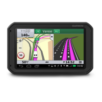
Overview of the device's main screen and customization options.
How to change the display brightness for better visibility.
Guide to creating a new vehicle profile with custom characteristics.
Steps to select and apply an existing vehicle profile.
How to modify, rename, or delete existing vehicle profiles.
Information on device alerts for speed and red light cameras.
Overview of how routes are calculated and managed by the device.
Steps to initiate navigation to a specific destination.
Explanation of the on-screen map display during navigation.
How the device indicates the correct lane for upcoming turns.
Accessing upcoming turn-by-turn instructions.
Information provided as you approach your destination.
How the device helps find parking spots at the destination.
Inserting additional stops into an active route.
Manually altering the route's path.
Options for deviating from the current route.
Selecting preferences for route calculation (e.g., fastest time).
Setting preferences to avoid traffic, tolls, and specific zones.
Defining specific roads or areas to exclude from routes.
Locating trucking-specific points of interest like truck stops.
Searching for truck repair and tire sales services.
Using keywords to search for addresses, businesses, or cities.
Browsing for locations organized by categories.
Viewing and interpreting results from location searches.
Modifying the area for location searches (e.g., near destination).
Information on creating and using custom points of interest.
How the device helps find nearby parking based on various criteria.
Specific instructions for finding truck parking locations.
Overview of tools for searching specific types of locations.
Detailed steps for searching for a specific address.
Locating nearby hospitals, fuel stations, and other services.
Creating shortcuts for quick access to menu items.
How to save favorite locations for future access.
Accessing and interacting with the map display.
Overview of tools available on the map screen.
Customizing which tools appear in the map tools menu.
Displaying upcoming points of interest or highway exits.
Accessing information about upcoming places on the route.
Explains symbols for hazards, road conditions, and alerts.
Details on warnings related to vehicle dimensions and loads.
Alerts for specific road conditions like curves or steep hills.
Viewing trip data, speed, and logs.
Checking for traffic incidents along the route.
Displaying traffic flow and delays on the map.
Locating specific traffic incidents on the map.
Adjusting map appearance and data layers.
Adjusting the map's view (e.g., 2D, 3D).
Steps to connect a mobile phone to the device via Bluetooth.
How to make calls using the device's hands-free functionality.
Features available during an active call.
How the device receives traffic information via a receiver.
Information on managing subscriptions for traffic data.
Accessing the complete manual directly on the device.
Displaying specialized truck routes on the map.
Recording fuel purchase information for tax purposes.
Modifying previously entered fuel records.
Accessing and exporting tax-related jurisdiction data.
Recording vehicle maintenance and service events.
Steps to create and save a new trip with multiple destinations.
Modifying the order and details of stops within a saved trip.
Automatically arranging stops for the most efficient route.
Finding and adding points of interest to your trip.
Starting navigation for a previously planned trip.
Modifying and saving the current navigation route as a trip.
Configuring navigation preferences like vehicle profile and route options.
Adjusting map detail, theme, and vehicle icon display.
Setting options for route calculation, avoidances, and restrictions.
Configuring driver alerts and proximity warnings.
Managing traffic data reception and alert preferences.
Steps to connect the device to Wi-Fi networks.
Adjusting screen brightness and other display options.
Configuring volume levels and notification alerts.
Using sliders to set audio and alert volumes.
Selecting the language for the device software interface.
Setting up accounts for email and data synchronization.
Configuring automatic or manual date, time, and time zone.
Managing system updates, status, and legal information.
Resetting device settings to factory defaults.
Viewing regulatory, compliance, hardware, and software versions.
Technical details like operating temperature and power input.
Guide to updating device maps and software wirelessly.
General advice on protecting the device from damage.
How to replace the fuse in the vehicle power adapter.
Performing a hard reset if the device malfunctions.
Steps to detach the device, mount, and suction cup.
Steps to fix the suction cup losing adhesion.
Troubleshooting steps for GPS signal acquisition problems.
Steps to diagnose and fix vehicle charging issues.
Tips to improve battery life and troubleshooting battery drain.
Solutions for Bluetooth connection problems with a phone.
Showing the device screen on an external wireless display.
Information on storing and managing files on the device.
Guide to inserting a memory card for expanded storage.
Steps to connect the device to a computer via USB.
How to move files between the computer and the device.
Information on buying and installing new map products.
Where to buy additional accessories for the device.
| Display Resolution | 1024 x 600 pixels |
|---|---|
| Touchscreen | Yes |
| GPS Receiver | Yes |
| Wi-Fi | Yes |
| Bluetooth | Yes |
| External Speaker Support | Yes |
| GLONASS | Yes |
| Built-in Sounder | No |
| Preloaded Maps | Yes |