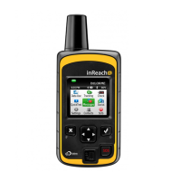
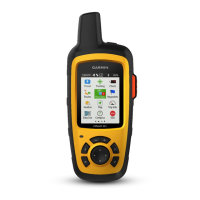
EasyManua.ls Logo

Garmin INREACH SE+ User Manual

Garmin INREACH SE+
14 pages
To Next Page IconTo Next Page
Page #1 background imageLoading...
Page #1 background image
INREACH SE®+
INREACH EXPLORER®+
Owner’s Manual

Questions and Answers:

Garmin INREACH SE+ Specifications

General IconGeneral
Map coverage-
Maps includedYes
Lifetime map updatesRoads change, but with Lifetime Map Updates your map will always be up to date. Start fresh every few months by downloading a new edition of the industry's most accurate map. New editions are issued four times per year.
Built-in cameraNo
Supported radio bandsNot supported
Routes quantity20
Number of waypoints500
Display diagonal2.31 \
Display resolution200 x 265 pixels
Power source typeBattery
Form factorHandheld
Product colorBlack, Yellow
International Protection (IP) codeIPX7
Weight and Dimensions IconWeight and Dimensions
Depth38 mm
Width68 mm
Height164 mm
Weight213 g

Summary

Getting Started

Device Overview

Provides a visual overview of the device and its components.

Turning On the Device

Instructions on how to power on the inReach device.

Charging the Device

Steps for charging the device using a USB cable.

Activating the Device

Guide to activating the inReach device via the website.

Keys

Status LED

Explains the meaning of different LED activities and statuses.

Status Icons

Describes various icons displayed on the device screen.

Bluetooth Connected Features

Pairing Your Mobile Device

Steps to connect the inReach device with a smartphone via Bluetooth.

Messages

Sending a Preset Message

Instructions for sending pre-written messages.

Sending a Text Message

Details on composing and sending new text messages.

Replying to a Message

How to respond to received messages.

Posting to Social Media

Guide to sending messages to social media platforms.

Checking for Messages

How the device checks for incoming messages.

Viewing Message Details

Steps to view specific message content and location.

Navigating to a Message Location

How to navigate to the location where a message originated.

Contacts

Adding a Contact

Instructions for adding new contacts to the device.

Editing a Contact

How to modify existing contact information.

Deleting a Contact

Steps to remove contacts from the device.

SOS

Initiating an SOS Rescue

How to activate an emergency SOS signal.

Sending a Custom SOS Message

Guide to sending a personalized emergency message.

Canceling an SOS Rescue

How to abort an active SOS signal.

Tracking

Starting Tracking

Instructions to begin recording and sending location track points.

Stopping Tracking

How to end the tracking session.

Navigation

Acquiring GPS Satellite Signals

Explains the process of obtaining GPS satellite data.

Routes

Information about creating and navigating saved routes.

Navigating a Saved Route

Steps to follow a pre-saved route.

Viewing a Route on the Map

How to display a saved route on the device's map.

Reversing a Route

How to navigate a route in the opposite direction.

Deleting a Route

Steps to remove a saved route from the device.

Waypoints

Creating a Waypoint

How to save a current location as a waypoint.

Navigating to a Waypoint

Steps to navigate to a saved waypoint.

Editing a Waypoint

How to modify waypoint details.

Viewing a Waypoint on the Map

How to display a waypoint on the map.

Deleting a Waypoint

Steps to remove a waypoint from the device.

Map

Navigating with the Map

How to use the map for direct navigation.

Sending a Reference Point

How to send location details for meeting someone.

Trip Info

Information about viewing trip details like time and distance.

Weather

Adding a Weather Location

How to set up locations for weather forecasts.

Requesting a Weather Forecast

Steps to get weather information for a location.

Updating a Weather Forecast

How to refresh an existing weather forecast.

Editing a Weather Location

How to modify saved weather locations.

Deleting a Weather Location

Steps to remove a weather location.

Data Use and History

Viewing Data Use

How to check current data usage details.

Viewing Data History

How to view past message and track point history.

Customizing the Device

Display Settings

Options for adjusting screen brightness, timeout, and color scheme.

Map Settings

Settings to configure map orientation, scale, and displayed elements.

Tracking Settings

Options for managing track logging and send intervals.

Bluetooth Settings

How to manage Bluetooth connectivity and paired devices.

Compass and Altimeter Settings

Calibration and configuration for compass and altimeter.

Messages Settings

Settings related to message reception and alerts.

Customizing the Device (Continued)

Sounds Settings

Configuration for device alert tones and volume.

Time Settings

Options for setting time format, zone, and daylight saving.

Units Settings

How to configure units for distance, temperature, and coordinates.

External Power Settings

Settings for automatic power on/off with external power.

Changing the Device Language

Steps to select a different language for the device interface.

Adding Owner Information

How to input owner details displayed at startup.

Device Information

Support and Updates

Information on accessing support, manuals, and firmware updates.

Attaching the Carabiner Clip

Removing the Carabiner Clip

Instructions on how to detach the carabiner clip.

Attaching a Lanyard

Locking and Unlocking the Keys

How to prevent accidental button presses by locking the screen.

Device Care

Cleaning the Device

Instructions for cleaning the device to prevent corrosion.

Troubleshooting

Maximizing Battery Life

Tips and settings to extend the device's battery duration.

Resetting the Device

Procedure to restart the device if it becomes unresponsive.

Restoring All Default Settings

How to revert all device settings to factory defaults.

Viewing Device Information

Where to find device details like IMEI and firmware version.

Specifications

Related product manuals