Do you have a question about the Garmin ZUMO 340 and is the answer not in the manual?
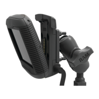
Details the process of securely attaching the device to a motorcycle.
Explains the function and connection of power cables for motorcycle mounts.
Guides on attaching the base to the motorcycle handlebars.
Explains the availability of pre-loaded locations for navigation.
Instructions on searching for locations using predefined categories.
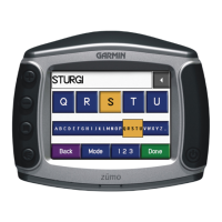
Steps to search for locations by typing keywords like address or name.
Overview of methods for searching for locations on the device.
Step-by-step guide to finding a specific street address.
Instructions for locating points where two or more streets meet.
Method for searching for and navigating to a specific city.
How to find locations using latitude and longitude coordinates.
Steps to begin navigating to a selected destination.
Options for customizing how routes are calculated (e.g., fastest time, shortest distance).
How to view and select from alternative routes before starting navigation.
Navigating to a destination that has been previously saved.
Introduces myDashboard for device registration, updates, and support.
Instructions on how to register the Garmin device for full functionality.
Steps to check for and install software updates for the device.
Information on receiving free map updates for eligible devices.
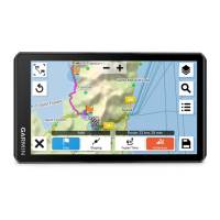
Adjusting map appearance and displayed data layers.
Selecting which data elements, like POIs, appear on the map.
Accessing a record of past travel paths and statistics.
Customizing the information displayed in map data fields.
Introduction to using wireless headsets with the device.
Steps to turn on the device's Bluetooth capability.
Instructions for connecting a Bluetooth headset to the device.
How to remove a previously connected headset from the device's list.
Creating and saving multi-destination travel itineraries.
Planning and organizing trips with specific start and end points.
Saving a searched or selected location for future access.
Storing the device's present position as a saved location.
Navigating to a destination that has been previously saved.
Modifying the details of an existing saved location.
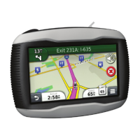
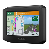
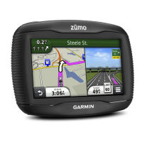
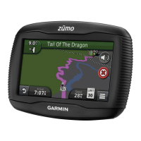
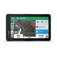
Understanding how the route is displayed on the map interface.
Features and controls for interacting with the map display during navigation.
How to add intermediate stops or waypoints to an active route.
Procedure to temporarily reroute around obstacles or traffic.
How to end the current navigation session.
Finding nearby services like gas, food, or lodging at upcoming exits.
Steps to locate services available at highway exits.
Directing the device to navigate to a specific upcoming exit.
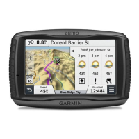
Displays current speed and trip statistics.
Resets trip computer data, including odometer and max speed.
Shows details about the device's current position for emergency use.
Locating essential services like hospitals or police stations nearby.
Introduction to using wireless headsets with the device.
Steps to turn on the device's Bluetooth capability.
Instructions for connecting a Bluetooth headset to the device.
How to remove a previously connected headset from the device's list.
How to access the built-in help system for device assistance.
Using the search function within the help system.
Creating and saving multi-destination travel itineraries.
Planning and organizing trips with specific start and end points.
Modifying vehicle types used for different legs of a saved trip.
Starting navigation for a previously created and saved trip.
Modifying the destinations or order of stops in a saved trip.
Retracing previous routes using recorded track data.
Requirements and process for receiving live traffic information.
Accessing and viewing location-relevant offers and coupons.
Displaying a list of all received offers.
Turning off live traffic data and offer notifications.
How traffic conditions are displayed and affect route calculations.
Displaying a list of traffic events along the current route.
Steps to manually avoid traffic delays on the current route.
Selecting and navigating an alternative route to bypass traffic.
Overview of storing files and using the memory card slot.
Lists the types of files supported by the device.
Information on purchasing and using memory cards for storage.
Steps for inserting microSD and microSDHC cards.
How to connect the device to a computer via USB for data transfer.
Steps for copying files between the computer and the device.
Safely removing the device from the computer to prevent data loss.
Procedures for removing unwanted files from the device memory.
Changes the icon representing your position on the map.
Sets the perspective on the map display.
Sets the level of detail displayed on the map.
Changes the color scheme of the map data.
Enables or disables Bluetooth wireless technology.
Adding, disconnecting, or deleting paired phones.
Steps to turn off the device's Bluetooth feature.
Enables or disables live traffic reception.
Information about the trafficTrends feature for route calculation.
Details on purchasing or renewing traffic subscriptions.
Sets the device's current time.
Sets the unit of measure used for distances.
Sets the language for voice prompts.
Sets all on-screen text to the selected language.
Sets the language for your keyboard.
Displays software version, unit ID, and other device information.
Records data for myTrends, Where I've Been, and Trip Log features.