Do you have a question about the Garmin Zumo XT and is the answer not in the manual?
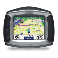
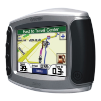
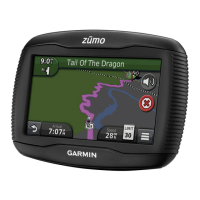
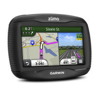
Introduces device hardware and covers powering on/off and basic operations.
Explains GPS acquisition, status icons, and using on-screen buttons.
Details adjusting volume, screen brightness, and selecting transportation modes.
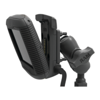
Guides installation of the powered motorcycle mount, including wiring and securing components.
Details installing the handlebar base using U-bolts or clamp brackets.
Instructions for attaching power cables and the base plate to the motorcycle mount.
Covers attaching the base plate to the handlebar, installing the device, and removing it.
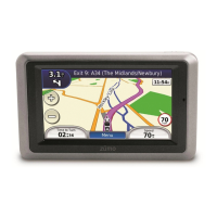
Provides instructions for mounting the device in a car using a suction cup and power connection.
Explains enabling rider alerts, speed limits, and information on red light/speed cameras.
Details setting up incident contacts, receiving notifications, and cancelling alerts.
Covers connecting, sending messages, and initiating SOS alerts with an inReach device.
Information on viewing helmet law notifications and searching for laws by state or province.
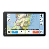
Covers route planning, starting navigation, and selecting calculation modes.
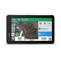
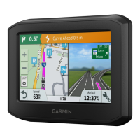
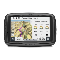
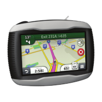
Explains interpreting route information on the map, lane guidance, and upcoming actions.
Guides on arriving at destinations, finding parking, and ending routes.
Covers managing active routes, adding locations, shaping, and taking detours.
Details settings for avoiding roads, tolls, areas, and using Off Road mode.
Covers enabling fuel tracking, setting warnings, and dynamic fuel stops.
Covers searching by bar, POI, categories, and within venues.
Explains finding addresses, junctions, and locations using coordinates.
Covers HISTORY, Foursquare check-ins, and Tripadvisor points of interest.
Details saving locations, editing favorites, assigning categories, and deleting.
Introduces map tools, Up Ahead, and viewing upcoming locations or towns.
Covers viewing trip data, resetting trip info, and traffic incident details.
Details changing map layers, data fields, buttons, and perspective.
Covers pairing phones/headsets, status icons, and managing connections.
Explains receiving notifications, making calls, and using voice dial.
Covers receiving traffic data via smartphone or receiver, subscriptions, and viewing traffic on map.
Guides on starting, joining, broadcasting messages/locations, and group ride settings.
Covers selecting presets, channels, adjusting squelch, Roger Tone, and Push-to-Talk.
Details using the media player and downloading BirdsEye imagery.
Covers planning, editing, optimizing trips, and discovering attractions.
Covers language settings, device information, and privacy options like data reporting.
Details restoring factory settings and viewing device specifications.
Covers charging the device, accessing support, and general device care instructions.
Explains updating maps and software via Wi-Fi or Garmin Express.
Covers product updates, avoiding theft, restarting the device, and basic troubleshooting.
Addresses issues like suction cup adhesion, GPS signal, battery life, and phone connectivity.
Covers pairing and viewing wireless cameras with the navigation device.
Details installing memory cards, managing data, and transferring files via USB.
Explains exporting BaseCamp data, importing to Explore, and purchasing additional maps.
| Aviation | - |
|---|---|
| Marine (chartplotters, sounders) | Yes |
| Form factor | Handheld |
| Product color | Black |
| Clock mode | 12h/24h |
| Address input | City, Geographical coordinates, Street |
| Spoken street names | Keep your eyes on the road while your GPS announces turn-by-turn directions, including street and place names. |
| Map storage | Internal storage |
| Lifetime map updates | No |
| Display diagonal | 5.5 \ |
| Display resolution | 1280 x 720 pixels |
| Battery type | Built-in |
| Power source type | Battery |
| Battery life (max) | 6 h |
| Storage media type | Memory card |
| Compatible memory cards | MicroSD (TransFlash) |
| Internal storage capacity | 32 GB |
| Depth | 24 mm |
|---|---|
| Width | 148 mm |
| Height | 88 mm |
| Weight | 262 g |