
A
Angela McintoshJul 26, 2025
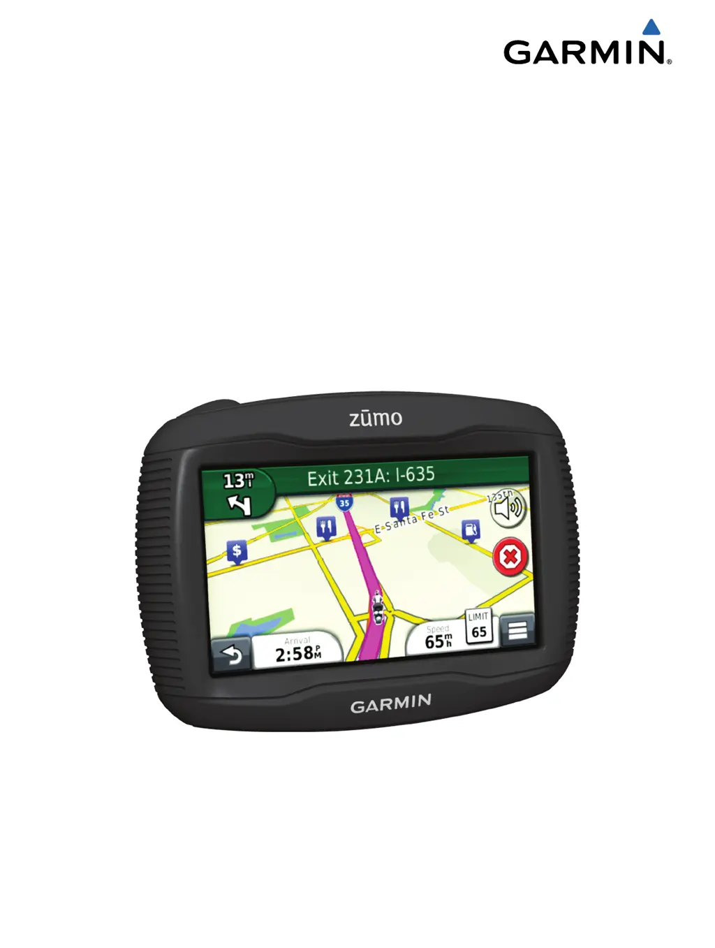
Why is my Garmin GPS not acquiring satellite signals?
- BBrenda PerryJul 26, 2025
Your Garmin GPS may not be acquiring satellite signals because the GPS simulator is turned on. Also, parking garages, tall buildings, and trees can block the signal. Try moving away from these obstructions and remaining stationary for several minutes.