EasyManua.ls Logo

Haiyang Smart7 Series User Manual

Haiyang Smart7 Series
95 pages
To Next Page IconTo Next Page
Page #1 background imageLoading...
Page #1 background image
- 1 -
Important Notice
Manual
Handling
Keep this manual in a safe place where you can access it quickly.
The Global Positioning System (GPS) consists of a total 24 GPS satellites that orbit the earth,
enabling you to determine your position anywhere in the world, 24 hours a day, if you can receive
satellite signals. During actual navigation, carefully compare the position data with all available
navigation sources such as Loran C, Decca, other navigators, charts, visual navigation, depth, water
temperature and others. It is your responsibility to make navigation judgments.
DGPS Operation Note :
Your position can be improved by DGPS correction. However, when you are communicating with other
ships, you may use a DGPS corrected position but they may not. Make your position source known
during communication.
The Electronic Chart :
Only official authorized charts and notices to mariners contain all the information needed for the safety
of navigation and, as always remember, the user is responsible for their prudent use.
Pictorials
This manual uses the following symbols for easy understanding safety instructions. Always follow
these instructions carefully.
WARNING
Always follow this safety instruction to prevent death or injury.
CAUTION
Follow this safety instruction to avoid possible injury or damage to your
property.
Symbol is a CAUTION or WARNING label indicating the safety
instruction.
Question and Answer IconNeed help?

Do you have a question about the Haiyang Smart7 Series and is the answer not in the manual?

Haiyang Smart7 Series Specifications

General IconGeneral
BrandHaiyang
ModelSmart7 Series
CategoryGPS
LanguageEnglish

Summary

Important Notices and Safety

Manual Handling and Storage

Instructions for keeping the manual accessible and safe for quick reference.

GPS and DGPS Navigation

Overview of GPS functionality and DGPS for navigation accuracy.

Electronic Chart Usage

Emphasizing the use of official charts for safe navigation and user responsibility.

System Safety and Cautions

Operator Safety Warnings

Critical warnings for operators regarding electrical shock, cabinet access, and ventilation.

Installation Cautions for Service Personnel

Guidelines to prevent personal injury and system malfunction during installation.

Maintenance Cautions for Personnel

Safety precautions for internal system inspection and maintenance procedures.

System Introduction and Operation

Operator Operation Notes

Key guidelines for users to ensure optimal system performance and prevent failure.

Smart7 Series System Overview

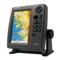
An overview of the HD-70 SERIES navigation system's capabilities.

Keypad Functionality

Detailed description of each button and its specific operation.

Display Customization

Selecting Display Pages

How to choose and view different display pages on the chartplotter.

Screen Layout Customization

Adjusting the formation and layout of the screen displays.

Data Bar Customization

Editing and configuring the information displayed in the data bar.

Chartplotter Functions

Chartplotter Display Modes

Understanding various views like Chartplotter, Highway, Steering, and GPS Information.

Waypoint and Route Management

Procedures for managing waypoints and creating navigation routes.

Track Recording and Setup

Configuring track color, thickness, and recording intervals.

Fishfinder Functions

Fishfinder Display Modes

Explanation of different fishfinder displays like frequency and depth.

Fishfinder Menu Options

Accessing and configuring depth range, shift, mode, and zoom settings.

AIS System

AIS System Overview

Introduction to the Automatic Identification System for collision avoidance.

AIS Target Information

Retrieving and displaying detailed information about AIS targets.

Navigation Data and Features

Tide Information Access

How to access and view tide data for principal places worldwide.

C-MAP Charting Features

Information on finding services, ports, and tide stations using C-MAP.

General Settings

GPS Configuration Settings

Adjusting coordinate systems, datum, and satellite signal filters.

Unit and Compass Settings

Configuring measurement units for distance, depth, temp, and compass variation.

Time and Date Configuration

Setting preferred time format, date format, and calendar options.

Installation Guide

Display Unit Installation

Guidelines for selecting location and mounting the display unit.

Power and Sensor Connections

Procedures for connecting power cables and remote sensors.

Transducer Installation and Maintenance

Steps for installing and maintaining sonar transducers for optimal performance.

Technical Reference

NMEA Output Sentences

Reference for NMEA data field descriptions used for communication.

How GPS Works

Explanation of GPS satellite constellations and position calculation methods.

GPS Antenna Installation

Instructions for optimal placement of the GPS antenna for signal reception.

Declaration of Warranty

Warranty Terms and Service

Details of the one-year guarantee and conditions for service and support.

Related product manuals