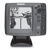
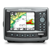
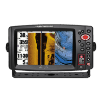
Do you have a question about the Humminbird 767 and is the answer not in the manual?
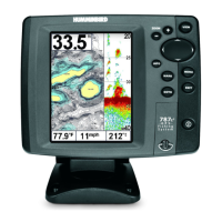
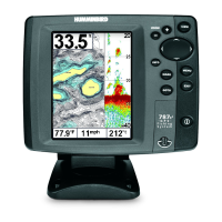
Explains the 200/83 kHz DualBeam PLUS™ sonar system with wide coverage area.
Details the use of the MMC/SD slot for additional maps and software updates.
Controls power, backlight, and contrast adjustments for the unit.
Accesses the Main Menu System and X-Press™ Menu for settings.
Provides options for unit startup: Normal, Simulator, System Status, or PC Connect.
Adjusts the detail shown on the display by controlling sonar return sensitivity.
Sets the shallowest depth range displayed on the Sonar, Split Sonar, Big Digits, and Circular Flasher Views.
Displays detailed position history as a breadcrumb trail of trackpoints.
Allows viewing, editing, or deleting previously saved tracks.
Displays instantaneous sonar returns at the fastest rate for depth conditions.
Charts changes in depth to create a profile of the bottom contour.
Instructions on how to update the unit's software using the MMC/SD slot.
Displays water depth, with options for shallow water alarms.
Displays boat speed, track distance, and can keep a Triplog.
Displays water surface temperature.
Presents a historical log of sonar returns with digital readouts.
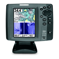
Displays Chart View and Sonar View side-by-side.
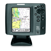
Displays cartography without an active cursor.
Moves the chart around the display using the 4-WAY Cursor keys.
Turns the unit on/off and adjusts backlight and contrast.
Cycles through all available display views.
Accesses the Main Menu System and X-Press™ Menu.
Used for menu selection, cursor movement, and activating Freeze Frame.
Cancels alarms, exits menus, cycles views, or removes cursor.
Allows selection of Normal, Simulator, System Status, or PC Connect mode.
Provides quick access to frequently used settings.
For on-water operation with a connected transducer.
Allows learning the system's features before using it on the water.
Displays results from the internal diagnostic self-test.
Shows sky chart, satellite data, and current position information.
Sets which transducer beam from WideSide® is shown in WideSide® View.
Steps to change the Side setting for WideSide® View.
Steps to increase or decrease the Sensitivity setting.
Steps to increase or decrease the Upper Range setting.
Steps to increase or decrease the Lower Range setting.
Steps to increase or decrease the Chart Speed setting.
Steps to change the method used to represent bottom and structure.
Steps to turn on Bottom Lock in the Sonar Zoom View.
Steps to discard the current route and exit Navigation Mode.
View the Waypoints submenu for the most recently created waypoint.
Lists choices for Edit, Delete, Go To, Target, and Grid for waypoints.
Quickly move the cursor to any saved waypoint for location or editing.
Saves the current track being displayed and starts a new one.
Discards current route and exits Navigation Mode.
Removes the waypoint target from the display.
Removes the waypoint grid from the display.
Deletes a single screen capture image from the Screen Snapshot View.
Sets which sonar returns from the transducer will be displayed on the screen.
Steps to select the 83 kHz, 200 kHz, or 200/83 kHz beam.
Steps to turn the Fish ID+™ feature on or off.
Steps to change the threshold for Fish ID+™ detection.
Steps to set the RTS® Window to Wide, Narrow, or Off.
Steps to adjust the width of the zoom window on the Sonar Zoom View.
Steps to adjust the sensitivity of the 83 kHz beam.
Steps to adjust the sensitivity of the WideSide® beam.
Steps to turn Depth Lines On or Off.
Steps to adjust the filter for surface clutter noise.
Steps to adjust the sonar Noise Filter to limit interference.
Steps to adjust the maximum depth of operation.
Steps to configure the unit for fresh or salt water operation.
Steps to select the desired transducer (DualBeam, QuadBeam, WideSide).
Allows viewing the Current Track submenu.
Allows viewing the Saved Tracks submenu.
Allows viewing the Waypoints submenu.
Allows viewing the Routes submenu.
Selects whether Chart and Combo Views are North-Up or Course-Up.
Allows displaying bearings as True North or Magnetic North.
Changes the map coordinate system to match paper maps.
Exports all saved Tracks, Waypoints, and Routes to an MMC/SD card.
Deletes all saved Tracks, Waypoints, and Routes.
Selects how much chart detail is displayed on Navigation Views.
Allows displaying or hiding map borders.
Allows displaying or hiding a grid showing latitude and longitude lines.
Allows displaying or hiding spot soundings, which are depth measurements.
Sets the position of the boat used in the Simulator.
Changes the map offset used by the 700 Series™.
Sounds when depth is equal to or less than the menu setting.
Sounds when the system detects fish corresponding to the alarm setting.
Sounds when the input battery voltage is equal to or less than the menu setting.
Sounds when the water temperature reaches the alarm setting.
Sounds when the boat has moved too far off course.
Sounds when the boat has exceeded distance to waypoint or entered Arrival Alarm Circle.
Steps to set the perimeter around the anchored position.
Steps to select the pitch of the alarm sound.
Selects the units of measure for all depth-related readouts.
Selects the units of measure for speed-related readouts.
Steps to change the menu system to Normal or Advanced.
Resets the Triplog to zero.
Resets all menu settings to their factory defaults.
Steps to select individual digital readouts for the Sonar View.
Adjusts the digital depth readout from the waterline or boat's keel.
Adjusts the temperature readout by the amount entered.
Adjusts the speed readout by a percentage entered.
Selects the time zone in reference to the time reported by the GPS receiver.
Adjusts the time display to account for local Daylight Saving Time.
Selects the format of the latitude and longitude position display.
Changes the time format used by the unit (12-hour or 24-hour).
Selects the format for the date display.
Turns the NMEA output on or off for data communication.
Deactivates Sonar and removes Sonar Views from view rotation.
Steps to set available views to hidden or visible in the view rotation.
Activates the screen snapshot function.
Steps to turn the Screen Snapshot function on or off.
Steps to capture the screen image using the MARK key.
Steps to view captured screen snapshots.
Troubleshooting steps for when the unit does not power up.
Troubleshooting steps for when the unit defaults to Simulator mode automatically.
Definitions of sonar-related terms used in the manual.
Definitions of GPS and navigation terms used in the manual.
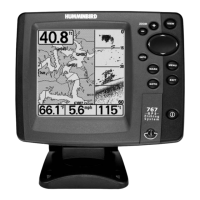
| Brand | Humminbird |
|---|---|
| Model | 767 |
| Category | GPS |
| Language | English |