Do you have a question about the Humminbird HELIX 5 SERIES and is the answer not in the manual?
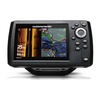
Explains the 200/83 kHz DualBeam PLUS sonar system and its coverage.
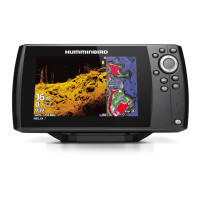
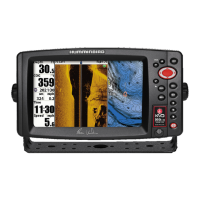
Details the Down Imaging transducer and its high-definition beams.
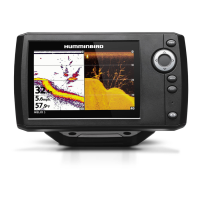
Covers the XD transducer and DualBeam PLUS for extended depth coverage.
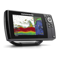
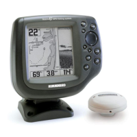
Describes the selectable dual-frequency sonar for ice fishing.
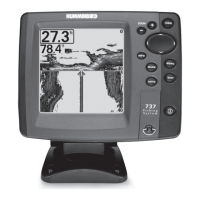
Details the primary functions of each key on the control head.
Explains the function and insertion/removal of microSD cards.
Explains how to add charts using built-in UniMap or microSD cards.
Guides on importing/exporting waypoints, routes, and tracks.
Instructions for updating unit software via microSD card.
Explains the significance of the sonar display and its data representation.
Explains how colors represent sonar intensity and bottom contour.
Controls sonar display modes and allows freezing the display for analysis.
Guides on interpreting shades, streaks, and shadows in Down Imaging.
Adjusts sensitivity for optimal Down Imaging clarity and detail.
How to navigate, select, and customize favorite views.
Customizes the digital readouts displayed on various views.
Displays and manages multiple views simultaneously on screen.
Describes the historical log of sonar returns and its display elements.
Details using the Sonar Zoom View for magnified bottom and structure.
Compares sonar returns from different beam frequencies side-by-side.
Views digital data in a large, easy-to-read format.
Sets up the Circular Flasher View for ice fishing or traditional format.
Explains the Down Imaging View and its X-Press Menu options.
How to enable and use the screen snapshot feature.
How to review saved screen snapshots and recordings.
Accessing functions for managing snapshots and recordings.
How to start, stop, and play back sonar recordings.
How the Bird's Eye View displays navigation data when navigating.
How to pan, zoom, and get information about chart objects.
Displays the chart view without any digital readouts.
Displays chart view with large digital readouts.
Displays compass, XTE, and digital readouts in one view.
How to navigate and manage chart elements like waypoints.
Accessing detailed chart info, ports, tides, and currents.
Defines waypoints, routes, and tracks and their storage capacities.
Steps to access the dialog box for managing navigation data.
Explains the interface for managing waypoints, routes, and tracks.
Procedures for creating, modifying, and removing waypoints.
How to add visual targets or grids to waypoints for navigation.
Saving, creating, and traveling saved routes.
Saving, clearing, hiding, and deleting tracks.
How to customize fields like name, icon, and visibility for navigation items.
Steps to activate Man Overboard navigation to locate a person overboard.
How to cancel the MOB navigation mode.
Accessing the menu upon power-up for initial setup.
Provides quick access to frequently-used settings relevant to the current view.
Standard menu organization with tabbed headings for settings.
Describes the Normal, Simulator, and System Status modes.
How to use the Simulator for learning unit operation.
Viewing system connections and running self-tests.
Displays GPS satellite status, signal strength, and positional accuracy.
How to interact with X-Press menus for quick settings adjustments.
Navigating and changing settings within the Main Menu structure.
Provides shortcuts and tips for efficient Main Menu navigation.
Sets menu complexity to Normal or Advanced.
Details common Sonar X-Press menu items like Active Side and Split Position.
Controls display detail by adjusting sensitivity for sonar frequencies.
Sets the shallowest and deepest depth ranges displayed in sonar views.
Determines how fast sonar information scrolls across the display.
Adjusts zoomed view for bottom contour and details.
Details common Flasher X-Press menu items like Sensitivity and Upper Range.
Sets color palettes for sonar returns in Circular Flasher View.
Options for starting, stopping, deleting images and recordings.
Adjusts ping rate and playback speed for sonar recordings.
Controls clarity and detail in Down Imaging views by adjusting sensitivity.
Adjusts Sensitivity, Contrast, and Sharpness for Down Imaging.
Selects the color palette for the Down Imaging display.
Common navigation options like canceling routes, skipping waypoints, active side.
Accessing waypoint submenus and decluttering chart layers.
Saving, clearing, and resetting tracks and routes.
Customizes digital readouts for the Sonar View screen.
Customizes readouts for navigation and manages route targets/grids.
Accessing options to edit, delete, or target waypoints.
Configures depth alarms and fish identification alarms.
Sets an alert for low battery voltage to prevent system shutdown.
Configures temperature and off-course alarms for navigation safety.
Sets an alarm for when approaching a destination waypoint.
Sets drift perimeter alarm and adjusts alarm sound pitch.
How to set up and use the unit's timer function.
Sets which sonar returns from the transducer are displayed.
Selects frequency for Down Imaging beams for image quality and depth.
Adjusts filters for surface noise and controls sonar return display modes.
Uses advanced processing to identify and display fish symbols.
Adjusts Fish ID sensitivity and RTS Window display.
Selects color palettes for displaying sonar information.
Selects bottom representation and adjusts zoomed view width.
Adjusts sensitivity for 50 kHz and 83 kHz sonar beams.
Adjusts 455 kHz sensitivity and controls display of depth lines.
Filters display to limit interference from sources like engine noise.
Configures max depth, water type, and source for digital depth readouts.
Selects Down Imaging beams and controls the display of the color bar.
Controls Circular Flasher View for ice fishing and selects DI color palettes.
Saving, clearing, and adjusting appearance of the current track.
Configures waypoint icons, default track appearance, and chart orientation.
Displays or hides waypoint proximity flags and manages chart decluttering.
Sets trackpoint interval, minimum distance, and map coordinate system.
Configures course projection lines and 3D view outlines.
Controls Lat/Lon grid, navaids, and chart selection.
Adjusts map offsets, depth shading, and chart detail levels.
Customizes display of map borders and spot soundings.
Controls automatic chart zooming, range scaling, and vessel icon positioning.
Options for contour lines, depth colors, highlights, and water level offset.
Highlights shallow water areas and views a list of lakes from microSD card.
Configures units of measure for depth, temp, distance, speed, and display language.
Sets menu complexity and display language for international models.
Resets triplog, restores factory defaults, and formats navigation directories.
Customizes digital readouts for the Sonar View screen.
Adjusts depth, temperature, and speed readouts for accuracy.
Configures local time zone, daylight saving, and date/time formats.
Sets decimal display format and enables NMEA 0183 output.
Controls demo mode, sound alerts, and screen snapshot function.
Encrypts microSD card for ChartSelect, requires a blank card.
Precautions and cleaning procedures for the control head and screen.
Cleaning procedures for the transducer to ensure optimal operation.
Addresses issues where the control head does not power up.
Solves problems with the unit defaulting to Simulator mode with a transducer.
Identifies causes and solutions for display issues like power loss or weak signals.
Identifies sources of electrical noise or interference affecting sonar reception.
Provides dimensional details for the HELIX 5 gimbal mount.
Provides dimensional details for the HELIX 5 in-dash mounting option.
Provides dimensional details for the HELIX 7 gimbal mount.
Provides dimensional details for the HELIX 7 in-dash mounting option.
| Tracks | 50 |
|---|---|
| Waterproof Rating | IPX7 |
| Display Size | 5 inches |
| GPS | Yes |
| Frequency | 200/455 kHz |
| Power Output | 500 watts (RMS) |
| Max Depth | 1500 ft (DualBeam PLUS), 350 ft (Down Imaging) |