Do you have a question about the Humminbird 788c and is the answer not in the manual?
Explains the dual sonar beam configuration for wide coverage and depth.
Details the four-beam sonar for enhanced bottom imaging and side structure.
Describes the specialized side-looking transducer for broad coverage.
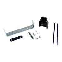
Covers the integrated transducer for Minn Kota trolling motors.
Explains how the GPS system determines position and provides navigation data.
Details adding detailed maps, updating software, and exporting data.
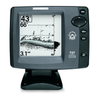
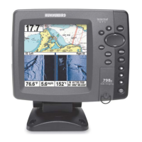
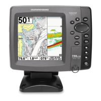
Lists key data displayed like depth, temperature, speed, and timer.
Explains how sonar returns are represented on the screen.
Describes how bottom hardness and contour are displayed.
The primary display for sonar returns and historical data.
Displays cartography from built-in or external maps.
Allows viewing saved screen snapshots and recordings.
Manages saved locations, planned paths, and boat's travel history.
Provides guidance to selected destinations or cursor positions.
Activates safety feature to locate a person overboard.
Explains the purpose and operation of each button on the control unit.
Selects the operating mode upon powering on the device.
Organizes all system settings under tabbed headings.
Provides quick access to frequently used settings based on the current view.
Alerts the user when a set depth is reached or exceeded.
Warns when the system's battery voltage drops too low.
Alerts if the boat deviates from the planned route.
Sets which sonar beam frequencies are displayed.
Enables advanced signal processing to identify fish.
Adjusts the level of detail shown on the sonar display.
Chooses which connected transducer the system will use.
Manages saved locations, names, and icons.
Creates and manages navigation paths between waypoints.
Sets the map display to North-Up or Course-Up.
Selects units for depth measurements (feet, meters).
Customizes menu options for simplicity or advanced control.
Resets all system settings to factory defaults.
Customizes which data windows are displayed on the sonar screen.
Steps to resolve issues when the unit does not turn on.
Addresses common issues with screen quality and information display.
Diagnoses and resolves sources of electrical or hydrodynamic noise.
Definitions of key sonar-related terminology and features.
Definitions of GPS and navigation concepts and acronyms.
| Sonar Type | DualBeam PLUS |
|---|---|
| GPS | Yes |
| Chartplotting | Yes |
| Depth Capability | 1500 ft |
| Maximum Depth | 1500 ft |
| Target Separation | 2.5 Inches |
| Power Output (RMS) | 500 Watts |
| Power Output (Peak to Peak) | 4000 Watts |
| Temperature | Yes |
| Backlight | Yes |
| Power Input | 10-20 VDC |
| GPS Trackplotting | Yes |
| Waypoints | 3000 |
| Routes | 50 |
| Waterproof Rating | IPX7 |
| Display Size | 5 inches |
| Sonar Frequency | 200 kHz |
| Sonar Coverage | 20° |
| Speed | Yes |
| Cartography | Yes |
| Tracks | Yes |
| Power Output | 500 watts RMS / 4000 watts peak-to-peak |
| Frequency | 200 kHz |