Do you have a question about the Humminbird 798ci HD SI Combo and is the answer not in the manual?
Provides a wide yet precise survey of water, including bottom topography and structure orientation.
Uses 200/83 kHz sonar with a wide (60°) coverage area for various conditions.
Provides an extremely wide 90° area of coverage with fan-shaped beams.
Explains the significance of the display and how sonar returns are plotted.
Describes how the unit charts depth changes to create a bottom contour profile.
Explains how Side Imaging technology produces the display images.
Provides tips for interpreting the Side Imaging display.
Explains how Down Imaging technology produces display images.
Controls how sonar returns appear on the display.
Shows a shadowed right- and left-looking view from the boat.
Uses high-definition profiling beams to produce detailed sonar data.
Presents a historical log of sonar returns.
Shows cartography from built-in maps or optional SD card maps.
Explains stored positions for areas of interest and paths.
Instructions for navigating to a cursor position or saved waypoint.
Activates navigation to an MOB waypoint for rescue.
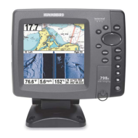
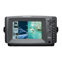
Powers the system on/off and adjusts backlight/contrast.
Used to access the menu system.
Initiates navigation to a waypoint or MOB function.
Adds detailed charts from built-in or SD card maps.
Instructions for updating control head software.
Selects system modes like Normal, Simulator, or System Status.
Connects to a PC for software updates.
Provides shortcut to frequently-used Sonar settings.
Provides shortcut to frequently-used Navigation settings.
Sounds when depth becomes equal to or less than the setting.
Sounds if the boat moves off course by a set distance.
Selects which sonar returns from the transducer are displayed.
Uses advanced signal processing to display fish symbols.
Allows selection of the connected transducer.
Allows viewing, saving, or clearing the current track.
Allows viewing and managing saved waypoints.
Allows viewing and managing saved routes.
Chooses which chart to use from built-in or SD card maps.
Selects how much chart detail is displayed.
Sets whether water contour lines are visible or hidden.
Sets the menu system to Normal or Advanced.
Sets information to display in fixed-position data windows.
Turns NMEA output on or off for data communication.
Troubleshooting steps for when the system does not power up.
Identifies and solves issues with display quality or information.
Identifies sources of electrical noise and interference.
Access specialized functions with this transducer.
Supports an integrated transducer built into trolling motors.
Definitions of sonar-related terminology.
Definitions of GPS and navigation-related terminology.
| Power Output | 500 Watts (RMS) |
|---|---|
| GPS | Yes |
| Waypoints | 3000 |
| Routes | 50 |
| Tracks | 50 |
| Power Output (Peak to Peak) | 4000 Watts |
| Temperature | Yes |
| Chartplotting | Yes |
| Humminbird LakeMaster Compatible | Yes |
| Navionics Compatible | Yes |
| Power Input | 10-20 VDC |
| Waterproof Rating | IPX7 |
| Display Size | 5 inch |
| Sonar Type | Side Imaging, Dual Beam PLUS |
| Target Separation | 2.5 inch |
| Depth Capability | 1500 feet (Dual Beam PLUS), 100 feet (Side Imaging) |
| Speed | Yes |
| Transducer | Included |