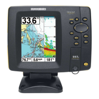
Do you have a question about the Humminbird 597ci HD and is the answer not in the manual?
Provides contact information for customer support and website.
Lists critical safety warnings regarding navigation, repair, chemical content, and speed limits.
Instructions on how to turn on the Humminbird control head and access initial setup.
Accessing the menu to select operating modes like Normal or Simulator.
Explains the fundamental principles of sonar technology used by the fishfinder.
Details DualBeam PLUS, Down Imaging, Xtreme Depth sonar, and Ice Transducer.
Explains how GPS technology is used for positioning and navigation.
Details the functions of POWER/LIGHT, VIEW, CHECK/INFO, MENU, cursor, MARK, GOTO, ZOOM, and EXIT keys.
Details the SD card slot and how to insert/remove an SD memory card.
Explains how to add detailed charts using built-in maps or SD cards.
Instructions for exporting waypoints, routes, and tracks to an SD card.
Guide on how to update the control head software via an SD card.
Explains the various information displayed on the sonar screen, including readouts and elements.
Describes how color palettes and bottom view methods represent sonar intensity and structure.
Explains display modes, freezing the display, and instant setting updates.
Explains the detailed sonar data from Down Imaging profiling beams.
Controls sensitivity and allows freezing the display to analyze sonar returns.
Sets available views to hidden or visible in the view rotation.
Capturing screen images, managing snapshots, and recording/playback.
Provides a 3D perspective view of the track and chart land contour.
Shows cartography from built-in maps or SD card, displaying track, waypoints, and routes.
Displays Chart/Sonar, Chart/Down Imaging, and Down Imaging/Sonar in split screens.
Selects view orientation: North-Up, Heading-Up, or Course-Up.
Overview of navigation features like marking waypoints and starting navigation.
Waypoints, routes, and tracks for navigation planning and recording.
Saving, creating, deleting, and navigating to waypoints.
Saving and creating routes, managing tracks, and editing navigation data.
Accessing modes like Normal, Simulator, and System Status during power-up.
Provides shortcuts to frequently-used settings based on the current view.
Standard menu settings organized by tabs (Alarms, Sonar, Nav, etc.).
Simplifies or expands menu options by setting user mode to Normal or Advanced.
Sets which sonar returns from the transducer are displayed on screen.
Selects frequency for Down Imaging beams for image quality and depth.
Adjusts clutter filter and controls how sonar returns are displayed.
Features for fish detection and real-time sonar updates.
Opens Waypoint Management dialog box for data creation and organization.
Sets waypoint icon category and default icon for new waypoints.
Settings for trackpoint creation based on time and distance.
Chooses which chart to use from built-in charts or map cards.
Selects how much chart detail is displayed, from Basic to Custom layers.
Adjusts map offset and changes depth used for shading on the Chart View.
Changes water level read from control head, affecting contour lines.
Selects units for depth, temperature, distance, and speed readouts.
Sets information displayed in fixed-position data windows on Sonar View.
Adjusts digital depth readout from waterline or boat's keel.
Steps to troubleshoot power issues and incorrect Simulator mode activation.
Identifies display issues, their causes, and how to find sources of noise.
Lists technical specifications for 587ci HD and 597ci HD models.
Lists technical specifications for 587ci HD DI and 597ci HD DI models.
Lists technical specifications for the 597ci HD XD model.
Definitions of sonar terms used in the manual.
Definitions of GPS and navigation-related terms.
| Display Type | Color TFT |
|---|---|
| Sonar Type | DualBeam PLUS |
| Sonar Coverage | 20° & 60° @ -10db |
| Sonar Frequencies | 200/83 kHz |
| Target Separation | 2.5 inches |
| Power Output RMS | 500 Watts |
| Power Output Peak to Peak | 4000 Watts |
| Depth Capability | 1500 ft |
| Backlight | Yes |
| Mount Type | Gimbal Mount |
| GPS Receiver | Yes |
| GPS Trackplotting | Yes |
| Chartplotting | Yes |
| Navionics Compatibility | Yes |
| Power Input | 10-20 VDC |
| Optional 50 kHz | No |
| Waterproof Rating | IPX7 |
| Display Size | 5" |
| Waypoints, Routes, Tracks/Points | 3000, 50, 50/20, 000 |
| Sonar Frequency | 200 kHz |
| GPS | Yes |
| Temperature | Included |