Do you have a question about the Humminbird 858c HD and is the answer not in the manual?
Provides contact details for the Humminbird® Customer Resource Center for support.
Lists critical warnings regarding device usage, potential hazards, and operational limitations.
Contains supplementary information and disclaimers about the manual and product features.
Details on obtaining lists of authorized international distributors for product support.
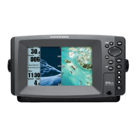
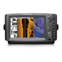
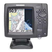
Lists the various Humminbird® 800/900 Series™ fishing system configurations covered by the manual.
Explains the fundamental principles of sonar technology and its operation in fishfinders.
Details how sonar returns are displayed and interpreted on the screen.
Explains the use of different sonar frequencies and the significance of power output.
Describes the features and coverage of the DualBeam PLUS™ sonar system.
Explains the high-definition, razor-thin beams of Down Imaging™ sonar technology.
Details the wide-area survey capabilities of Side Imaging® sonar technology.
Covers the extreme depth coverage provided by the Xtreme Depth sonar.
Explains the wide coverage and detailed views offered by QuadraBeam PLUS™ sonar.
Describes the integrated transducer system for compatible trolling motors.
Explains how the fishing system uses GPS for navigation and chartplotting.
Details GPS features like current position, track, speed, and navigation capabilities.
Discusses how configurations affect installation and menu options.
Explains the accessory bus, Video Out, and RS 232 connectors.
Details the Ethernet connector for networking multiple units.
Step-by-step instructions for powering on the Humminbird® control head.
Covers the POWER/LIGHT key for power, backlight, and contrast adjustments.
Details the VIEW, MENU, and 4-WAY Cursor Control keys for system interaction.
Explains keys for view presets, exiting menus, information, and marking waypoints.
Describes the function and insertion process for SD memory cards.
Instructions on how to add maps using SD memory cards.
Guidance on importing and exporting waypoints, routes, and tracks.
Steps for downloading and installing software updates via SD card.
Identifies key information displayed on the sonar screen like depth and temperature.
Explains the color spectrum and water temperature layers shown.
Describes the RTS Window for displaying real-time sonar returns.
Details how SwitchFire™ controls sonar return display modes.
Explains how to freeze the display and use the active cursor.
Covers color palettes for sonar returns and bottom representation methods.
Highlights features that define bottom structure and outlines.
Identifies key features for interpreting bottom contour and structure.
Explains how sonar technology produces the Side Imaging® display.
Details the frequencies and beam coverage for Side Imaging® sonar.
Provides guidance on optimizing Side Imaging® display performance.
Illustrates real-world examples of interpreting Side Imaging® data.
Identifies key features for interpreting structure and bottom contour.
Explains how sonar technology produces the Down Imaging™ display.
Guides on interpreting light and dark shades for terrain and object identification.
Details how to adjust sensitivity for optimal sonar return visibility.
Explains how to freeze the display and use the active cursor.
Introduces various display views and combo views available on the unit.
Guides on hiding or showing views in the rotation sequence.
Instructions for saving favorite views to preset keys for quick access.
Explains how to customize displayed digital readouts in various views.
Details the Sonar View, including historical logs and depth range numbers.
Explains the magnified view for detailed examination of bottom and structure.
Describes viewing sonar returns from different frequencies side-by-side.
Details the shadowed right and left-looking view of the bottom.
Explains the view showing detailed sonar data directly below the boat.
Introduces the view for reviewing saved screen snapshots and recordings.
Steps to enable the screen snapshot function with an SD card.
Guides on navigating and viewing saved snapshot and recording files.
Instructions for initiating and ceasing sonar data recording.
Details on playing back recorded sonar data and changing playback settings.
Procedures for removing saved images and recorded sonar data.
Details the activation and usage of the screen snapshot function.
Explains the available display layouts for Side Beam View.
Describes the specific characteristics of each Side Beam View layout.
Explains the 3D perspective and how to shift the eye point.
Details chart display, panning, zooming, and object information.
Introduces views that display two or more screens simultaneously.
Describes various combinations like Side/Sonar, Chart/Bird's Eye, and others.
Explains North-Up, Heading-Up, and Course-Up orientations.
Details chart panning, zooming, decluttering, and object information.
Introduces marking points, creating paths, and recording travel history.
Explains how to organize and manage navigation data.
Provides procedures for managing individual waypoints.
Guides on starting navigation to selected points or cursor locations.
Details how to add visual aids for targets and trolling patterns.
Instructions on creating, planning, and traveling saved routes.
Covers saving, clearing, editing, and hiding track data.
Explains how to customize navigation items.
Details the procedure for activating MOB navigation for safety.
Describes the initial menu for selecting operating modes like Normal or Simulator.
Explains how to access and use the quick-access X-Press™ and Main Menus.
Covers setting the User Mode to Normal or Advanced to simplify/expand menus.
Settings for cancelling navigation, selecting active side, and split position.
Adjustments for sonar sensitivity and depth range display.
Settings for deepest depth range, chart display speed, and layout options.
Controls for zoomed view bottom tracking and depth range.
Settings for cancelling navigation, active side, and split position.
Adjustments for beam selection, sensitivity, and image enhancement.
Settings for Side Imaging® range and chart display speed.
Options for selecting the color palette for Side Imaging® display.
Settings for cancelling navigation, active side, and split position.
Adjustments for sensitivity, contrast, and sharpness in Down Imaging™.
Controls for setting the shallowest and deepest displayable depth ranges.
Settings for chart display speed and Down Imaging™ color palettes.
Settings for cancelling navigation, active side, and split position.
Functions for waypoints, cursor navigation, chart declutter, and track saving.
Functions for saving routes, resetting XTE, removing targets, and grids.
Options for cancelling navigation and managing sonar recording.
Procedures for deleting individual or all captured images and recordings.
Settings for adjusting playback speed and stopping playback.
Configuration for depth alerts and fish identification alarms.
Settings for low battery, temperature, and off-course alerts.
Configuration for arrival, drift alarms, and alarm sound pitch.
Options for setting up, starting, and stopping the timer function.
Sets which sonar returns from the transducer are displayed.
Selects frequencies for Down Imaging™ and Side Imaging® beams.
Adjusts Down Imaging™ frequency and filters surface clutter noise.
Controls how sonar returns are displayed in Clear or Max Mode.
Enables fish symbol display and adjusts detection sensitivity.
Configures the Real Time Sonar window and display color palettes.
Selects bottom representation methods and adjusts zoom width.
Fine-tunes sensitivity for different sonar frequencies.
Enables display of depth lines and Side Imaging® range lines.
Manages digital readouts, noise filtering, and maximum operational depth.
Configures unit for water type and selects digital depth source.
Selects connected transducer and controls Down Imaging™ pings.
Manages color bar, temperature graph, and Down Imaging™ color palettes.
Adjusts the width of the Down Imaging™ beam for display information.
Functions for saving, clearing, and changing the appearance of the current track.
Opens the dialog box for creating, editing, and organizing navigation data.
Configures default waypoint icons and categories.
Sets default appearance settings for newly saved tracks.
Selects chart display orientation and controls proximity waypoint flags.
Allows display of waypoint circles and sets north reference.
Manages waypoint display density and trolling grid orientation.
Sets parameters for adding trackpoints based on time and distance.
Defines the depth range displayed as black for depth-colored tracks.
Adjusts map coordinate system and displays 3D view outlines.
Controls North-Up icon display and continuous navigation mode.
Manages boat icon display and direction guidance in Side Imaging® views.
Options to show or hide latitude/longitude grids and navigational aids.
Allows selection of built-in charts or SD card maps.
Allows setting simulation position and adjusting map offsets.
Configures depth shading and the amount of chart detail displayed.
Controls display of map borders and depth measurements.
Manages automatic chart zooming and scaling based on boat speed.
Adjusts boat icon position based on speed for better chart view.
Settings for displaying water contour lines and depth shading.
Highlights specific depths and adjusts water level readings.
Highlights shallow areas and displays a list of included lakes.
Sets units for depth, temperature, and distance measurements.
Sets speed units and selects Normal or Advanced menu system.
Configures display language and resets the trip log data.
Resets settings to factory defaults and formats navigation data directories.
Customizes information displayed in fixed data windows.
Adjusts depth, temperature, and speed readouts for accuracy.
Sets time zone, daylight saving, and latitude/longitude display formats.
Configures display formats for time, date, and decimal places.
Manages NMEA output, local sonar display, and demonstration mode.
Configures audible alerts and video output format.
Allows setting available views to hidden or visible in rotation.
Lists available menu choices based on connected accessories.
Details AIS compatibility for vessel monitoring and identification.
Explains AIS target display in charts and submenu controls.
Guides on adjusting AIS tracking, CPA limits, and target lists.
Precautions for cleaning and protecting the control head screen.
Guidance on cleaning the transducer for optimal operation.
Steps to resolve problems if the fishing system does not power up.
Troubleshooting for system defaulting to simulator mode with transducer attached.
Identifies common display issues and their potential causes and fixes.
Guides on identifying and resolving electrical noise affecting sonar reception.
Technical details for the 858c HD and 958c HD models.
Technical details for the 858c HD DI and 958c HD DI models.
Technical details for the 898c HD SI and 998c HD SI models.
Technical details for the 858c HD XD and 958c HD XD models.
Information regarding Waste of Electrical and Electronic Equipment regulations.
Statement on the restriction of hazardous substances in electrical equipment.
Details on the Linux operating system and GNU General Public License.
Definitions of common sonar-related terminology.
Definitions of GPS and navigation system terminology.
Provides a template for installing the Side Imaging® transducer.
Provides telephone and email contact information for customer support.
| Display Type | Color TFT |
|---|---|
| GPS | Yes |
| Chartplotting | Yes |
| Networking | Yes |
| Target Separation | 2.5 Inches |
| Power Output (RMS) | 500 Watts |
| Power Output (Peak to Peak) | 4000 Watts |
| Temperature | Yes |
| Speed | Yes |
| Backlight | Yes |
| GPS Receiver | Internal |
| GPS Trackplotting | Yes |
| Optional 50 kHz | Yes |
| Power Input | 10-20 VDC |
| Sonar Type | DualBeam PLUS |
| Waterproof Rating | IPX7 |
| Transducer Included | Yes |
| Sonar Frequency | 200 kHz |
| Max Depth | 1500 ft |
| Sonar Coverage | 20° / 60° |
| Mounting | Gimbal Mount |
| Waypoints, Routes, Points | 50 routes |
| Display Size | 7 in |