Do you have a question about the Humminbird 800 series and is the answer not in the manual?
Key operational and safety warnings for using the device.
Lists incompatible accessories and legal disclaimers.
Explains system configurations and how sonar technology works.
Details of DualBeam PLUS™ and Down Imaging® sonar.
Information on Side Imaging® and Xtreme Depth sonar.
Explains QuadraBeam PLUS™ sonar and how GPS works.
Lists GPS functions and shows system configurations.
Details connectors for system expansion and networking.
Step-by-step instructions on how to power on the control head.
Identifies control head components and essential button functions.
Details the functions of cursor, view, and menu keys.
Explains preset views, exit, info, and mark key functions.
Navigation controls and SD card usage details.
Using SD cards for maps and data management.
Steps to update the unit's software via SD card.
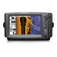
Identifies key sonar display info and the RTS Window.
Settings for sonar colors, bottom view, and structure identification.
Controls for sonar display and display updates.
Key features and technology of the Side Imaging® display.
Details frequencies and the range of side beams.
Recommendations for optimal boat speed and navigation.
Visual examples of interpreting sonar data in real-world scenarios.
Key display info and how to interpret Down Imaging®.
Adjusting sensitivity, enhance, and freeze frame for Down Imaging®.
Lists available views and how to manage them.
Details the standard sonar and zoom views.
Displays sonar from different beams side-by-side.
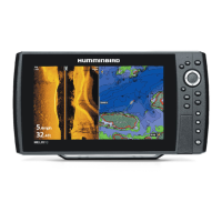
Explains the specific Side Imaging® and Down Imaging® views.
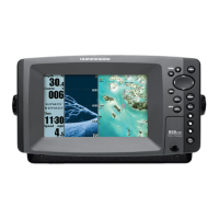
Navigating and viewing cartography data.
Displaying two views and combining SI/Sonar.
Merging Chart with Bird's Eye and displaying two chart views.
Combining Chart with Sonar and Side Imaging® views.
Combining DI/SI and Chart/DI views.
Reviewing screen snapshots and recordings.
Adjusting playback settings and deleting recordings.
Displays sonar data from side and down beams.
Overview of the 3D perspective view and its controls.
Basic principles of marking waypoints and starting navigation.
Interface for managing navigation items and sorting options.
How to create, modify, and remove waypoints.
Steps for starting navigation to a selected point.
Features for marking targets and creating trolling grids.
How to create, save, and travel routes.
Procedures for saving, clearing, and displaying tracks.
Activating and using MOB navigation for safety.
Selecting operating modes like Normal or Simulator.
Overview of shortcut and main menu structures.
Sets menu complexity and display language.
Common settings for sonar views.
Shortcut for Down Imaging® view settings.
Adjusts sensitivity, selects SI beams, enhance, and range.
Selects color palette and adjusts beam width.
Shortcut for navigation-related settings.
Chooses sonar beam frequencies and imaging modes.
Fish identification and real-time sonar display settings.
Settings for sonar colors, bottom view, and noise reduction.
Controls grid display and selects the active chart source.
Adjusts map position, depth shading, and detail level.
Displays or hides specific chart layers.
Settings for map borders, soundings, auto zoom, range, and vessel offset.
Settings for contour lines, depth shading, and water level.
Highlights shallow areas and lists available lakes.
Configures units of measure and user mode for menus.
Resets trip data, restores defaults, and formats directories.
Customizes data displayed in readouts.
Adjusts sensor readings and configures time/GPS settings.
Controls demo mode and audio alerts.
Manages views and captures screen images.
Locates and monitors other vessels via AIS.
Displays and manages AIS target data.
Definitions of sonar-related terminology.
Definitions of GPS and navigation-related terms.
Mounting template for Side Imaging® transducers.
Contact details for support and service.
| Brand | Humminbird |
|---|---|
| Model | 800 series |
| Category | Fish Finder |
| Language | English |