Do you have a question about the Humminbird 898 c SI and is the answer not in the manual?
Explains the fundamental principles of sonar technology and its application in fishfinders.
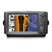
Details the primary control keys on the Humminbird unit for navigation and operation.
Describes the information and elements displayed on the sonar screen for interpretation.
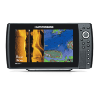
Explains the features and interpretation of the Side Imaging sonar display.
Details the information and interpretation of the Down Imaging sonar display.
Details the specific view for Side Imaging sonar data and its interpretation.
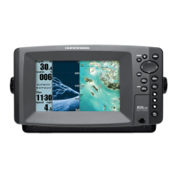
Explains how to display and manage multiple views simultaneously on the screen.
Covers storing, managing, and using navigation points and paths.
Provides instructions on how to set a destination and begin navigation.
Details the critical safety feature for locating a person overboard.
Explains the initial modes available when powering on the unit.
Provides quick access to frequently used settings based on the current view.
Describes the organized tabbed structure of all system settings.
Configures the unit of measure for depth readings displayed on the unit.
Resets all system settings to their original factory configurations.
Accesses all sonar-related settings for display and performance.
Sets sonar frequencies from the transducer that are displayed on the screen.
Controls sonar return display modes, offering different clarity options.
Accesses all chart and navigation display settings.
Allows choosing between built-in charts or maps on an SD card.
Controls the visibility of underwater topography lines on the chart.
Guides for diagnosing and resolving common operational problems.
Outlines the terms and conditions of the product warranty.
Lists optional accessories that enhance system functionality and features.
Provides technical data, capabilities, and physical characteristics of the unit.
Defines technical terms used throughout the manual for clarity.
| Display Type | Color TFT |
|---|---|
| Display Pixel Matrix | 800 x 480 |
| Sonar Type | Side Imaging, Down Imaging, DualBeam PLUS |
| Max Depth (Down Imaging) | 150 ft |
| Max Depth (DualBeam PLUS) | 1500 ft |
| Depth Capability | 1500 ft |
| Power Output (RMS) | 500 Watts |
| Power Output (Peak to Peak) | 4000 Watts |
| GPS | Yes |
| Chartplotting | Yes |
| Waypoints | 3000 |
| Routes | 50 |
| Waterproof Rating | IPX7 |
| Temperature | Yes |
| Speed | Yes |
| Backlight | Yes |
| Mount Type | Gimbal |
| Humminbird LakeMaster Compatibility | Yes |
| WeatherSense Compatible | No |
| PC Connect | Yes |
| Wireless Remote Control | No |
| Software Upgradable | Yes |
| Split Screen Zoom | Yes |
| Split Screen Bottom Lock | Yes |
| Large Digits View | Yes |
| Custom View Selections | Yes |
| Temperature Alarm | Yes |
| Display Size | 7 inches |
| Display Resolution | 800 x 480 |
| Sonar Frequency | 455/800 kHz (Side Imaging) |
| Max Depth (Side Imaging) | 150 ft |
| Target Separation | 2.5 inches |
| Tracks/Points | 20, 000 points |
| Battery Voltage | 10-20 VDC |
| Operating Temperature | -15°C to 55°C |