aaaaaaaaoaaoaaaaf
aaaaooaaaaaaaaaaaaaalf
Display of
Navigational
Information'''
' '
' '
Navigational
information
such
as waypoint marks, and a maximum of
256
point
of NAV lines,
coastlines,
depth contours
and
NAV
marks can be
created,
displayed,
read out,
saved,
edited
and
cancelled.
(This
funclion
is effective only when navigation equipment
is connected to this
system.)
lU
Displaying Waypoint
Marks
lf
waypoint information
is senl from navigation equipment, a
waypoint mark will appear on the
radar display.
lf the waypoint
appears within the radar
display,
it
is
displayed as
"oWP".
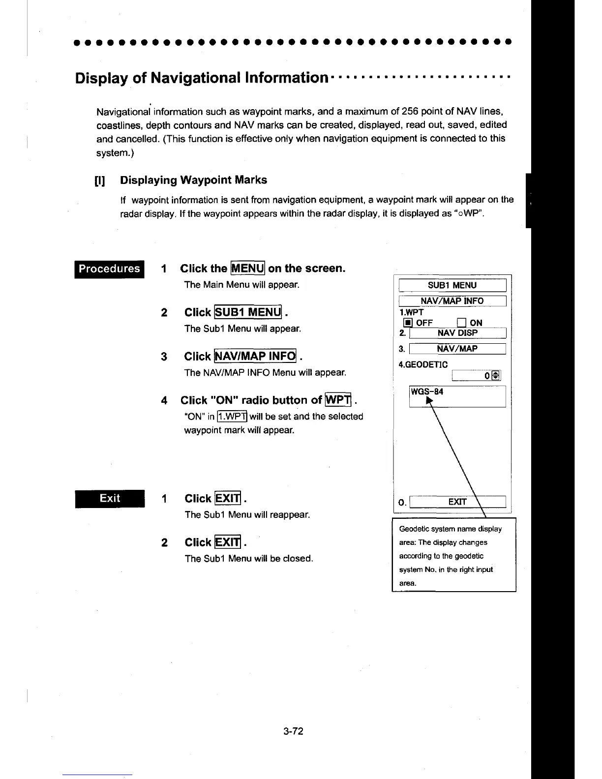
1 Glick the
lMENUlon
the
screen.
The
Main Menu
will aDoear.
Click
UB1 MEN
The
Subl
Menu will appear.
V/MAP INF
Glick INAV/MAP
INFOI .
The NAV/MAP
INFO Menu will appear.
Click
"ON" radio
button
of
WPt'l
.
'ON"
in
h
l /PTlwill
be set and
the
selected
waypoint
mark will
appear.
Click
lExlTl
.
The
Subl
Menu will reappear.
clickExtr.
The Subl
Menu will
be
closed.
SUB1 MENU
INFO
l.WPT
m oFF
n
oN
_--_,
2.I NAV DISP
/MAP
Geodetic system name display
area: The display changes
according
to
the
geodetic
system
No.
in the
right input
area.
3-72
 Loading...