12 | Page
•
: As the Station builds memory, it will compare the current average pressure to
the past forty day average pressure for increased accuracy. The longer the Station operates
in one location the more accurate the forecast icons will be.
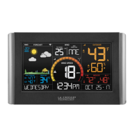
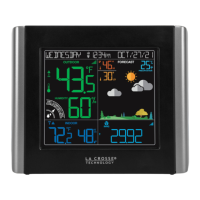
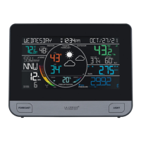
When your station is connected to the La Crosse View™ app you will see an
additional 8 forecast icons from the National Weather Service (NWS). Your forecast will update
multiple times per day. The forecast icons predict weather condition for the next 3-6 hours.
Additional forecast icons when connected:
• Windy
• Light Rain
• Severe T-Storm
• Light Snow
• Wintry Mix
• Blizzard
• Ice
• Fog
1. Your weather station checks with the NWS eight times per day.
2. Different stations may show different aspects of the NWS based on when they update from
the NWS.
the NWS can update their website at any time.
⋅
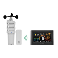
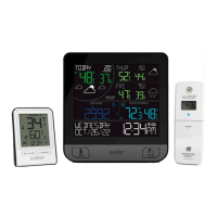
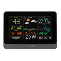
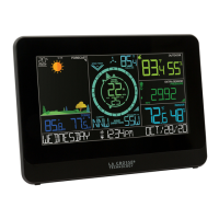
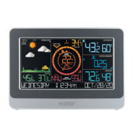
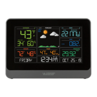
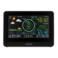
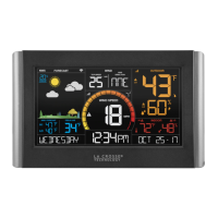
Weather Forecast Icons (Sun, Rain, etc.):
Predicting weather in the next 3-6 hours.
⋅
Forecast for 12 hour period
⋅
Forecast of daytime maximum temperature and overnight minimum
temperature.
⋅
Chance of Hail within 25 miles.
⋅
Chance of Thunderstorms within 25 miles.
⋅
Chance of Thunderstorms within 25 miles.
⋅
Cloud cover percentage for the current hour.
⋅
Expected accumulation of new snow in a 6 hour period
⋅
Forecasted sustained wind direction for the indicated hour
⋅
Forecasted sustained wind speed for the indicated hour.
⋅
Maximum 3-second wind speed (in knots) forecast to occur within a
2-minute interval. Wind gust forecasts are valid at the top of the indicated hour.
All NWS wind reads are at a height of 32.8 feet (10 meters).