Do you have a question about the Lowrance HDS12 Live and is the answer not in the manual?
Contains warnings, limitations, and disclaimers for product usage.
Specifies the official language version for documentation conflicts.
Lists registered trademarks associated with the product and company.
Details copyright information and warranty service procedures.
Information regarding compliance with regulatory directives for Europe.
Explains the function of each key on the device's front panel.
Details the use of the memory card for data storage and updates.
Describes how to unlock features and register the device.
Information on downloading and using the mobile application.
Details the layout and function of the Home page.
Explains multiple panel page configurations and active panel identification.
Describes the control bar, application panel, and menu button.
Covers predefined split pages, favorites bar, and system controls.
Provides quick access to basic system settings and functions.
Instructions for safely removing the protective suncover.
Procedures for turning the system on/off and standby mode.
Adjusting brightness, night mode, and managing pages/panels.
How to access and navigate through menus.
Creating, deleting, and stopping navigation for MOB waypoints.
Securing the touchscreen and simplifying account access.
Instructions on how to take and save screen captures.
How to customize the Home page wallpaper with personal images.
Guides on adjusting panel splits in multi-panel pages.
Setting up and editing data overlays on chart and sonar pages.
Adding, modifying, and saving favorite pages for quick access.
Customizing key presses for quick access and home keys.
Enabling or disabling features through advanced settings.
Identifies key elements displayed on the chart panel.
Information on preloaded cartography and selecting chart sources.
Covers zooming, panning, and chart orientation.
Explains how to use the cursor for navigation and information retrieval.
Procedure for measuring distances between points on the chart.
Details weather, structure, and heat map overlays on charts.
Specific options and features for C-MAP charts.
Covers photo overlay, shading, and fishing range for Navionics® charts.
Configuration options for chart display and data.
Saving, moving, and editing waypoints.
Creating new routes, editing existing ones, and deleting routes.
Creating, editing, deleting, and setting up trails.
Coloring trails based on source data and specified limits.
Details displayed on the Steer panel during navigation.
Navigating to cursor, routes, and starting navigation from dialogs.
Using autopilot functionality for navigation.
Configuring arrival radius, XTE limit, trails, and logging.
Explains the sonar image elements and multiple source display.
Steps for zooming the sonar image and using the cursor.
Starting, stopping, and viewing recorded sonar log data.
Configuring the sonar image and selecting fishing modes.
Adjusting range, frequency, and sensitivity for optimal sonar.
Details on noise rejection, surface clarity, and scroll speed.
Accessing stop sonar, zoom, bottom lock, and flasher modes.
Configuring internal sonar, network sonar, and log settings.
Introduction to SideScan, its panel, and image zooming.
Details on using the cursor, viewing history, and recording data.
Configuring the SideScan image, including source and advanced options.
Adjusting frequency, range, and contrast for SideScan.
Surface clarity, flip options, and more options for SideScan.
Overview of DownScan, its panel, and image zooming.
Details on panel elements, cursor, history, and data recording.
Configuring the DownScan image, source, and advanced options.
Adjusting frequency, range, and contrast for DownScan.
Surface clarity, flip options, and more options for DownScan.
Introduction to 3D Sonar and its panel.
How to zoom images and use the cursor in 3D view.
Explains vessel mode, cursor mode, and viewing image history.
Covers source, range, contrast, and advanced options for 3D Sonar.
Details on surface clarity, flip, vertical enhancement, and sensitivity.
Description of the Ghost 360 feature and its activation.
Configuring range, frequency, and advanced options for Ghost 360.
Adjusting position, scan, and more options for Ghost 360.
Introduction to ActiveTarget, its modes, and sharing capabilities.
Details on forward, down, and scout panel views.
Zooming images, stopping sonar, and using the cursor.
Instructions for recording and stopping ActiveTarget video.
Changing modes, sensitivity, and noise rejection settings.
Specifying sources and flipping the image view.
Overview of ActiveTarget 2, its features, and configurations.
Setting up split screens for forward and scout views.
Introduction to StructureMap, its image, and sources.
Details on live data, saved files, and usage tips.
Covers structure options, transparency, and mapping card usage.
Overview of instrument panels, dashboards, and gauge types.
Creating, starting from blank, copying, and using templates.
Customizing dashboards, adding gauges, and choosing gauge data.
Introduction to the video function and camera connection.
Configuring the video panel, source, and additional options.
Guidelines for safe operation and autopilot alarms.
Details on the autopilot controller interface and activation.
Procedures for engaging, disengaging, and indications.
Description of steering modes and anchor options.
Using NAV mode, turn patterns, and associated variables.
Controlling trolling motor speed via autopilot.
Configuration options for chart compass, autopilot, and arrival mode.
Guidelines for safe operation and autopilot alarms for outboard motors.
Details on the outboard autopilot controller interface and activation.
Procedures for engaging, disengaging, and indication displays.
Description of steering modes like Heading hold and NoDrift.
Using NAV mode, turn patterns, and associated variables.
Using depth contour tracking for autopilot steering.
Settings for chart compass, data sources, and steering response.
System requirements for SteadySteer compatible autopilot.
How SteadySteer controls autopilot reaction to manual steering.
Introduction to the simulation feature and retail mode.
Choosing data files for simulator operation.
Manually controlling simulator settings like GPS source and start position.
Overview of supported radar sensors and their features.
Identifies components of the Radar panel like PPI and data boxes.
Selecting radar sources and overlaying radar images on charts.
Explains power off, standby, transmit, and sector blanking.
Settings for radar range, including dual range capability.
Using the cursor and adjusting the radar image gain and clutter.
Details on custom, harbor, offshore, weather, and bird modes.
Managing clutter, gain, sea state, and rain clutter settings.
Settings for noise rejection, threshold, target expansion, and interference.
Understanding radar symbols and target trails.
Using EBL/VRM markers and setting guard zones for alarms.
Explains radar target symbols and identifying dangerous targets.
Using MARPA for tracking targets and collision avoidance.
Configuring radar settings like bearings, data bar, and vessels.
Introduction to audio system control and device connection.
Details on the audio controller, speaker zones, and volume control.
Selecting audio sources and managing Bluetooth devices.
Using the AM/FM radio, tuning channels, and favorites.
Controlling SiriusXM® radio, selecting channels, and locking.
Controlling DVD playback and setting video standard.
Introduction to AIS, target display, and collision avoidance.
Selecting, searching for, and displaying AIS targets.
Viewing detailed information about AIS targets.
Initiating DSC calls and tracking DSC vessels.
Understanding AIS SART signals, icons, and alarm messages.
Setting vessel alarms and identifying dangerous targets.
Explanation of various AIS target symbols and their meanings.
Configuring MMSI, course extension, and vessel tracking.
Details on the Navico WM-4 receiver for weather and audio services.
Overview of SiriusXM® weather services and availability.
Displaying SiriusXM® weather on the chart panel and showing details.
Accessing current weather and forecast information.
Configuring weather view options, precipitation, and weather icons.
Animating weather data and setting up weather alarms.
Overview of options for remotely controlling the MFD.
Explanation of the internal Wi-Fi® module's dual mode capability.
Connecting and using the mobile app for remote control.
Connecting the MFD to hotspots and access points.
Setting up and configuring the LR-1 wireless remote controller.
Functions available when connecting a phone to the MFD.
Steps for connecting and pairing phones via Bluetooth®.
Managing phone notifications, creating text messages, and responding to calls.
Troubleshooting connection issues and missing notifications.
Details on managing paired Bluetooth® devices.
Descriptions of toolbar tools like Waypoints, Alarms, Vessels, and Info.
Managing storage, connecting phones, and accessing the store.
Customizing language, boat settings, text size, and time.
Configuration for wireless functionality, advanced tools, and services.
Overview of the alarm system and message classification.
How alarms are indicated and how to acknowledge them.
Enabling/disabling alarms and accessing alarm dialogs.
Basic maintenance for connectors, display unit, and housing.
Procedure for recalibrating the touchscreen display.
Logging NMEA data, exporting logs, and updating software.
Creating service reports and backing up system data.
Exporting waypoints, routes, trails, and settings.
Monitoring and controlling Mercury engines via VesselView.
Displaying video and controlling FLIR® cameras over Ethernet.
Monitoring and controlling Suzuki, Yamaha, and BRP engines.
Controlling FUSION-Link™ devices and CZone® power systems.
Controlling Power-Pole® anchors via Bluetooth®.
Controlling vessel lighting via ITC controllers and NMEA 2000®.
Enabling/disabling and configuring RGBW lighting controllers.
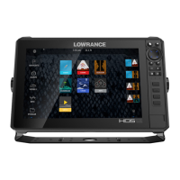
| Display Resolution | 1280 x 800 |
|---|---|
| Networking | Ethernet, NMEA 2000 |
| Power Supply | 12V DC (10.8-17V DC min-max) |
| Water Rating | IPX7 |
| Sonar | Active Imaging, CHIRP, StructureScan 3D |
| Wireless Connectivity | Bluetooth, Wi-Fi |
| Card Slots | Dual microSD card slots |
| Operating Temperature | -15°C to 55°C |
| GPS | Yes, with built-in GPS antenna |