Do you have a question about the Nextar 3.5" and is the answer not in the manual?
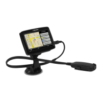
Covers basic setup, essential safety warnings, and usage considerations like UV-protected windshields and theft prevention.
Details how to access and view GPS status and satellite information.
Explains the use of the on-screen virtual keyboard for data input.
Describes how to navigate between screens and the procedure for resetting the GPS device.
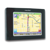
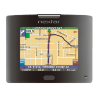
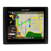
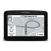
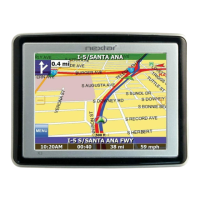
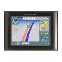
Explains the map display, current location, compass, zoom controls, and turn-by-turn maneuver details.
Details how to pan the map, switch to 3D view, and view the list of route maneuvers.
Shows how to find current location details and information about Points of Interest on the map.
Describes functions accessible via specific tap areas on the map display.
Introduces methods for setting a destination: Address, Intersection, POI, Favorites, Recent, City Center.
Step-by-step guide for setting a destination by entering a street address or city first.
Instructions for setting an intersection as a destination by street or city.
Details how to select a Point of Interest as a destination from categories or lists.
Explains selecting POIs by distance, alphabetically, or by city.
Guides on selecting destinations from your Favorites list and recent destinations history.
Guides on selecting a city center as a destination, by name or proximity.
Explains how to bypass parts of a route or mark roads as unavailable to recalculate the route.
Details the process of adding intermediate stops to a route and how to cancel them.
Describes how to create, manage, and re-order multiple destinations in a trip itinerary.
Covers using shortcuts for quick access to frequently used locations like Home or ATM.
Provides instructions for editing destination names and removing entries from the Favorites list.
Explains how to access detailed turn-by-turn route information and current location data.
Covers viewing trip stats, sun/moon data, software version, and copyright details.
Details information related to GPS signal strength, coordinates, date, and time.
Explains how to save parking location and use the feature to find your parked car.
Details options for map orientation, guidance display, day/night mode, and POI icons.
Explains settings for route calculation methods, ferries, toll roads, carpool, and turns.
Details safety features including Fatigue Alert, Fog Assist, Speed Alert, School Zone, Emergency Option, and Headlight Reminder.
Guides on setting up auto or fixed speed alerts to warn about exceeding speed limits.
Explains Fog Assist, Fatigue Alert, School Zone Alert, Emergency Option, and Headlight Reminder functionalities.
Covers selecting the interface language and configuring Text-to-Speech voice prompt options.
Details settings for Time Zone, Daylight Savings Time, and distance units (Miles/Kilometers).