Working with the map
The system gives you many ways of looking at the map. You can see your
current position, you can view any of the maneuvers on a route, and you can
pan the map to view other areas. You can zoom in and out, and you can find
information about specific locations.
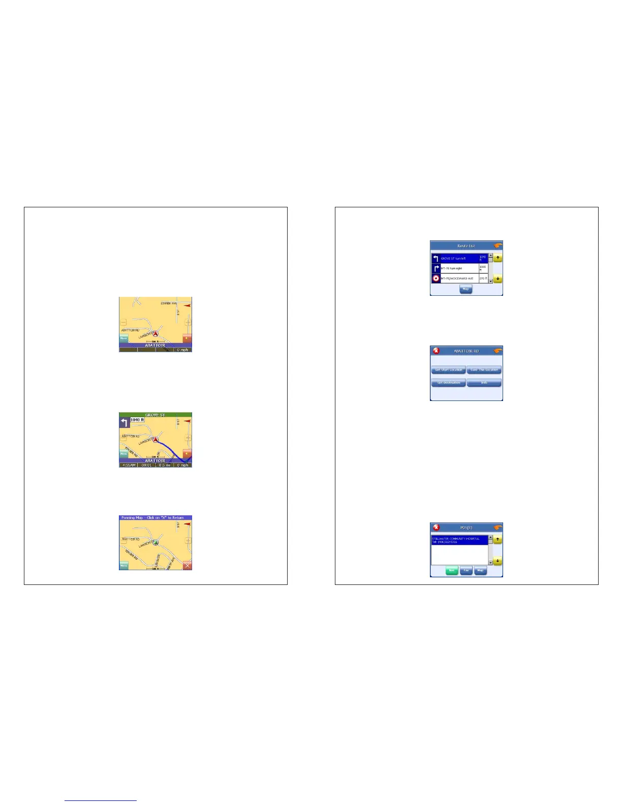
Map view
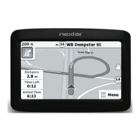
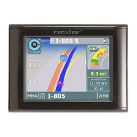
If you have a GPS signal, the map view on the system shows you your
current location, indicated by a green arrow. If the arrow is red, you do not have
a GPS signal, and if the arrow is yellow the GPS signal is weak.
At the bottom of the map is a scale indicating your current zoom level.
Maneuver detail
If you have set a destination, the map displays additional information. As
you navigate to a destination, the top of the map displays the name of the next
street, the direction of your next turn and the distance to that turn.
At the bottom of the map you see the time, an estimate of how much time
before you arrive at your destination, the remaining distance to your
destination, and your current speed.
Panning the map
You can pan the map by tapping and dragging the map.
To return to the regular map view, press the “X” button.
Route list
Tapping an item on the list and then tapping Map will display the maneuver
detail screen for that maneuver.
Location and POI information
You can find location information about any point on the map by pressing firmly
on the map. A screen appears giving you the opportunity to set the location as
the Start or the Destination, save the location to your Favorites list, or view
information.
From the Information screen you have several options:
Set start location
Set destination
Save this location
Information
Setting the location as a starting point is useful if you are trying to find the
distance between two locations. Setting the location as your destination is a
quick way to set a destination. Saving the location adds the location to your
Favorites list (you'll learn more about Favorites later in this manual).
If you press firmly on a POI (Point of Interest) icon, you see the POI(S) screen,
which lists the POIs at that location on the map.