Create a new landmark category
On the categories tab, select Options >
Edit categories.
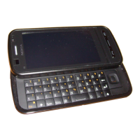
GPS data
GPS data is designed to provide route
guidance information to a selected
destination, position information about
your current location, and traveling
information, such as the approximate
distance to the destination and
approximate duration of travel.
Select Menu > Applications > Location
and GPS data.
Route guidance
Route guidance shows the straightest
route and the shortest distance to the
destination, measured in a straight line. It
ignores any obstacles on the route, such
as buildings and natural obstacles, or
differences in altitude. Route guidance is
active only when you move. Start the
route guidance outdoors to receive the
necessary information from the satellites.
Select Menu > Applications > Location
and GPS data > Navigation.
Set your destination
Select Options > Set destination and a
landmark as the destination, or enter the
latitude and longitude coordinates.
Clear the destination
Select Stop navigation
Retrieve position information
You can view the position information
of your current location and an estimate
of the accuracy of the location.
Select Menu > Applications > Location
and GPS data > Position.
Save your current location as a
landmark
Select Options > Save position.
Landmarks can be used in other
compatible applications and transferred
between compatible devices.
Trip meter
With the trip meter, you can calculate
the distance, speed, and time of your trip.
Use the trip meter outdoors to receive a
better GPS signal.
Select Menu > Applications > Location
and GPS data > Trip distance.
Start calculating the trip distance
Select Options > Start. The calculated
values remain on the display.
Start a new calculation
Select Options > Reset. This sets the trip
distance and time and average and
maximum speeds to zero.
Set the odometer and total time to
zero
Select Options > Restart.
The trip meter has limited accuracy, and
rounding errors may occur. Accuracy can
also be affected by availability and quality
of GPS signals.
Positioning settings
Positioning settings define the methods,
server, and notation settings used in
positioning.
Positioning (GPS) 71
© 2010 Nokia. All rights reserved.