Do you have a question about the Raymarine Marine RADAR and is the answer not in the manual?
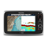
Explains the functions of buttons and controls on the E-Series display unit.
Details how buttons and soft keys are used to navigate the system and interact with the display.
Explains how to select page sets, pages, and windows for display customization.
Provides instructions on inserting and removing CompactFlash cards for data storage and transfer.
Introduces the chart application and its uses, including navigation and data display.
Details how to view chart information, change orientation, and adjust motion modes.
Explains how to view detailed information about objects, ports, tides, and currents on the chart.
Covers displaying panoramic photos, pilot book information, and aerial photo overlays.
Introduces the 3D chart view, explaining its use for navigation and visualization.
Details how to navigate within the 3D chart, change motion modes, and synchronize with 2D charts.
Explains what waypoints are and how to create, manage, and use them for navigation.
Guides users on how to create and follow routes, which are sequences of waypoints.
Introduces the radar display, its components, and how to interpret the data shown.
Explains the use of guard zones and radar overlay for collision avoidance.
Details the Mini Automatic Radar Plotting Aid (MARPA) for tracking targets and assessing collision risk.
Covers the Automatic Identification System (AIS) for identifying and tracking vessels and providing collision avoidance data.
Explains how to monitor the boat's course and steer using the Course Deviation Indicator (CDI).
Introduces the fishfinder application, its display elements, and how to interpret bottom structure.
Details how to adjust fishfinder settings like range, shift, presets, and gain.
Explains how to monitor engine data and other system information via dedicated applications.
Describes how to display video input from cameras or external sources on the E-Series display.
Covers receiving and viewing Navtex alerts and Sirius Weather data for navigation and forecasting.
Details the weather symbols and graphics available from the Sirius Weather service.
Explains the colours and settings of the digital radar display for optimal viewing.
Details how to set up and manage a networked system of E-Series displays.
Explains how to enable, engage, disengage, and use the autopilot system.
| Brand | Raymarine |
|---|---|
| Model | Marine RADAR |
| Category | Marine GPS System |
| Language | English |