3D VIEW
OPTIONS...
PRESENTATION…
ADJUST
EXAGGERATION
ADJUST
EXAGGERATION
Adjust
factor as
required
PRESENTATION...
DECLUTTER
ON OFF
D8735_2
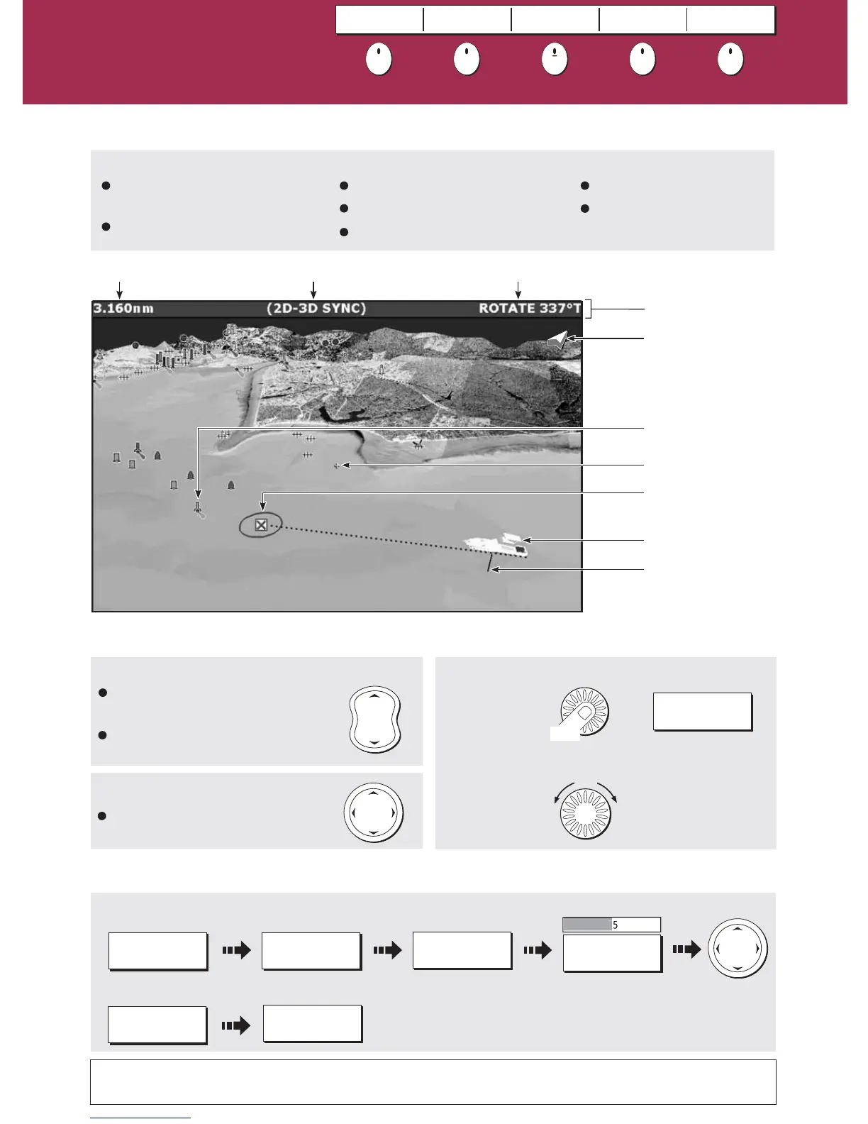
Changing the view on the 3D chart
What can I use the 3D chart for?
How do I move around the 3D chart?
To change the scale:
To pan the 3d chart:
Mode RotationRange
Boat symbol
Center-of-view
North arrow
Cartographic objects
Depth scale
Active waypoint
(with arrival circle)
To adjust rotation/pitch
Rotates the view or
changes the vertical
angle of view.
Adjust the
rotation/pitch:
Select rotate
or pitch:
Toggle control to
required function
Status bar
To enhance objects and make it easier to see their shape and position:
To show/hide pre-set cartographic features:
Press RANGE (OUT) to see a larger
area of the chart.
Press RANGE (IN) to see a smaller
area in more detail.
To pan a 3D chart to a different
area
See 'Using the 3D Chart' chapter of the E-Series Reference Manual
RANGE
IN
OUT
Turn
1.
2.
If you are using a suitable chart card you will be able to:
What can I see?
Understanding the
3D chart
Card 9
Synchronize the 2D and 3D chart.
Locate where you are.
Monitor where you are going.
Display a 3D view of land, sea &
features.
Interpret your surroundings.
FIND SHIP
GOTO
ADJUST ON
EYE CENTRE
ADJUST
ROTATE PITCH
PRESENTATION
Press
Or
ADJUST
ROTATE PITCH
Go to an existing waypoint.
Navigate a route.
?
More information...
 Loading...
