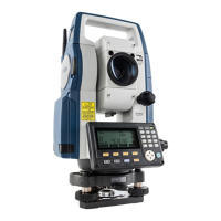
Do you have a question about the Sokkia CX-106 and is the answer not in the manual?
Details safety precautions related to power supply, battery charging, and electrical hazards.
Introduces fundamental key operations and button functions for instrument control.
Provides a step-by-step procedure for charging the instrument's battery.
Explains the process of centering the instrument over the survey point using optical or laser plummer.
Describes how to level the instrument using screen display or the plate level.
Details the steps for powering on the instrument, including password entry and initial checks.
Outlines the correct procedure for powering off the instrument to save power or shut it down.
Guides the user through the essential settings for establishing Bluetooth communication.
Explains how to connect the CX instrument with a pre-paired Bluetooth device.
Details how to register known points or output JOB data wirelessly via Bluetooth.
Explains how to measure horizontal angles and set the horizontal angle to 0 degrees.
Details how to set and hold a specific horizontal angle for referencing or setting out.
Covers angle measurement procedures and how to output the collected data.
Describes how to simultaneously measure distance and angles to a target.
Covers distance measurement procedures and outputting the collected data to external devices.
Explains coordinate measurement and how to output the data to external devices.
Details the Remote Measurement (REM) function for calculating heights of inaccessible points.
Explains how to input instrument station coordinates and the backsight azimuth angle.
Details the steps for performing 3-dimensional coordinate measurements of targets.
Explains how to set out points based on calculated horizontal angles and distances.
Details setting out points based on horizontal angle and distance from the instrument station.
Explains how to perform REM setting-out for points where targets cannot be directly installed.
Guides on defining a baseline for setting-out line measurements and point projections.
Explains how to find required point coordinates by inputting length and offset relative to a baseline.
Describes how to determine horizontal and vertical distances of measured points from a baseline.
Explains how to define an arc using various parameters like coordinates, radius, and angle.
Explains how to find required point coordinates along an arc by inputting arc length and offset.
Guides on defining a baseline for projecting points onto it.
Explains how to project points onto a defined baseline and display distances.
Details how to configure observation settings prior to topography surveying.
Guides the user through the process of performing topography observations.
Explains how to find a point's coordinates by entering its horizontal distance from the target point.
Describes how to find a point's location using the included angle from offset points.
Explains how to measure points by using two offset points and their distances.
Details how to measure distances between multiple points without moving the instrument.
Guides on calculating surface area by observing points that form a closed area.
Explains how to calculate surface area using previously registered coordinate data.
Covers setting the instrument station as a reference point for route surveying.
Explains how to calculate coordinates for center and width pegs for straight line segments.
Details the calculation of center and width pegs for circular curves.
Explains calculations for spiral (clothoid) curves and their properties.
Covers calculations related to parabolic curves and their properties.
Explains how to calculate intersection and azimuth angles using curve properties.
Covers the process of finding center and width pegs for a route containing multiple curves.
Details how to input curve properties (parameters, radius, offset) for route calculation.
Covers automatic calculation of cardinal points (center, width pegs) based on curve properties.
Explains how to find coordinates of arbitrary points on any calculated curve.
Guides on setting a baseline for projecting points onto it.
Explains how to record instrument station coordinates, point name, height, and other data.
Details how to store distance measurement data, including using automatic recording.
Explains how to store coordinate measurement data in the current JOB.
Covers storing both distance and coordinate data simultaneously for the same point.
Explains how to register or delete coordinate data for known points.
Explains how to output JOB data to a host computer via connection.
Explains how to customize softkey allocations to suit different applications and operators.
Describes how to check and cancel tilt zero point errors related to the tilt sensor.
Details how to check the laser plummet for proper alignment.
Details the need for and method of calculating atmospheric correction factors for precise distance measurements.
| Model | CX-106 |
|---|---|
| Category | Measuring Instruments |
| Type | Total Station |
| Magnification | 30x |
| Angle Accuracy | 6" |
| Internal Memory | 10, 000 points |
| Protection Class | IP66 |
| Compensator | Dual-axis |
| IP Rating | IP66 |
| Distance Range with Reflector | 5, 000 m |
| Measurement Range (with prism) | 5, 000 m |
| Distance Measurement Time | Rapid: 0.7 s |
| Operating Temperature | -20°C to 50°C |
| Weight | 5.6 kg |