Do you have a question about the Topcon ES-107 and is the answer not in the manual?
Covers safety guidelines for using the instrument, handling the carrying case, and general warnings.
Details safety precautions related to battery chargers, batteries, power cords, and handling electrical connections.
Advises on safety precautions when using the instrument in very low temperatures, focusing on skin contact with metal parts.
Classifies the laser product and provides critical warnings about hazardous radiation exposure and proper usage.
Details cautionary measures for laser beam usage, including avoiding direct eye exposure and proper instrument handling.
Explains fundamental operations like power ON/OFF, display backlight control, target type switching, and laser/guide light control.
Provides instructions on how to charge the battery, including temperature ranges and storage guidelines.
Explains how to center the instrument using both the optical plummet eyepiece and the laser plummet.
Guides the user through the levelling procedure using circular and tilt levels to ensure instrument stability.
Details the necessary settings for Bluetooth communication, including setting the mode to 'Slave'.
Provides instructions on establishing a connection between the ES and a paired Bluetooth device, noting battery consumption.
Explains how to perform measurements using a data collector via Bluetooth communication.
Explains how to measure the included angle between two points using the 0SET function to set the horizontal angle to 0°.
Details how to reset the horizontal angle to a required value and use it to find the horizontal angle of a new target.
Explains how to measure both distance and angle simultaneously and interpret the displayed EDM information.
Details the REM measurement function used to find the height of points inaccessible for direct installation.
Covers methods for setting instrument station data, including key input and reading registered coordinates.
Explains how to set the backsight angle using input or calculation from backsight coordinates.
Guides on inputting station coordinates, instrument height, target height, and azimuth angle before coordinate measurement.
Details how to set the backsight station's azimuth angle by calculating it from coordinates.
Explains how to determine instrument station coordinates by performing multiple measurements of known points.
Guides on performing observation settings prior to resection measurement, including RL observation and sigma Z display.
Describes how to observe known points with coordinate data to calculate the instrument station's coordinates.
Details the procedure for RL observation within resection measurement, involving measurements in Face 1 and Face 2.
Explains how to determine only the Z (height) coordinate of an instrument station using distance measurements.
Details how to find the 3D coordinates of a target using station data, target height, and backsight information.
Guides on measuring target coordinates by sighting and using the 'Coordinate' function in OBS mode.
Details how to set out a required point by inputting coordinates and calculating setting-out angles and distances.
Explains how to find a point based on horizontal angle from a reference direction and distance from the instrument station.
Guides on performing REM setting-out to find points where targets cannot be directly installed.
Explains how to define a baseline by inputting coordinates or observing two points for setting-out line measurement.
Details how to find required point coordinates by inputting length and offset based on a defined baseline.
Explains how to measure horizontal and vertical distances of a point from a connected line or baseline.
Guides on defining an arc by inputting parameters like radius, angle, and coordinates for key points.
Details how to find required points along an arc by inputting arc length or chord length and offset.
Explains how to define a baseline for projecting points, which can be used in setting-out line and point projection.
Details how to project a point onto a baseline by measuring or inputting coordinates and calculating distances.
Guides on performing observation settings for topography, including measurement patterns and registration options.
Explains how to perform topography observation by measuring directions and recording data.
Details the procedure for RL topography observation, including measuring target points in R and L directions.
Explains finding a point by entering the horizontal distance from the target point to the offset point.
Details how to find a target point from an included angle by installing offset points and measuring angles.
Describes measuring distances between target and two offset points to find the target point.
Explains finding distance and coordinates of a plane edge where direct measurement is not possible.
Details finding distance and coordinates of a column center by measuring circumscription points.
Explains measuring slope, horizontal distance, and angle to targets without moving the instrument.
Guides on calculating missing line data by inputting coordinates for the first and second targets.
Details calculating land area by observing points clockwise or counterclockwise around the area.
Explains calculating area by reading in previously registered coordinates in the correct order.
Explains finding intersection points between two reference points using length or azimuth angle specifications.
Describes the process of traverse measurement, coordinate calculation, and adjustment to improve precision.
Details different methods for adjusting traverse data, including Compass, Transit, and Angular adjustments.
Details calculating coordinates for center and width pegs of a straight line using reference and IP points.
Explains finding center and width peg coordinates for circular curves using BC and IP point data.
Covers calculation of center and width pegs for spiral (clothoid) curves based on reference points and curve properties.
Details finding center and width pegs for parabolas using reference point and curve properties.
Explains finding cardinal points, centerline pegs, and width pegs using coordinates of 3 IP points and curve properties.
Details calculating cardinal points and width pegs from intersection angles, curve properties, and IP coordinates.
Guides on finding center and width pegs for routes containing curves, including inputting curve properties and automatic calculation.
Describes the process of inputting Intersection Points (IPs) for route calculation.
Explains how to input curve properties like parameter A, radius, and offset for calculating route points.
Details measuring a target point's coordinates by sighting and defining a baseline.
Explains registering or deleting coordinate data for known points in the current JOB using key entry or external instrument.
Details the procedure for checking and adjusting the circular level bubble for instrument levelling.
Explains how to check the tilt sensor for zero point errors and adjust the instrument's leveling.
Guides on measuring and correcting collimation error to ensure accurate angular observations.
Details procedures for checking and adjusting the optical plummet's centering accuracy.
Guides on checking and adjusting the laser plummet beam to ensure it remains centered on the target.
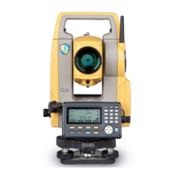
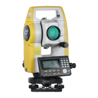
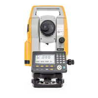
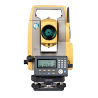
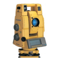
| Model | ES-107 |
|---|---|
| Category | Measuring Instruments |
| Type | Electronic Total Station |
| Measurement Time (Fine Mode) | 1.2 seconds |
| Operating Time | 36 hours |
| Laser Pointer | Yes |
| Internal Memory | 10, 000 points |
| Protection Class | IP66 |
| Power Supply | Rechargeable Li-ion battery |
| Operating Temperature | -20°C to +50°C |
| Distance Range Reflectorless | 500 m (1, 640 ft) |
| Display | LCD |
| Angle Accuracy | 7 arc seconds |
| Accuracy | ±(2 mm + 2 ppm) |