62 Navigation System
Map Scale
Rotate the Interface Dial knob or say a voice command such as “Display 1/2 mile scale” (see page 160) to change the scale of
the map. Zooming in increases the detail, while zooming out gives you a view of a wider area. After changing the scale, give the
system a few moments to update the display.
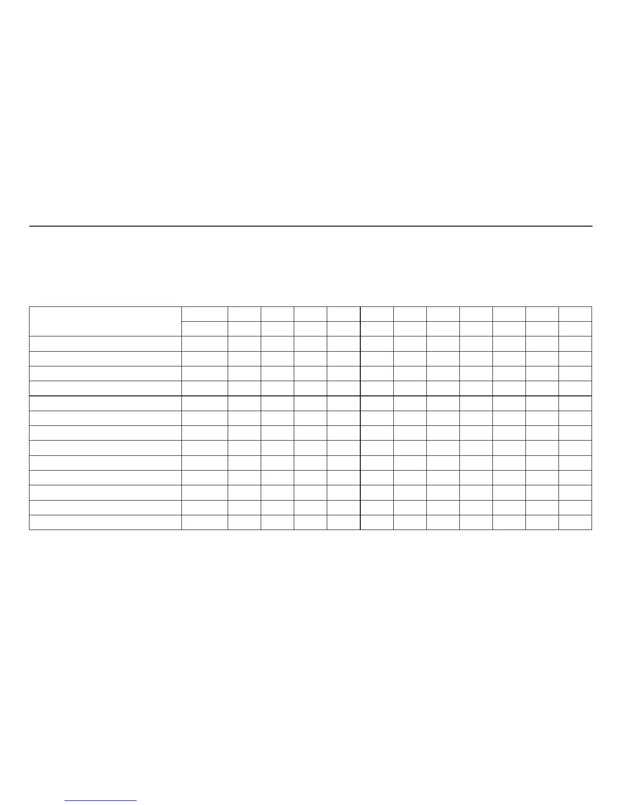
Functions available at various map scales
NOTE:
• You can change between miles or kilometers in SETUP (see Units on page 101).
• For information on the available voice commands, see Voice Command Index on page 159.
Map Scale (English and Metric)
For selecting units, see page 101.
1/20 mi.
1/8 mi. 1/4 mi. 1/2 mi. 1 mi. 2 mi. 5 mi. 15 mi. 50 mi. 150 mi. 350 mi.
80 m 200 m 400 m 800 m
1.6 km
3 km 8 km 24 km 80 km
240 km 560 km
POI icon symbols (like ATM) page 64 XX
Breadcrumbs (off-road tracking dots)
page 70 XXXX
Freeway exit information icons page 64 XXX
One-way traffic icon page 64 X
Unverified road display (light brown)
page 102 XXX
Map orientation “Heading-up” page 63 XXXXX
Map orientation “North-up” page 63 XXXXXXXXXXX
Map features (park, golf course, etc.)
page 57 XXXXXXXXXX
Avoid area shown on map page 106 XXX
Avoid area scales (when creating) page 106 XXX
Waypoint “flag” icons page 75 XXXXXXXXXXX
Traffic speed / incident page 22 XXXXXXX
Weather Information page 65 XXXXXXXXXXX
Driving to Your Destination

 Loading...


