Do you have a question about the BENDIXKing KMD 850 and is the answer not in the manual?
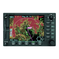
Overview of physical controls like keys, joystick, and fault indicator.
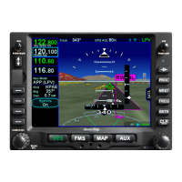
Explanation of features like Stormscope, obstacles, maps, startup, and help displays.
How to choose between TOPO ON and TOPO OFF map views.
Details on map navigation, range adjustment, and auto zoom features.
Procedure for interrogating airspace and data points on the map.
Accessing and displaying detailed information about airports from the database.
Accessing detailed information about navigation aids like VORs and NDBs.
Explaining the meaning of various data icons displayed on the map.
How to query and display information about specific airspace boundaries.
How flight plan data is displayed as an overlay on the map.
Options for displaying data from one function over another on the screen.
How to select and display weather radar, Stormscope, or FIS data.
How to activate and view traffic information on the display.
How to activate and use the EGPWS function.
How to display video input from a connected NTSC source.
Overview of the unit's setup process and controls.
Configuration settings for map display elements, icons, and zoom levels.
Procedures for setting up the WX-500 Stormscope system.
Description of geographic data card areas and their combinations.
Step-by-step instructions for replacing the data card.
Information on data card availability and subscription options.
User responsibility for keeping the database current.
Glossary of terms used in the manual.
List of common acronyms and their meanings.
Overview of the WX-500 sensor and its data processing.
Detailed steps for using the Stormscope, including power-up, views, modes, and overlays.
Overview of the WX-1000E sensor and its detected lightning areas.
Steps for operating the WX-1000E, including selection, power-up, views, and overlays.
Icons and characteristics for political boundary lines on maps.
Icons and characteristics for railway lines on maps.
Icons and characteristics for different types of roads on maps.
Icons and characteristics for Victor Airways displayed on maps.
Icons and characteristics for heliroutes displayed on maps.
Icons and characteristics for various types of airspace boundaries.
Icons and characteristics for cities displayed on maps.
Icons and characteristics for intersections displayed on maps.
Icons and characteristics for obstacles displayed on maps.
Icons and characteristics for Non-Directional Beacons (NDBs) on maps.
Icons and characteristics for VHF Omni-directional Radio (VOR) beacons on maps.
Icons and characteristics for airports, including runways and labels.
Icons and characteristics for helipads displayed on maps.
Icons and characteristics for Visual Reference Points (VRPs) on maps.
| Display Type | LCD |
|---|---|
| Operating Temperature | -20°C to +55°C |
| Operating Voltage | 28 VDC |
| Display Size | 6.5 inches |
| Certifications | TSO C113 |