– 45 –
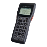
IT-G500
<Checking by information display>
No. Operation Display Test Details
1
Select “Start” – “GPS
Information” in that order.
Select “Status” tab.
[ NOTE ]
If GPS information is not
display, move IT-G500 to the
open air where entire sky can
be seen.
(To receive and display the
information from the satellite,
it will take about one to fi ve
minutes.)
Satellite
Displays the information of the
satellite from which the signal is
being received.
Quality:
Displays the targeted positioning.
“GPS” is displayed if the power to
the GPS module is on.
Selection:
“Auto” is displayed if the GPS
module is turned ON.
FixType:
Displays the reliability of the
positioning data. Either “3D (3D
positioning)”, “2D (2D positioning”
or “– (positioning is not possible)”
is shown.
Received:
Display the time set by the signal
received satellite.
S/N Radio:
The satellite number is shown
on the left while, on the right, the
intensity of that satellite’s signal is
indicated in the form of bar graph.
As the signal becomes stronger,
the bar extends toward the right.
2
Select “Position” tab.
Displays the position information
received from the satellite.
Latitude:
Displays the latitude obtained by
positioning.
Longitude:
Displays the longitude obtained by
positioning.
Heading:
Displays the traveling direction
found out by positioning.
Speed:
Displays the traveling speed found
out by positioning.
Always North top:
When checked, the displayed
direction is always shown with
north on top.
Disp Satellites:
When checked, the satellite
position is displayed.
Disp Heading Arrow:
When checked, the traveling
direction is displayed with a red
arrow.